
Follow me!
Follow my hike live on the map and scroll down to read my blog!
Blog
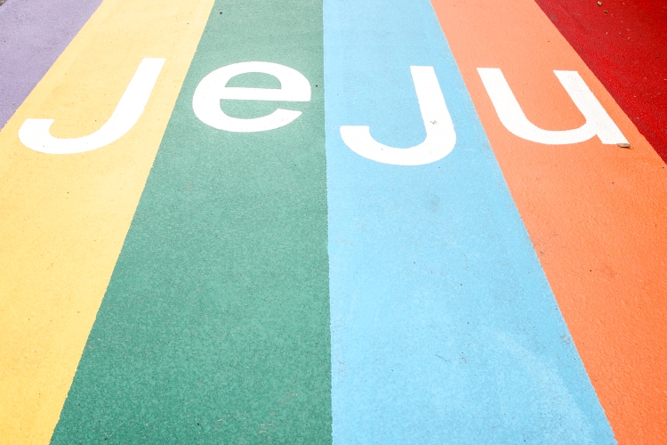
Fake Wood, Real People

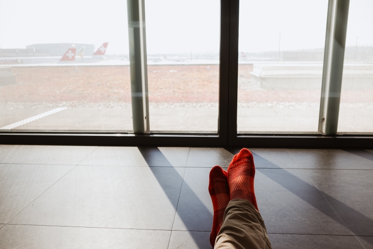
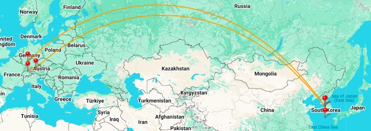
The last 30 hours have been intense. Not intense in a hiking kind of way but because of a Lufthansa pilot strike affecting my journey back home.
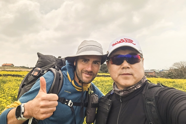
It all began while playing chess with (well rather while getting beaten by) my Couchsurfing friend's son, when an email arrived, informing me, my flight to Munich has been cancelled and that I would be rebooked as soon as possible... I did not pay too much attention, because I wanted to enjoy my last moments with my friends in Ulsan.
Once I caught a bus to Seoul. a four hour ride, I had a closer look at my cancelled booking. With hundreds of cancelled flights it would take longer to get rebooked and I should us an AI chat bot to check on alternatives.
That's where the mess began. While initially not offering me any alternatives, I then got the suggestion to rebook via Dubai, still an active war zone. A 30 hours journey, nearly two days after my scheduled flight. Unacceptable for me. They wouldn't let me talk to a human.
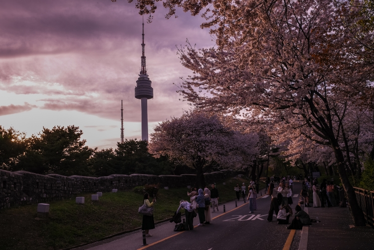
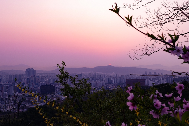
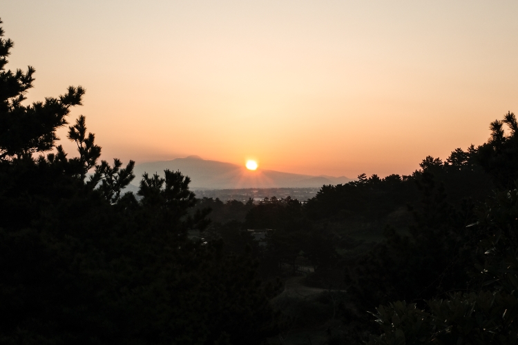
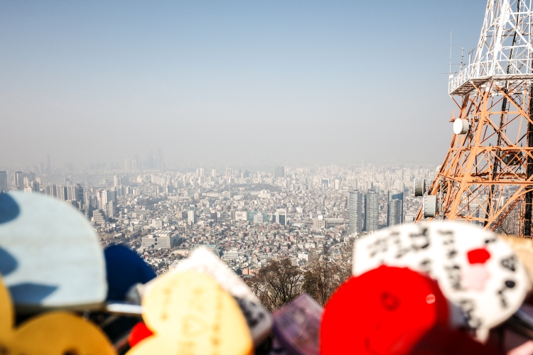
So I kept on trying. Getting more ridiculous alternatives. Obviously, by then I have long arrived in Seoul. Despite the rebooking frustration, I still tried to enjoy my time there, climbing Namsan, enjoying a fantastic sunset together with a huge crowd, eating some more delicious food.
Back at the hostel, I couldn't really sleep and by 4:30 in the morning, I headed out for a run. The most productive thing I could do. I ran up Namsan. Down on the other side and up again as the sun rose. Not many people were out and about and I thoroughly enjoyed my run and the views.
Freshly showered, I struggle with the AI chat assistant some more then headed for the airport, without a valid booking. In the meantime, at least I got some acceptable alternative flights but they were not bookable.
As expected, the queue was long and slow moving. While in the queue, I struggled some more with the chat bot. I was already first in line, when I finally got an acceptable and bookable alternative. Yay!
While still waiting for my turn at the ticket counter, I booked it, checked in. Once everything was confirmed, I swiftly left the queue, probably getting some confused glances from the people behind me.
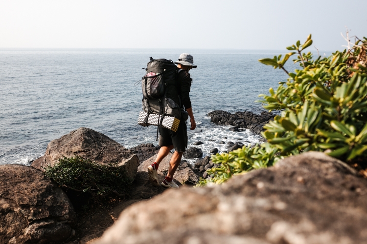
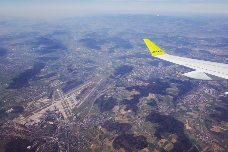
With departure time only two hours away, I hopped into a bus to the other terminal, dropped my bags and headed for the gate. Once on board, I finally could relax. Very happy with the outcome, I looked down at South Korea slowly disappearing in the haze.
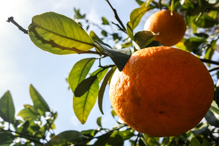
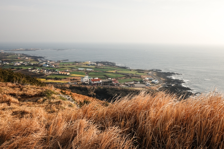
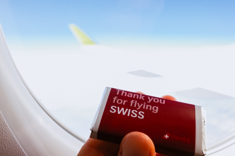
Now, four hours into my 13 hours flight to Frankfurt with Asiana Airlines (which is so far, compared to Lufthansa, a much better experience), I feel like it's the perfect time to reflect. Three weeks in South Korea. On the little volcanic island called Jeju, Hallasan throning in the middle.
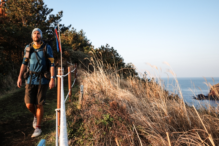
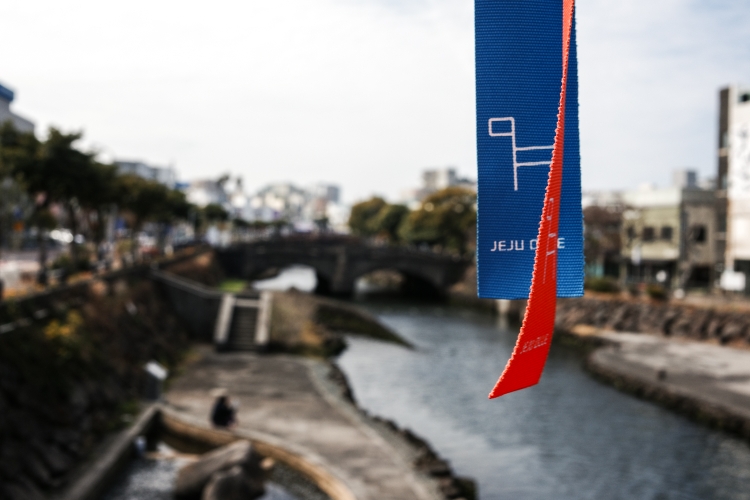
Walking a trail called the Jeju Olle. Olle - meaning driveway or path to a house. And it certainly felt a bit like this. Exploring the island on foot, at times off the beaten track, up close and personal, gave me an insight of the Jeju island live. At least I think so. Coming from a different culture, far away from South Korea, there are things I don't understand, never will. And that's okay.
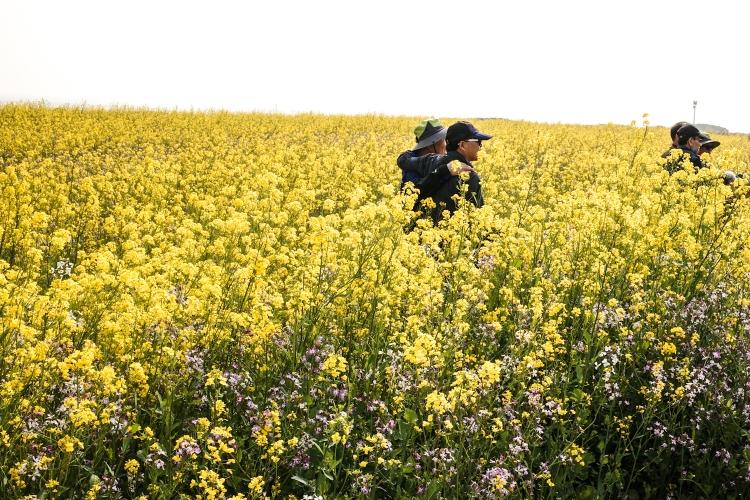
Jeju Olle, with the Ganse, the lazy Jeju pony, showing the path also stands for the slow approach of exploring the island. It was a new way for me. And while a bit challenging at times to slow down, embrace the moment, just idling, overall I think it had a positive effect on me; despite the trails often being not trail but rather road walking, the scenery nice but a far cry from the natural beauty of Switzerland, New Zealand or Norway, I felt good while walking. In fact I think I found the pleasure again in walking, that somehow vanished a bit over the last couple of months. Maybe it were the short days, no pressure to cover long distances, just living and walking in the here and now, focussing on the details, enjoying the food. The favourable weather helped, so did the lack of mosquitoes, ticks and other unwanted animals
Obviously, there's always the backside of the medal.
I'll start with surveillance cameras: Everywhere. On the roads, parks, even along hiking trails. Rather than making feel safe and secure, the feeling of being under surveillance constantly was rather unpleasant.
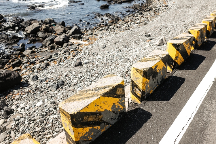
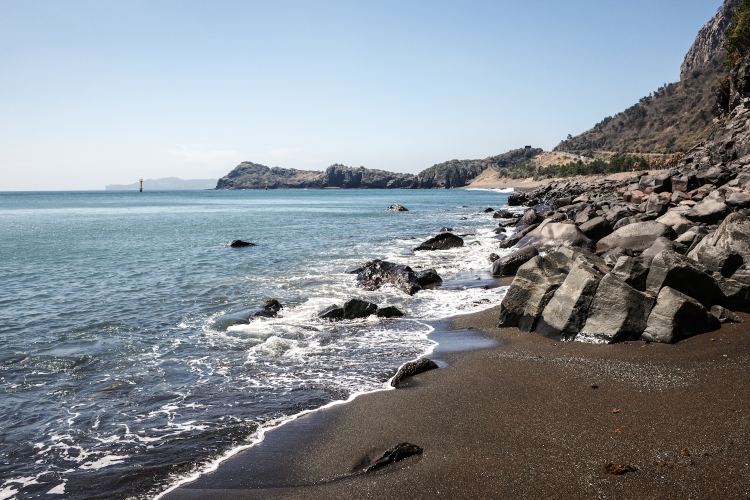
Rubbish: there are no public rubbish bins on Jeju. Which is fine for me. So are all the no littering signs. However, when I looked down at the beaches, the water or up into the farmland, there's rubbish everywhere. Plastic, fishing nets, you name it. An ugly, depressing sight and a stark contrast to all the no littering signs. Rendering them somewhat cynical.
Tinted windshields of the cars: basically all cars in South Korea have tinted windows - even the windshields. You can't see the driver, you can't make eye contact. As a walker, something I find a bit disturbing and unsafe. I'm still wondering how this can be legal. On a side note: usually I lake waving at the drivers. Not so in South Korea. Not so in Korea. Why should I, if I can't see them.
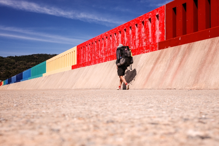
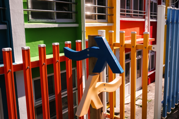
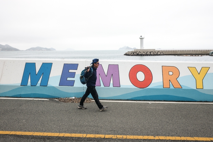
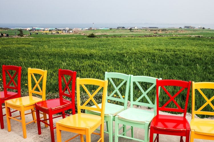
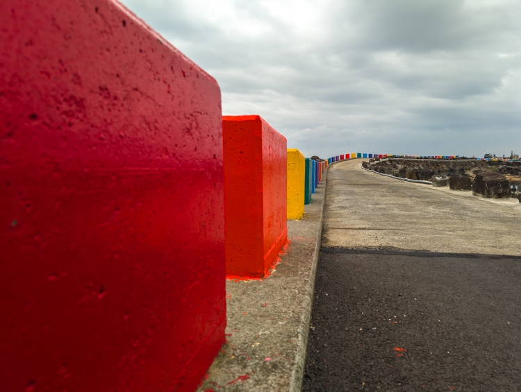
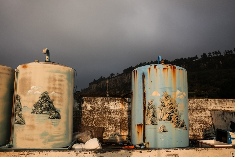
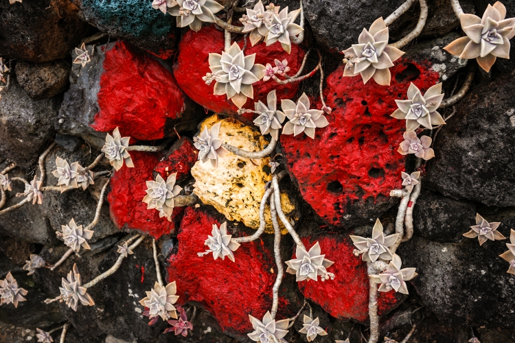
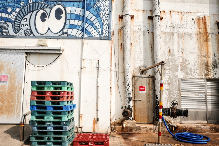
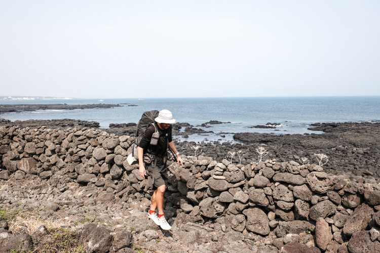
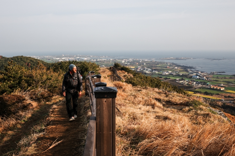
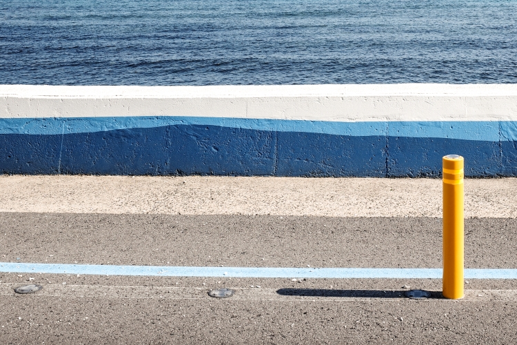
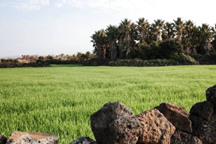
Special planning and architecture in general: spacial planning doesn't really seem to exist. Houses scattered everywhere, big wind turbines flanking a cafe and a hotel. It's just not that nice to look at. So are the buildings in general. A lot of concrete, little charm. Kilometers walking along fake wooden fence. Made out of concrete, painted to make them look like wood. It bothered me more than it probably should have. In the beginning at least. Until I changed my mindset and just see the positive side. The Koreans, in there own way, are somehow able to turn something rather ugly into something rather sweet. With lovely decorations and creative paintings and lots of dedication, the Jejuans turn a run down concrete structure or ugly seawall becomes a little piece of art.
The people of Jeju. Overall, they seem happy, enjoying their life. I enjoy watching them. They also seemed to enjoy my company. A lot of talking along the way, even more food that was offered to me. I felt welcome in Jeju. Then there are all the Jeju Olle volunteers putting life into the the trail. The ladies at the information booths, the walking mates. I wasn't expecting so much volunteering, so much dedication. Always polite, always happy. Together with all the other Jejuans, they massively added to attractiveness of my walk.
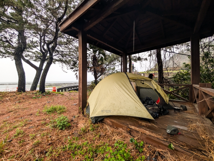
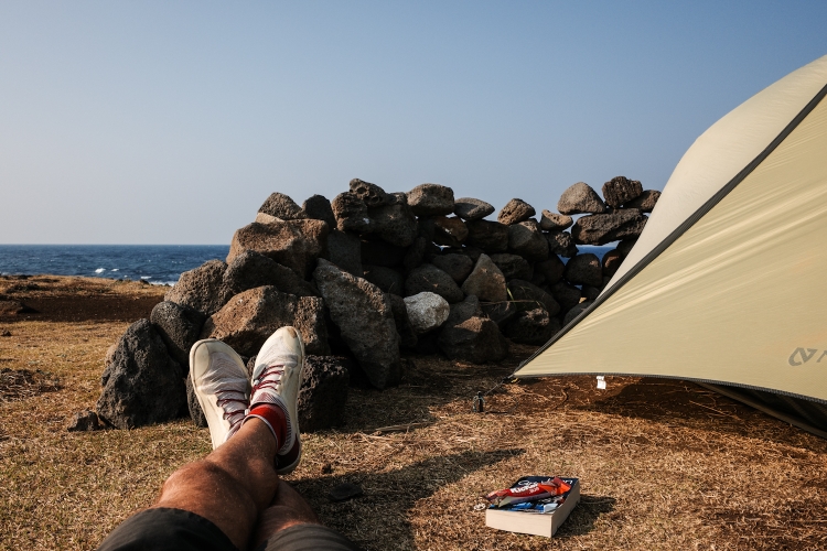
Nonetheless, I don't think I would hike it again. While I thoroughly enjoyed it, it's not my natural habitat. The great outdoors, the views, the solitude. Things that I appreciated the longer the more during the walk. With the camping that I did on the trail, I compensated a little bit for an otherwise very civilized trail. It added to the overall positive impressions that I take home.
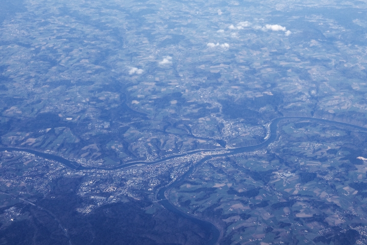
Home, sweet home, where I will be in a couple of hours. I'm somewhere over the Black Sea. 10 hours into my 13 hour flight. With my feet getting restless, I'm already starting to plot my next adventure in my head.


Day 18: Another One Done And Dusted
Daewangsan to Sinyang Port
Distance: 10km
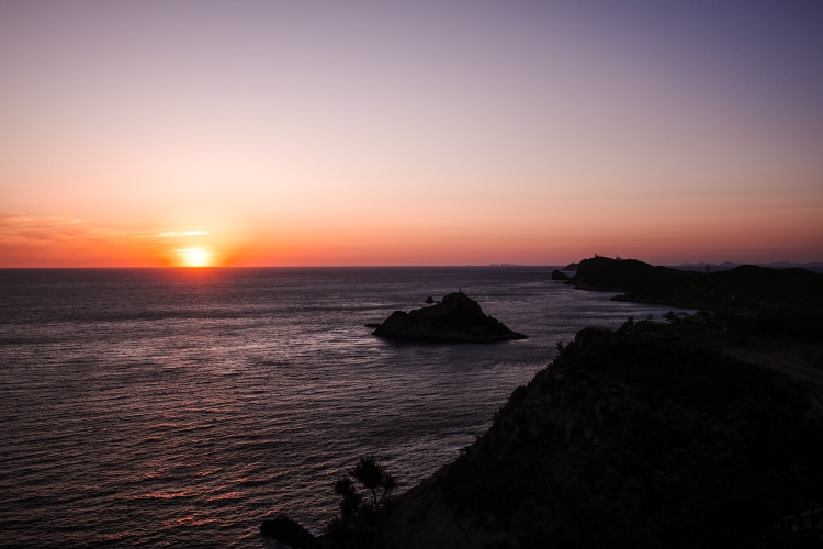
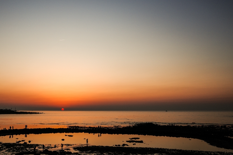
After saying goodbye to the sun, setting over the ocean yesterday, 11 hours later, the orange glowing ball is popping up again - again over the ocean. Somehow, this always feels a bit special, viewing sunset and the following sunrise over the ocean. From the same spot.
With a super short walking day ahead of me, I take my time. Sipping my coffee, doing some stretching, listening to an audiobook. Despite being so close to the harbor, not a single soul is passing 'my' pagoda.
As usual, I get restless rather quickly nonetheless and eventually leave. Down to a beach, where I have another quick dip into the ocean. Mainly to wash myself.
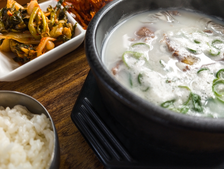
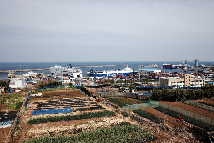
I climb another small hill, then head down to Sinyang Port, desperately trying to find a place to eat. Ghost town like, most places are shut. After a short backtrack, I get lucky, have a meal with plenty of side dishes.
Oh and by the way, Sinyang is the end of the Chuja Island Trail, and in my case also the whole Jeju Olle Trail. All trails completed! Another one done and dusted. A slightly anticlimactic ending, but I can live with that very well.
With another 2 hours to 'kill', I head out one of the massive walls, protecting the harbor from the waves, where I'am currently writeling this blog.
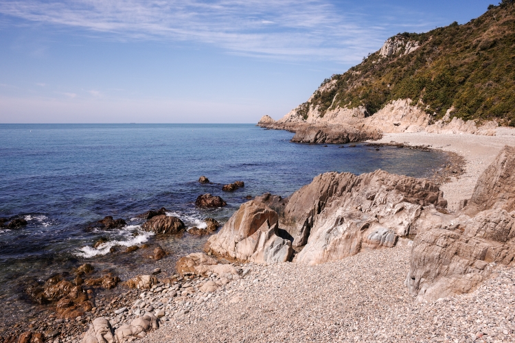
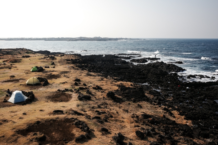
Despite being part of the Jeju Olle Trail, Chuja was very different to Jeju Island. My first impression was 'quiet'. And that's how it stayed throughout my 3 days here. However, the other first impression I had "oh that looks like Great Barrier Island" is, like my faithful follower Geroge correctly recognized, didn't come true. It turned out to be quite different. People wise and also the scenery.
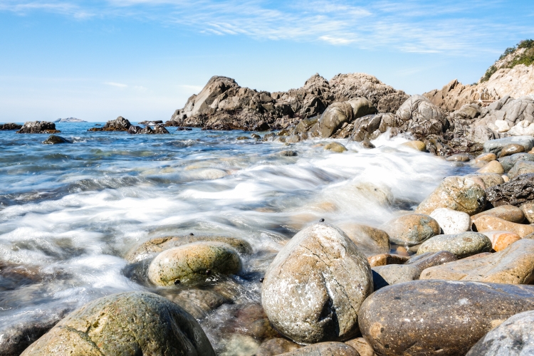
Ignoring the polluted coastline (I'll go into detail in my next post), the scenery was spectacular, the pebbly beaches, the hiking and camping spots really cool. I haven't met a lot of people. Those I met were mostly hikers. Locals were hardly anywhere to be seen and sticking to themselves. Overall a nice experience and a worthy ending of my Jeju Olle Trail adventure.
So what now? Everything is pretty much already planned and booked. The ferry back to Jeju, one night (maybe two) camping, one (maybe none) in a hostel before flying to Ulsan, meeting up with an old Couchsurfing friend, then a bus ride to Seoul, before I fly back home on the 13th.
In a few days, with some distance between me and the traiI, I will publish another blog entry. Talking about fake wood, the polluted coastline but definitely about plenty of positive impressions as well. So stay tuned!
Day 17: Like Stars
Dondaesan to Daewangsan
Distance: 25km
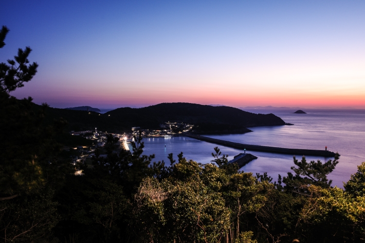
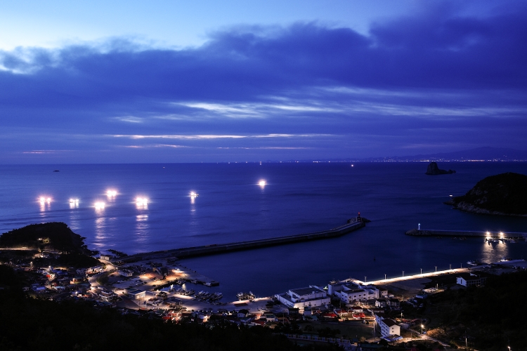
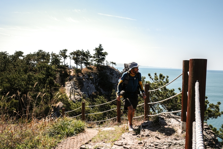
Relentless low rumbling sound of the fishing boats throughout the night. When I wake and get up - it is still dark - the brightly lit boats scattered around Chuja are sparkling like stars in the sky. A special sight.
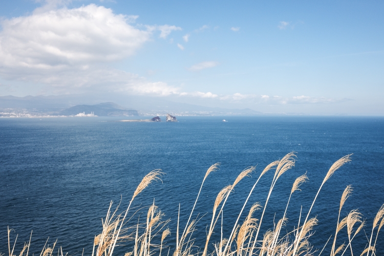
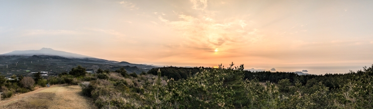
Luckily the forecast was right and the last clouds vanish with sunrise. The visibility is as good as never before. Jeju with Hallasan volcano is clearly visible. So are some smaller hills that I walked up during the last two weeks.
Also mainland Korea is visible to the north. What a glorious morning.
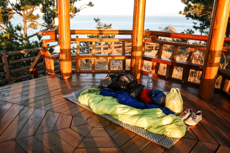
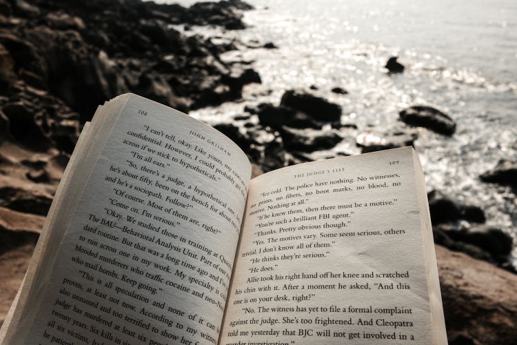
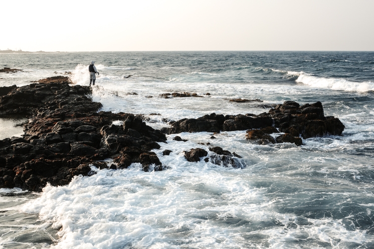
Highly motivated, I start my walk. Down one hill, up the another, following a spectacular cliff walk. The cliff walk is not part of the official Jeju Olle Trail. A shame because it's the best stretch of trail I have hiked. Maybe a bit too exposed. However, being Korea, the trail is well maintained and secured. After taking a short rest at a pagoda, offering spectacular views and finish reading my book up there, I tackle the descent and eventually reach Hupo Beach. Once a campsite, now plastered with 'no camping' signs. Doesn't matter, it's still before lunch time and I plan to keep on going anyway. But not before a quick dip and wash in the cold, refreshing water.
From there it's just a couple of steps to Daeseo, by far the largest settlement of Chuja. While I don't really enjoy the town, I hang around for a while, buying some food, visiting the Jeju Olle Trail information booth before I keep going. More up and down, some chitchat with locals until I reach my spot for the night. With another hour until sunset, I sit down, relax and enjoy the fantastic view.
Eventually, the sun disappears behind the ocean. With the sun gone and the wind picking up, it gets uncomfortably cold rather quickly. I disappear as well, into my sleeping bag, looking at the fishing boats heading out into another night.

Day 16: First Taste Of Chuja
Sinyang Port to Dondaesan
Distance: 7km
First of all, I'm not even sure if it's worth to write a blog for these 7km. However, this trip is not only about the walking but also the things happening around.
I leave the hostel, navigating to the ferry terminal. Faster than anticipated, I find the ticket counter. The lady is flipping through my passport, saying "Visa?! Visa?!". All I can answer is "No Visa". I get sent to the supervisor, who, after a view calls, hands out the ticket. It would have surprised me, if I needed a visa indeed.
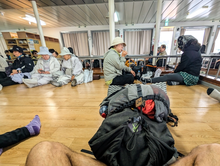
Anyways, after a short wait, I 'queue' as the sole foreigner in the foreigner line. The other 100 or so passengers are all Koreans. Amongst them, many sporting Jeju Olle branded hiking equipment.
Once on the boat, I find my way to the 3rd class cabin. Heated floor once more. However, I only sit/lay there for a wee while before venturing outside to explore the ferry, which is rocking and rolling in the open water. Slowly, Jeju with Hallasan is disappearing in the mist.
2 hours after leaving, the ferry arrives in Chuja. I step off the ferry into a completely different world - compared to Jeju City. Quite, sleepy. I like.
I take my time, check the sailing times for my trip back. Either I go back south to Jeju or north to the mainland. Something to decide later.
For the moment, I enjoy my time on the island. With plenty of time at hand (20km in 3 days), I stop right at the first beach. Lunch time! With the sun shining through the clouds every now and then, it's pleasantly warm, despite the wind. Yet, it's mostly grey in grey, everything is looking a bit dull and my camera stays in my pocket for nearly the entire day.
A bit more walking, resting and reading along a lovely coastal trail. And eventually, after a short but steep climb I arrive at Dondaesan Mountain. With the weather deteriorating quickly, everything is engulfed in clouds. It's unpleasant and a bit sad that there are no views at all. The good thing is, all weather forecasts I check predict good weather for tomorrow. Therefore, I decide to call it a day and keep my fingers crossed. It's been a nice day, nothing special. Mainly due to the weather. Yet, so far I like Chuja. And with the sun out, hopefully it will become a little adventure.
Day 15: The Circle Closes
Sin-eom to Iho Tewoo
Distance: 24km
I spent the evening looking at the ocean, where ships with their bright lights try to attract the fish.
The wind stopped, the clouds vanished and eventually, I fell asleep.
An early start, the ships are returning to the port as I sip my coffee and shortly after head east along the coast, into a wonderful sunrise. My hiking spirit is high, even as I leave the coast and head Inland. For once, the visibility is good and I can see Hallasan as clear as never before. Eventually, I head to the coast again. A long way back, following a river. It's a bit of a fight but with a bit of music, I slowly but surely reach the coast. From there it's only a short walk to Iho Tewoo, where I started my little adventure 2 weeks earlier. As always, I feel a bit melancholic, I feel a bit sad but happy at the same time. Sad it's over, happy it's over. Well, not completely ovrt.
While I might have completed Jeju Island, Jeju Olle has still two more hikes up its sleeve.
Two trails on Chuja Island, where I am headed tomorrow.
So I leave Iho Tewoo beach. I keep walking towards Jeju City along Jeju Olle Trail, like two weeks ago. But no worries. I won't do it again a second time. At least not in the foreseeable future. All I do is head to the last stamping station, which I passed a fortnight ago, but wasn't able to stamp because I didn't have the passport back then.
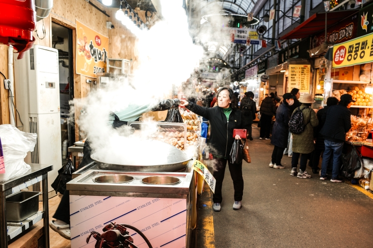
With the stamp in my passport, I take the bus to Jeju City, check into my hostel and dive into a completely different world, visiting the vast Dongmun market, eating through all the food, celebrating a little bit for the little achievement.
Day 14: The Windy West
Geumneung to Sin-eom
Distance: 22km
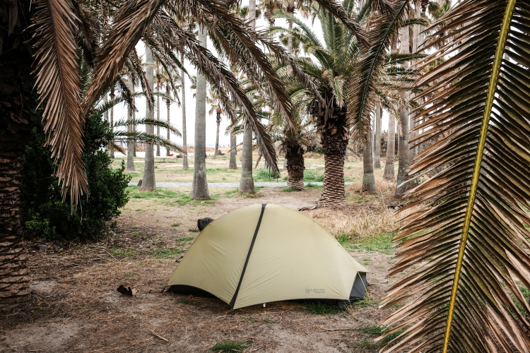
A stormy night with plenty of rain and wind. My tent was reasonably sheltered. Yet, with the noise of the palm trees getting hit by the wind, I had better nights.
It's still windy and unwelcoming in the morning. At least the rain has stopped. I take my time, drink my coffee and slowly leave the campground. The first steps are through dunes. A beautiful and, with the wind and high waves, nearly a bit dramatic.
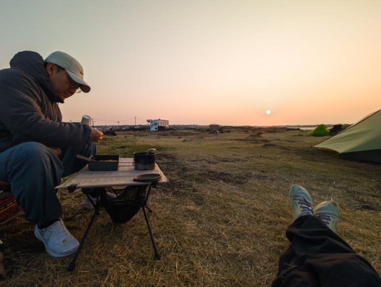
I see a blue lining at the horizon, hoping it would make it all the way to the coast - to me. However, the weather God has different plans and if remains cloudy and windy throughout the day. Layered up, it's not to cold and actually quite an enjoyable coastal walk. I stop at a coffee place, get an iced flat white (which was not the plan but I blame it on me for not speaking the language) and with the wonderful help of a good Korean friend of mine, who I know from Couchsurfing, I sort out my ferry trip to Chuja, to complete my Jeju Olle hike. It's still windy so I drop by at the Jeju Olle Information booth. The ladies volunteering there, are always so wonderful. No different this time. She gives me her own, self made lunch and a coffee. While I sip my hot beverage, a hikers walks in. With 40'000km on the Jeju Olle Trail, he apparently is holding the record. He walked the whole trail more than a 100 times. That's what I call dedication. And motivation for me.
I continue, lazy, idling. Following the spirit of the trail. I have a late lunch. The lovely lady is putting one dish after the other in front of me. For less than 5 Swiss Francs.
I thoroughly enjoy my meal and we'll fed I carry on until I reach my spot for the night. Overlooking the wild ocean, listening to the waves crashing into the rocks below me.

Day 13: Contrasts
Gapado and Inland side trails (Trail 10-1 and 14-1)
Distance: 15km
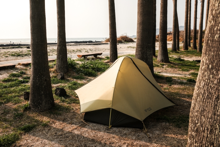
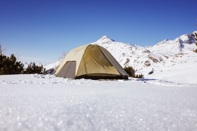
A quiet night, an early start. On today's list are two side trails. Gapado Island and an inland trail leading to a tea plantation. They are part of Jeju Olle, but not really hike able in a thruhiking sense. So I will leave my tent and stuff here in Geumneung and go slack packing the two trails.
Before I leave, however, I relocate my tent. For my piece of mind. Away from the beach, back somewhere between the trees. Heavy winds are forecasted to develop around lunchtime. By doing so I will worry less about my tent and enjoy more my day away.
A bus takes me to Hamo, where I try hard to find the right ticket counter to get my boat ticket to Gapado. With my translator app translating all the signs I eventually make it to the counter. Right in time to catch the 08:40 ferry. My passport gets checked twice. Feels like Gapado is on a different continent. Maximum time on Gapado one is allowed to stay on the island is 2 hours. So not too much time to complete the 4km hike and the 1km back to the starting point. With 200 hundred other passengers I flood the little island. Shops and restaurants ready for us visitors. That's how being a cruise ship passenger must feel.
I stamp my Olle Passport and off I am. Not many other hikers walking this Jeju Olle Trail today. So, quite surprisingly, sometimes I am completely on my own.
Everything feels a bit rushed. Nevertheless, I enjoy my time on the island, which is flat as a pancake and besides tourism mainly used for growing barley.
Like for a cruise ship passenger, it's crucial to be on time for the departure. After stamping my passport once more at the finish, I hurry back, straight across the little island. Right in time for boarding. I find myself again with the same 200 passengers for the 10 minutes ride back.
The bus to the next trail is not leaving for another 30 minutes so I something very European and go for a coffee. What a positive surprise. Great atmosphere, great tasting cafe latte.
The inland trail couldn't be more different than Gapado. Once I leave the tea museum behind, it's just me and the birds. A very quiet trail. The sky has become cloudy, the wind stronger. With my light Day pack, I make swift progress. Every now and then I even run a bit. In no time, I am at the end of the trail. Right in time for the bus taking me back to Geumneung. It's a public holiday here as well. Not Easter, I think. Anyway, all busses are free, which is a nice little extra.
Back at the beach, I go for a early dinner, grab some snacks and my book. I'm reading and snacking at the beach until the rain starts and I retreat to my tent. It's around 17:00. With no plans to leave my tent, I have plenty of time to write my blog and plan for the next couple of days.


Day 12: Losing Patience
Chagwido Port to Geumnung
Distance: 33km
A glorious sunrise over Hallasan to the east, a great view out over the water to the west. A fantastic start into my day as I follow the coast for a bit. What a great start.
Sooner than later, I turn inland. It's where things get annoying. The trail goes all over the place, turns to the left, to the right and I hardly make any progress. It's mostly road walk through farmland. The views very monotonous. My patience is getting challenged today. Despite not having any expectations on this trip whatsoever. At one point I am tempted to just cut across and head back to the coast. But no, I came so far, I complete this thing. So I carry on. At the most inland point, in I climb a mountain, which is nice, have lunch shortly after, which is nice as well before doing the same sh** again on the way back to the coast.
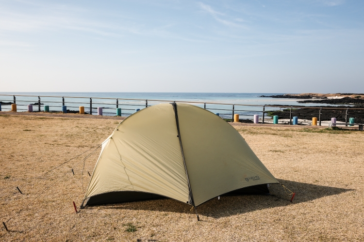
Once there, I feel depleted. Yet, I have to continue. I walk through a cactus park (after having walked through a chair park earlier today), follow the coast along an attractive stretch of the trail. However, I can't really enjoy. All I want to do is reach the campground. Which I eventually do. It's open, some tents but not too crowded. With the last motivation I can find, I pitch my tent, get some food before I sit down and read my book.
Today was the first day I didn't really enjoy. While I appreciate the work the locals put into Jeju Olle Trail, it wasn't an attractive stretch at all. Too much inland without too much to see. Additionally, it was yet another long day, which probably didn't help.
Therefore, I will take it slowly the next couple of days, trying to find my motivation again.


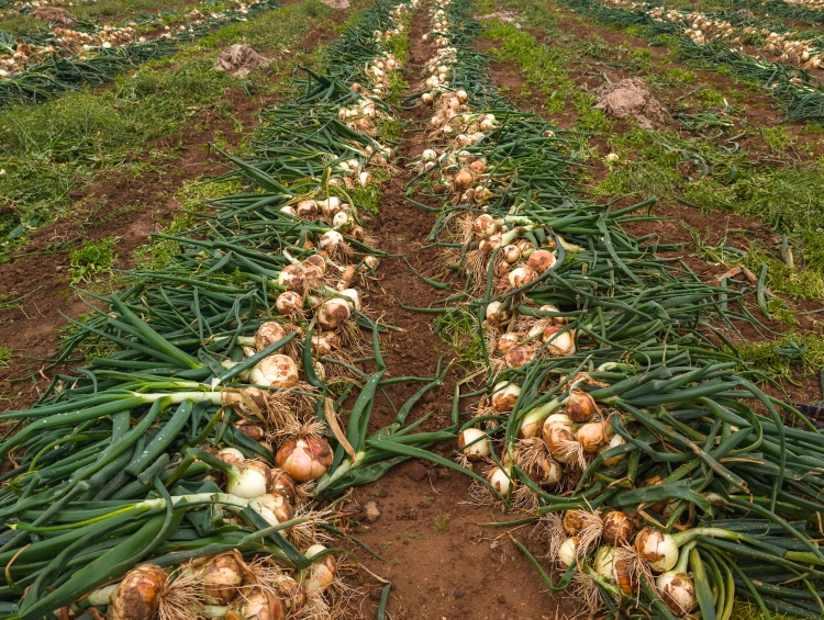
Day 11: Onions
Alteurreu Airfield to Chagwido Port
Distance: 40km
Once again, the birds make for a wonderful morning. Drinking my coffee to the sound of the birds, makes it taste even better.
I cross the defunct airfield and therefore am quite surprised to see a powered paraglider firing up it's noisy engine for a short flight. With a long day ahead of me, I do not wait for it to depart but rather continue through the somewhat depressing town of Hamo. It's a comparably remote stretch that follows so I buy some Kimbap (a triangle shaped rice dish with all kind of fillings) that should keep me going.
It's raining as I leave town, climb a mountain, walk through forests. Not a persistent rain, no wind, no cold. Manageable. Nevertheless, the roads are looking like it has been pouring down for hours. No idea how they look like in the rainy season.
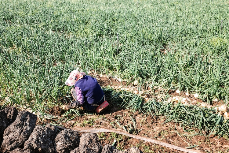
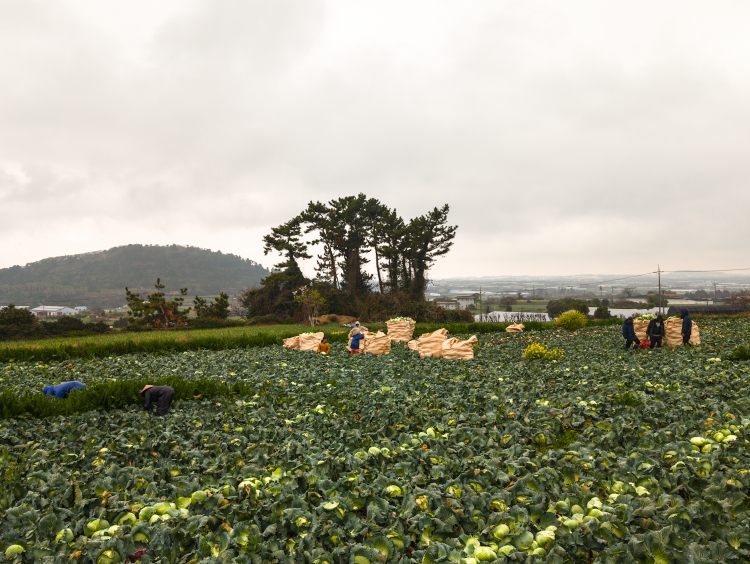
I can smell it in the air. It's not a pleasant smell so early in the morning: It's harvesting season for cabbage and onions.
In fact, guest workers from India, Pakistan or maybe Bangladesh are the only people I see this morning. A very solitary walk.
This changes as I reach the coffee place marking the end of trail 11 and the start of trail 12. Plenty of hikers in thete. After a well needed orange juice and an orange pastry, I continue. The rain stopped as I make my way to the coast and follow it, now also meeting some fellow hikers and locals.
After a quick dinner it's time to set up camp as it's already getting dark. Another long day comes to an end. Despite the rain in the morning and the smell of onions, overall another enjoyable day on Jeju.

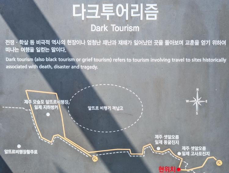
Day 10: The Dark Tourist
Daepyeong Port to Alteurreu Airfield
Distance: 26km
Sleeping close to the Ocean, with the waves having a calming effect on me, sleep is usually good. No difference tonight - at least until the wind came and woke me up at around 3. The sleep wouldn't come back anymore.
Still, reasonably rested, I start my walk, climbing Gunsan mountain. Some lovely trails and just me, myself and I. Only at the top I meet a older man, working in the fire lookout tower up there. Today however, there's not much to observe. The mountain is engulfed in clouds, visibility zero. Therefore, I do not spend too much time up there, heading back down and back to the coast. As I walk through am orange plantation, the sun comes out and once back at the coast, the temperature feels like summer.
In a secluded bay, I decide to go for a quick swim. A wise, well maybe lucky decision. The next beach is crawling with tourists. Crazy how quickly it changes.
The trail stays busy for the next couple of kilometers along a fantastic stretch of coast until I pass a sign that I am now becoming doing 'dark tourism'. Doesn't seem to be a thing here and all of a sudden it's just me and some Jeju Olle hikers again. A lovely bunch of people.
I enjoy the quiet and decide to call it a day.
Tomorrow, my plan initially was to do hike 11.1 on Gapado island. The weather doesn't look too inviting though. So most probably, I will skip Gapado island for the moment and do in a couple of days once the weather plays along. But I will decide tomorrow.

Day 9: My Feet Say Thanks
Seongcheon to Daepyeong Port
Distance: 11km
Being waken by singing birds is always a great way to start into a day. A planned, short day. After yesterday's 45 kilometers, I feel a bit exhausted. Furthermore, rain is expected from mid-morning, lasting throughout the day.
After my compulsory cup of instant coffee I head off. The first hour is throu Jungmun Beach Resort. A massive hotel complex, deserted on this early Monday morning. It feels weird, fake. Walking past the honeymooners' gate, chocolate land and the Teddy Bear museum is not exactly enjoyable. Neither is the road walk taking me around the golf course.
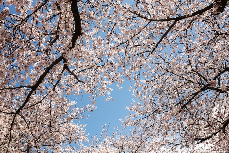
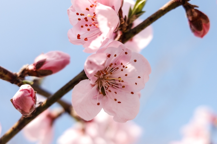
Eventually, I leave the road, follow a river back to the coast. Cherry blossom season is just about to take off. The people here seem to go crazy for this season. And to be honest, they infected me a bit with their enthusiasm.
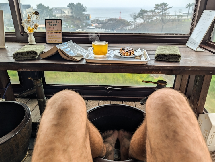
Back at the coast, I take it slowly. Frequent stops to enjoy the views and once I stumble across a foot spa coffee place, I obviously have to check it out.
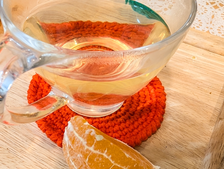
With my feet in a foot bath tub, the smell of eucalyptus oil in my nose, Juju yuzu tea and a chocolate pastry in front of me, reading my book, overlooking the ocean, life can't get much better.
Only when my feet are all wrinkly I leave, heading straight for a late lunch or early dinner. Like most of the time, it's just me in these mom and pop restaurants, enjoying another great dish.
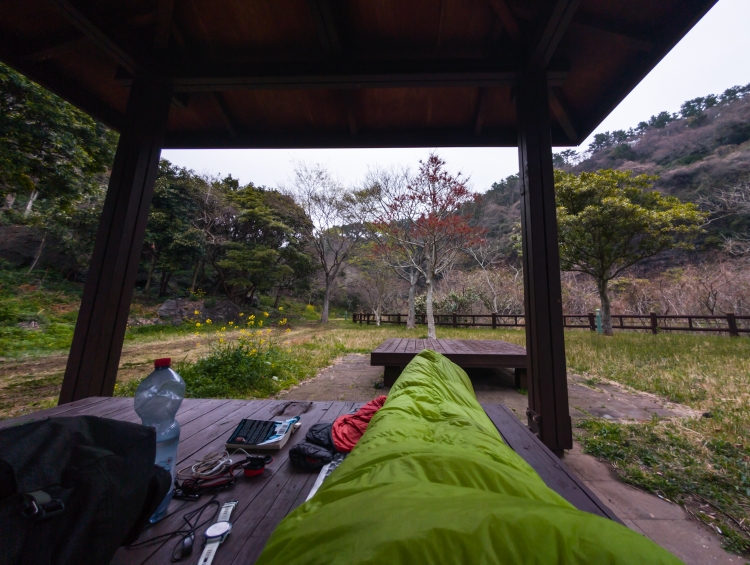
While having my feet wellness and feed, it started raining heavily. I head to a nearby pagoda, where I pitch my tent. With no motivation to leave my tent, I spend the afternoon looking at the ocean, reading my book and just relaxing.
Day 8: Hike'n'Run
Seogwipo to Seongcheon
Distance: 45km (15km running)
A real bed for a change. To be honest, though, the sleep is not much different than in the tent. While the room is much more quite, the lack of familiarity (which I have in my tent) leads to a light sleep nonetheless.
Still, I get some decent rest and by six I am on the trail again. Running. The somewhat chaotic layout of the trail (Trail 7 and 7.1), won't allow a continuous thru hike. So I run trail 7.1. A different experience which turns out to be quite a wonderful one.
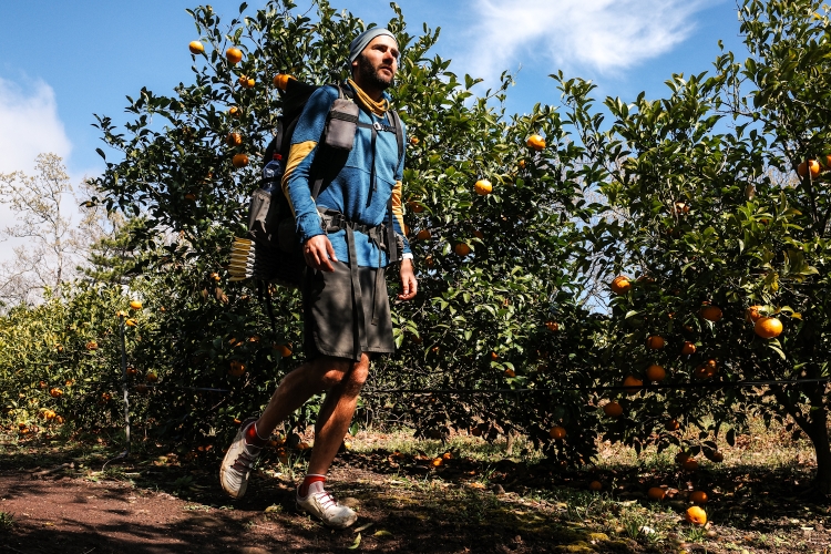
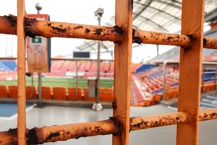
Soon after starting my run, I leave the city during dawn and pass through farmland and citrus plantations before climbing Gogeunsan mountain. A steep climb up. Eventually, I reach the top with sweeping views of Hallasan. I take my time, enjoy the view and eventually run down the mountain towards the Seogwipo football stadium. It's a pleasant mix of roads, grassy trails and hiking trails (most of them covered with a carpet like cover. Like the majority of the hiking trails here. Something, which I still have to get used to. Like endless fake-wood-fences. I will write about this another time).
At the stadium, I catch a bus back to the hostel, where I shower, eat breakfast, check out and hit the trail again. Direction football stadium. This time along the coast. Being a sunny Sunday, I am not the only one out and about. I chitchat with other hikers every now and then but mainly hike by myself. While the first couple of kilometers are easy going, it's getting harder with every minute. I miss running. In general, my run this morning reminded me of home. The 'real' outdoors, the mountains, the solitude. Anyways, sometimes it's good to get out of the comfort zone, experiencing new things.
At the stadium, I have to hike my own hike to the beginning of trail 8. No markings. It's when I notice how much the markings help. Without them, navigation is challenging.
Eventually, I make it to the trail head, follow it for a while until I find a quiet park for the night.
Another long day. A bit too long. Tomorrow, I will take it slow. Embracing, what the Olle Trail stands for: slow idling.
Day 7: Jeju's Wild Coast
Namwon to Seogwipo
Distance: 27km
No wind, a flat surface and, after all the food that I ate, feeling nice and warm in my sleeping bag. Perfect ingredients for a good sleep. Yet, I wake up every now and then and never really fall into a deep sleep.
Anyways, after saying goodbye to Kim and her husband, I start my day feeling quite okay. Progress is slow though. The views are fantastic and I stop numerous time to take photos, read my book, a quick swim or just enjoy the view. Aside from some touristy hotspots, I often find myself completely alone. A new, welcome feeling on Jeju.
Eventually, I need to push myself a little bit to get to Seogwipo. It's hot, hazy and the lack of sleep doesn't help either. Some ice cream and Hallabongs help me going.
Once more, I meet many friendly Koreans along the way, a smiley, a wave or stopping for a little chat. Walking here hardly gets boring.
Trail number 6 is a bit of an up and down. Nothing too strenuous. Nevertheless, I am soaked as I walk through Seogwipo.
Needles to say: I am relieved when I finally check into my hostel. As a thru hiker, I know the drill:
Straight into the shower, changing into whatever clean clothes I have (rain pants and a shirt in my case), getting the laundry going and then head out for some food.
Being Saturday night, the city is packed with people. Right next to the hostel, I find a quiet noodle place.
A bit reluctant, I head to the marked to hunt for some dessert. It's crawling with people and I soon have to admit it's not my habitat. With something sweet in my pocket, I had back to the hotel. It's not like I will be bored there since I have to plan my coming days.

Day 6: The Unexpected
Pyoseon to Namwon
Distance: 18km
A long story/day short: always expect the unexpected.
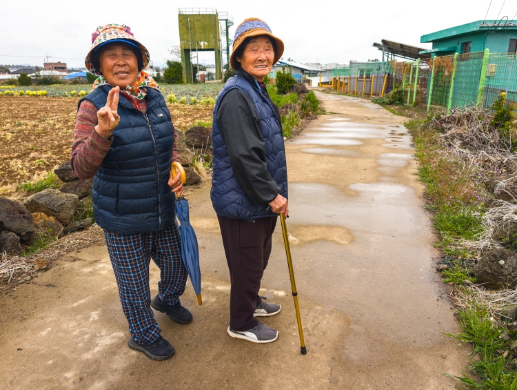
So I am brushing my teeth, getting ready for a day out on the trail, as a woman, who is camping next "door" is approaching me and invites me for a Korean breakfast in front of her and her husband's tent. Noodles, rice, kimchi. A lot to digest for my westerner stomach so early in the morning.
Anyways, I follow yet another an invitation for a "quick" touristy tiki tour inland with their car. An interesting experience for sure. But an experience I highly appreciate as it gives me a wonderful little insight on Korean culture.
Time flies and eventually I have to push them a little bit to take me back to the trail. They seem to enjoy my company!
It's mid-afternoon, still hot, but I am glad to be back on the trail, away from the hustle and bustle. On a trail, which I enjoy a lot. Nice people a long the way, lovely stretches through forest, over rocky beaches and inland through citrus plantations.
Kim and her husband warned me that they would be stalking me this afternoon. And sure enough they pass me twice in their car, always giving me a friendly wave.
As the sun is setting, I approach Namwon, where me and Kim agreed to have dinner. Well, it turns out to be a feast.
Not often do I feel completely full. But today was one of these days.
We finish this very intense day with some (unsuccessful) fishing and a cup of rice wine before I crawl into my sleeping bag.

Day 5: A Long Walk Into The Night
Biyangdo to Pyoseon
Distance: 42km
Overnight, the northerlies turned into westerlies. The imprivised rockwall wasn't as effective anymore. Yet, it was blocking the wind enough to leave the tent pitched.
Needless to say: with the tent rocking in the wind, my sleep was far from a good one.
Anyways, the show must go on and with sunrise I start into my hiking day. Udo feels deserted. It mainly caters day trippers and with the first ferry not arriving until 08:15, I enjoy the peace and quiet. No electric, pink tuktuks with cat ears on the roof buzzing past left and right.
The climb up towards the Udo lighthouse offers spectacular views of the island, also the descent on the other side, leading through a miniature lighthouse landscape is highly interesting. As I get closer to the port, visitors spill out of the ferry. It's the moment I say to myself, let's go. I fill in a departure card, show my passport and off I am back on the ferry to Jeju. This time outside, enjoying the fantastic spring weather.
As I get off the ferry, the line to get to Udo is ridiculously long. More than happy with my decision to camp on the island and swim against the flow, I continue my walk. Speaking of swimming: for the first time since I've been on the island I go for a quick, refreshing swim. A great feeling.
Back on the trail, I buy some Hallabong. Their taste is growing on me.
The following 15 or so kilometers are inland. With the small exception of a short part over Daesusanbong, a hill, trail number 2 is rather underwhelming. It's hot and the walk through the farmland a bit depressing. Memories from my E1 hike, skirting around Milan, pop up. Very similar. Eventually, the coast is insight again. With nearly 30 kilometers done, my feet and legs start feeling tired. Stil... After a rather short day yesterday, I feel like keep on going.
With some music and the view of the coast, time is passing quickly. It's already 17:00 and I have still 10 kilometers ahead of me. However, I really need a feed. My energy level is getting low.
Right next to the mid-route stamping post is a little restaurant. The lovely lady serves me a massive menu.
Eating an eel with chopsticks is changing but eventually I figure it out and soon after, am on my way again. With my hiking spirit high again, I walk into the night. Always a magical but also slightly eerie experience. With each step the lights of Pyoseon are growing bigger until I reach the city.
They have a spot designated for tents. I don't mess around and pitch my tent at the first best place.
Tired but also with that special, satisfying feeling after a long day, I get ready for a hopefully good night's sleep.


Day 4: The Island Of The Island Of The Island
Jondal to Biyangdo
Distance: 20km
A rainy night. And a windy night. By 06:30 the wind becomes so strong that I begin to worry a bit about my tent. While I boil the water for my coffee, I pack my stuff. Over the years, I have become rather efficient.
I drink my coffee behind a massive golden monument of carrot, protected from the wind and rain. Eventually, I hit the trail, which initially loops around inland, to the official starting point of the Olle Trail. It's wet as I walk through the forest up a hill. The bird are apparently enjoying it and are singing loudly. My hiking spirit is high and I thoroughly enjoy my time.
Back at the coast, the wind driving the rain straight into my face dampens the mood a bit. But knowing that the weather is supposed to improve keeps me going.
After an early lunch, I catch the ferry to Udo. An island next to Jeju. It's raining when I step on board. Warming up on the heated floor (there are no seats) feels great. 15 minutes later, I get off the ferry and step on a sunny Udo. What a dramatic change of the weather.
Full of motivation I continue the trail, enjoy a peanut ice cream with Udo peanuts before I cross the bridge to Biyangdo, yet another island and my campsite for the night. It's windy but thanks to some stone walls possible to pitch my tent. There are some other people camping at this truly spectacular spot.
The atmosphere is great and with my tent neighbour Jun, I enjoy a noodle dinner while watching sunset.

Day 3: The Satisfying Olle Passport
Gimnyeoung Beach to Jondal
Distance: 27km
After a good night's sleep, I wake up to a peculiar sky. It looks like rain. The air smells like rain.
Yet, I get up, pack my tent, drink my coffee and hit the trail. A trail with an attractive beginning - thru dunes and over volcanic rock formations. Eventually, it's back to take usual road walk. Grey sky and also less colors along the trail compared to yesterday. In fact, everything looks slightly grim. The Wind in my face and the noisy wind turbines don't help. At least it doesn't rain. And once I approach first stamping post, the weather and with it my mood also improve.
Stamping my Olle Passport is oddly satisfying. Such a simple thing but such a wonderful idea. 3 stamping posts per route. At the beginning, halfway and at the end. Completing a rout and filling the page gives a feeling of accomplishment. Moreover, there is always a short description of the route in the passport. Interesting and helpful - today it was spot on.
I keep on going. At the end of the route, I once more stamp my passport and have a lovely chat with the lady at the Jeju Olle Trail Information Center. Another fantastic thing, located at the trail terminus/head. She offers me a banana juice and soon after, I am on my way again.
Just a couple of minutes later, I meet Mr. Cho from Seoul. A section walker. Together we walk most of the remaining 10 kilometers of Route 21, during which I learn plenty of interesting stuff about the island. After climbing a 410m high hill, it's time to say goodbye. Another great trail experience. I'm starving and head straight for a noodle restaurant.
Well fed, I look for a place to pitch my tent. The sky turned dark again and the wind makes being outside uncomfortable. So I am not to picky and pitch my tent just south of Jondal behind some bushes, overlooking Udo. The island I am heading to tomorrow.
I finish my day with an OSM bar, kindly safeguarded and gifted by Maria. Now, typing these lines, the rain finally started. The forecast is not looking promising. At least until tomorrow afternoon. Can't change the weather. I just hope I can stamp my passport despite the rain.

Day 2: Settling In
Gwangot to Gimnyeoung Beach
Distance: 20km
It's a chilly night, nonetheless, I sleep better than the previous nights and wake up to sunrise. The sun is warming me up quickly and before I have even fixed my coffee, I feel quite comfortable.
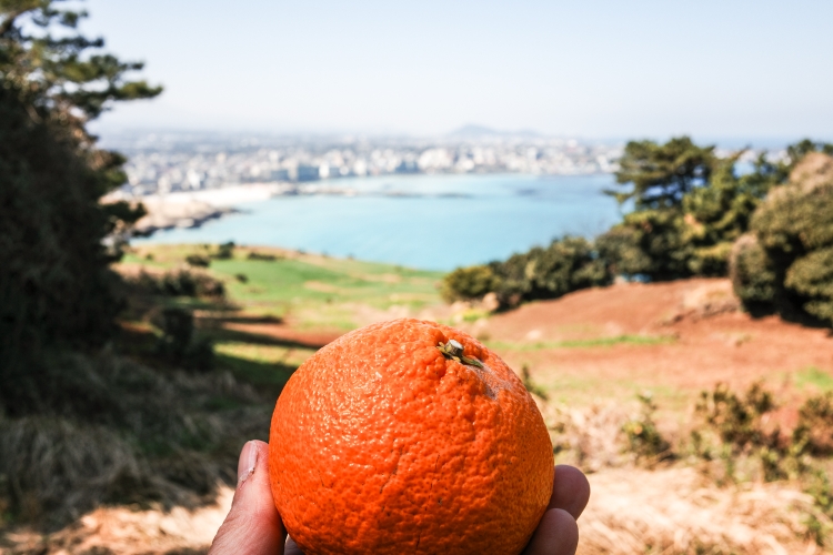
I'm in no hurry to leave. When I eventually do, I more or less bump straight into a lady walking her dog. She invites me to her home to freshen myself up. An offer I gladly accept. A few minutes later, I sit in their kitchen, talking to her husband, eating my first Hallabong (a Jeju citrus fruit). Sweet, yet a bit sour. I love the taste. An egg and tea follow, before I have a quick wash and hit the trail again. What a wonderful start into my day.
The sun is shining as the trail number 19, which I am following today, passes a busy beach town, a quite fishing village and eventually heads inland through forest. Some nice, proper hiking trail without anyone else around. Out of the forest, I pass through farmland. It's also where I hit my daily low. It's early afternoon, I am hungry and already miss the sea.
Eventually, I am back at the coastline. The ending point of Trail 19. Right next to it, a restaurant. Perfect!
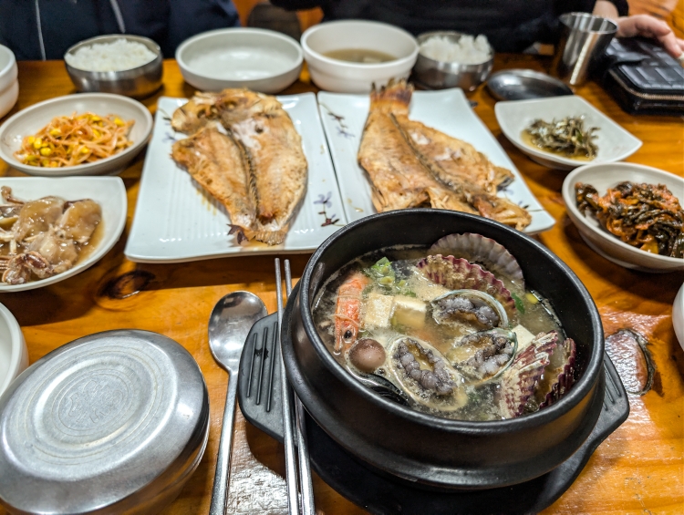
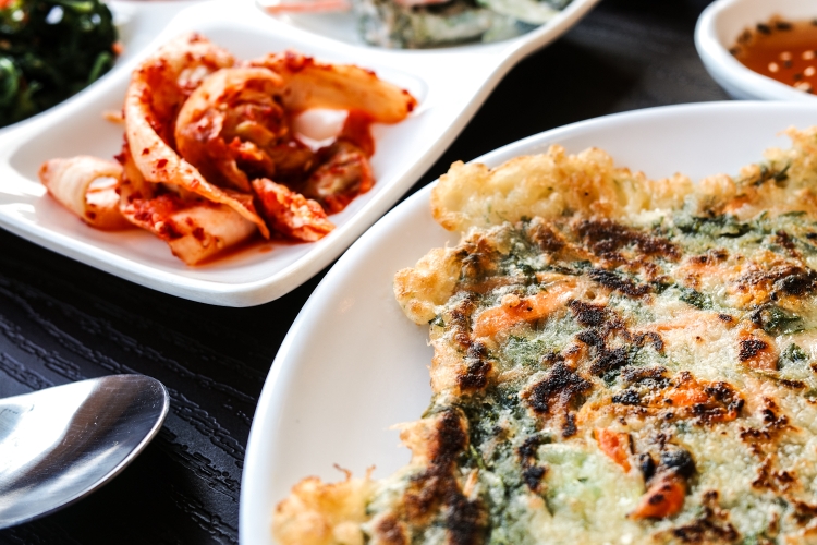
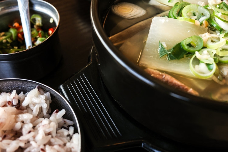
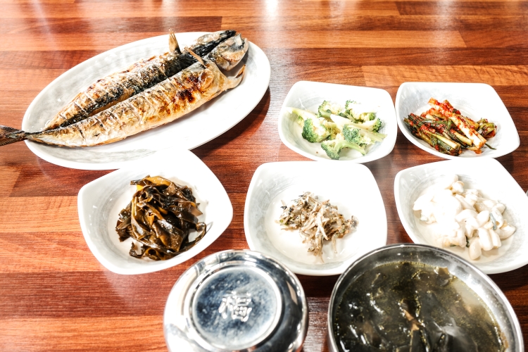
As usual, the menu is only in Korean. What eventually ends up on my plate always a surprise. Today it is a fried Mackerel with many side dishes. Super tasty and very affordable. For the 6 Swiss Francs I paid, I wouldn't even get a coffe and croissant back home.
Anyway, after I bravely tried to eat the fish with chopsticks (but eventually had to surrender), I once more hit the trail. With plenty of energy, the last few kilometers to the campground were easy going.
Earlier than I anticipated, I pitch my tent on a massive open field with fantastic views of the ocean.
I grab my book and some snacks at the nearby Seven-Eleven and settle in for a cozy evening.

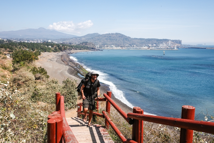
Day 1: Trail Mode On
Iho Tewoo Beach to Gwangot
Distance: 30km
After an uneventful flight, without any service whatsoever, the aircraft slams down hard on Jeju's runway. At least 15 minutes ahead of schedule.
Before I headed to Iho Tewoo Beach, I grabbed a leaflet from the Jeju Olle Trail Information desk at the airport (yes, there is one, right where you leave baggage claim) and headed straight for the beach, which I reached right in time for a great sunset view. The campground wasn't really there anymore, unfortunately. Just a small patch of grass behind some camper vans, which, I think, is intended for tents.
Still a bit jetlagged the night is rather restless. Therefore, I'm not too unhappy to hit the trail in the morning. With the sea to my left, the Hallasan vulcano to my right, navigation isn't particularly difficult. Also the marking of the trail is outstanding. If I am not somewhere completely else with my thoughts, getting lost is nearly impossible.
I watch the aircraft landing and departing, observing the locals doing their walks and runs.
Faster than I thought I get lucky and find a screw top gas canister. With the Jeju Olle Trail Passport, which I pick up shortly after, I have everything I need.
So I carry on, leaving the airport and the big city behind. However, I am never far away from civilization.
As I walk, I bump into several other hikers. Even groups. At the half way point of Trail 18, I meet a so-called hiking mate. One of many Olle Trail volunteers, offering people to join them for a walk. She invites me as well to join (which I happily accept) and before we start, I get offered sandwiches, scones and a rice juice.
Well fed, me, the volunteer an Italian and some Japanese are on the way again. It's interesting to get some local knowledge along the way.
At the end of Trail 18, I get invited for another tea. Then the guide and the others go their own way. Back to their home or hotel. I carry on for an hour along Trail 19. The sun already low on the horizon, I climb up a little hill with a pagoda on top. The view of the sunset is lovely and since the weather is nice, I decide to cowboy camp right there.
Tired but happy how the day turned out and therefore curious what the next days will bring.


Acclimation
...not necessarily because of the weather (which is, with 13°C and plenty of sunshine, pleasant here in Seoul and more or less exactly the same as when I left Zürich) but it's mostly due to cultural things. The language barrier, transportation, the food, the hustle and bustle of a massive city in general. Little things - but they added up. So, as I am typing these lines (once again from the airport, waiting for my flight), without even having really started, I am actually feeling a bit exhausted alread. In fact I am longing to leave for Jeju, starting my hike tomorrow morning.
Despite the acclimation (which to be fair was rather short), and having read through plenty of blogs and the trail notes, it's still a hike into the unknown. Maybe another reason why I can't wait to start and finally see how everything goes.
Not much more I can do other than waiting for the boarding call for Flight TW721 to Jeju. A roughly 1 hour flight south.
This will be my last pre hiking blog entry. Tomorrow afternoon, after a long day on the trail, hopefully I will have lots of interesting stuff to report.

Focusing
A couple of busy weeks later, I am now sitting on seat 36A, on board a Lufthansa A350. Still docked at Gate Z50. It's ridiculously hot inside, making it impossible to cool down after a sprint from my delayed flight from Zurich to the gate to my connecting flight.
Nonetheless, I am relieved to finally be on my way. Away from the snow, the mountains the daily grind.
The last few days, I really had to pull myself together, concentrating on the details, finishing up my planing. As good as I can at least. Part of thru hiking is always dealing with the unknown. A thing which, initially always brothers me a bit, but eventually adds to the, at least for me, satisfying nature of these longish hikes.
Since I have an 11 hour flight ahead of me (taking me south of Russia and north of Iran through a narrow corridor over Azerbaijan) and a growing delay due to some faulty/missing technical documents, I can give a quick outline of how my next couple of days will look like (if we finally become airborne):
Arriving in Seoul Incheon at around lunch time (hopefully), I will take a train to Gimpo, the airport my flight to Jeju leaves the next day (on the 21st). I booked my self into a hostel, right next to the airport. Depending on when I arrive, I will have a walk around the neighborhood, acclimate myself a little bit, changing money, activating my sim card. The usual stuff.
On the 21st, my flight to Jeju leaves mid-afternoon. Once on ground, I walk straight to Iho Tewoo Beach. Roughly 4 kilometers from the terminal. A public campsite, located halfway into Route 17 of the Olle Trail. Perfect for a first night on Jeju Island. From then on all I have to do is following the markers. Somewhere along the way, I might get lucky and find some camping gas and a Jeju Olle Passport. A passport shaped booklet, that you can complete by stamping at the starting, halfway and finishing point of each of the routes. While not "required", it's still a cool thing to do I think. And a great souvenir.
Until the passport is full, I still have a bit of walking ahead of me. 437 kilometers to be precise. But for now, all I can do is sit back, relax and trying to enjoy my flight, which, by now, finally made it into the air.
Daydreaming
My flight is leaving on March, 19th. From Zurich to Seoul via Frankfurt. One night Seoul and then onwards to Jeju. With T'way. An airline completely unknown to me. My passport is ready. My hiking equipment... Well not yet. I don't like packing. But eventually, I'll have to do it. But there is still time.
It's early March, I am at work, writing these lines. Outside it's snowing, spring seems far, far away. Even more so, I am looking forward to hiking the Jeju Olle Trail. Escaping from the cold, the snow, the daily grind and diving into a completely different world. Trail life. For the first time in Asia. While technically nothing spectacular, I'm extremely excited nonetheless. Despite my planning, reading blogs, looking at photos, I am still not sure yet what is awaiting me. All I can do for now is wait and see and revel in anticipation.
Day 84 (26): I See A Light
Rom to Lindesnes Fyr
Distance: 33km
A walk in the park. At least I thought so when I set sail at around 9. What a late start. I feel splendid as I navigate through Lyngdal then along windy, narrow and surprisingly busy roads.
It's then, when I somehow hit a wall. Going suddenly gets tougher. Some friendly locals, enjoying the sun on their veranda, invite me for a late breakfast at 11:30. A lovely gesture and a well needed boost.
Mid afternoon I reach Spangereid. One last ice cream stop and a visit to the cemetery to fill up my water bottle. Since it's quite late already, I will stay near the light house and want to make sure I have enough water.
The last 10 kilometers! Not too emotional. Only when I spot the lighthouse through a gap in the rocks my heart pumps a bit faster. I made it, well nearly.
Since the lighthouse and the area surrounding it are a museum, one has to pay to enter when it's open. It's not a lot, yet somehow feels wrong.
So I climb a nearby hill, cook my dinner (celebratory Mac'n'cheese), while watching over to the light house. Such a pretty view.
By 20:00 I make my way over to the Fyr, the lighthouse. Initially built in 1656, making it Norwegian's first one.
Finally there! Norge-på-langs officially completed!
It's an wonderful, interesting place with lots of history and things to check out. Eventually, the sun is setting. A surprisingly spectacular sunset and a magical end to my journey.
I put my sleeping right next to the lighthouse. A sheltered spot with amazing views. Can't get any better.
A Swiss family is hanging around as well,celebrating our Swiss National Day, singing the anthem. Feels like being home.
Eventually, they leave, I fall asleep quickly. Only wake up once. The fyr's light beam is spectacular under a wonderful sky full of stars.
Back to sleep. A deep sleep and I even sleep through sunrise and wake up to a steel blue sky. Some more photos and while I am typing these lines, my coffee is brewing next to me.
I take it slowly. I won't get a ride out of here, Norway's southernmost point, anytime soon anyway.
And where to? Well north,obviously. And then... I will see.


Day 83 (25): When Trail Magic Hits
Gletnesvatnet to Rom
Distance: 38km
After a wonderfully calm night with a good sleep and a black tea, I walk my first couple of steps on a stunningly beautiful morning.
It's all road. Initially quite back roads but mainly a, at time, busy main road. I remain on this road, following a river, for over thirty kilometers. Easy navigation.
I stop at a nice waterfall for lunch, at a road side shop for ice cream and coffee to go. Walking goes smooth and I am well on track to reach my goal for today, Lyngdal, in the late afternoon.
Until... Until I start talking to two cyclists on the road. Long story short, one thing leads to another, and I get invited to one of the cyclist's house. His daughter is celebrating here 22nd birthday and the whole family is attending.
A wonderful evening. Delicious and a shear amount of food, a very interesting and intimate insight into a Norway's family live, a hot shower, my washing done, a real bed,...
I could go on and on but it go late yesterday. 2 in the morning actually and I am still in bed the following morning as I am typing this. Still a bit tired after a short night but incredibly happy and thankful.
Shortly, I will head down to meet some of the family for breakfast. Energy, for my last day on the trail. I know, after last evenings great memories, it will be a wonderful day.
Lindesnes, here I come!


Day 82 (24): Looking Ahead
Åseral to Gletnesvatnet
Distance: 30km
A long night with little sleep. The locals kept on talking until early in the morning. Not loud but still making sleeping difficult. At least they keep the fire going throughout the night so I have a nice warning fire to wake up to.
Since I have got tons of food, I cook myself a porridge before climbing down the steep hill back to the town, where I hit the road.
These road walks give me time to think, to plan. I still have a month in Norway. What am I going to do with my time? So many options. I can't find the right one. There's no rush though. And tomorrow's another day.
After a bad night's sleep, going is generally tougher than normal. So I instantly and spontaneously decide to call it a day onxe I walk past a fishing shelter. It's huge, it's perfect to stay for the night. Great views and plenty of driftwood for a nice little fire.
For most of the evening, I have company of a cat. It's very friendly but terribly hungry. I feel a bit sorry that all I can offer are some bland, boring oatmeals, which isn't even exactly healthy.
Time passes by quickly. After a swim and warming up by the fire, I slip into my sleeping bag,keeping my fingers crossed for a good night's sleep.


Day 81 (23): ha det bra, mountains!
Stemtjonn to Aseral (Tippin Hut)
Distance: 38km
After a pleasantly warm and surprisingly calm night, I take my sweet time packing and leaving - enjoying my last couple of minutes in the mountains.
And sure enough, after just a couple of hundred meters, I descend steeply down into the valley. A quick ending of my walk in the mountains. Ha det bra, mountains. Bye bye mountains!
After a muddy walk through bush and forest, sooner than expected, I join a freshly bulldozed road. From this moment onwards, it will be roads only, all the way to Lindesnes. Roundabout 130 kilometers.
I follow Langvatnet, a dammed lake. Water level is low, revealing what's generally beneath the water surface. A petty sight.
I pass a skiing village and after more than 30 kilometers reach Åseral. A small town, but most importantly, it has a supermarket. Time for resupply and a little treat. Somehow, the time is flying. By the time I finished resupplying, it's nearly 6. There's a so called day hut right up the hill. That's where I am headed.
It's well worth the climb. A stylish hut. Not made for sleeping but just to hang out. With USB chargers, a nice fire place and nice views. Some locals are spending the night up there as well. We have a wonderful time around the fire, sharing stories and food.
It's warm with no rain expected. I decide to simply roll out my pad, hoping to do a bit of stargazing tonight.


Day 80 (22): To Cross Or Not To Cross
Aklaevatnet to Stemtjonn
Distance: 35km
Another crisp cold morning. Unlike yesterday, I decide to stay in my tent until the sun pops up from behind the mountains. That should be around 06:00. Or so at least I thought. Murphy's clouds places itself right where the sun would rise. I wait, I wait a bit longer, another 10 minutes. Screw it.
Without sun and warmth, I pack and leave. Sheep tracks take me down a couple of kilometers to a road. There, I have to make a decision: follow the road a bit and then turn right to Haheller hut (which is a 2 kilometers detour) or continue along the lake then cross a bridge? Problem: the bridge is only depicted in one of the two maps I use for navigation.
Since there's a sign pointing along the lake for the bridge option, I risk it, hoping there would be a bridge.
The bridge is massiv, I see it from far away. Lucky! Not really. As I get closer, I notice a piece of the bridge collapsed.
Three options: turn back and go the long way, follow the lake then hope that I eventually rejoin via an off-trail routing or just cross it.
Being on a thru-hike, I don't like option one. Option two is also kind of a long shot. So it's option three. Carefully, I climb down the collapsed part, balancing over some remaining metal pieces. It requires concentration but is actually not as risky as I thought. Still, I think if I wasn't on a thru-hike I probably wouldn't have done it. However, on long hikes like this one, generally I am willing to just go for it in such instances.
With the obstacle crossed, the remaining part is boggy with lots of ups and downs. Not slow going, nevertheless it's tiring.
Eventually, it's time to find a place to pitch for the night.
Not easy because of the wind, wetlands and vegetation. After a bit of struggling, I find a reasonable spot. I guess after the last fantastic campspots I got a bit spoiled. This one is a bit mediocre in comparison but quite nice nonetheless.
It's my last time on Norge på langs out in the "wild". Only 5 more kilometers and I will hit a road. From that moment on it's road walk all the way to Lindesnes. Around 150 kilometers I think. While I won't miss all the mud, I sure will miss these camping spots.


Day 79 (21): Fascination Camping
Ulvtuvtjonn to Aklaevatnet
Distance: 34km
After a cold night follows a cold start. Instead of taking the correct path after leaving the causeway, I follow an old marker, guiding me in the complete wrong direction. Still a bit sleepy, it takes me a minute to realize.
Back on track, progress is good. My foot feels better and also the trail is nice to walk on. For mosts parts at least. It's muddy once I briefly descend below the bush line. Nothing unusual and expected.
There's really not much worth mentioning. Just a nice day walking.
As I get closer to my campspot, big, black clouds are rolling in over the hills. I feel some drops of rain and kind of expecting the rain to intensive.
By this time, I feel exhausted. There's no way I can go any faster. Slow but steady I make my way south.
I pitch my tent at the first best place. Just as I am inside it starts pouring. My campspot is not optimal at all. Uneven, rocky. Once the rain stops, I quickly move to another spot. Nestled between rocks, a river and the lake, the views are outstanding. Once more. Somehow, I have the feeling that my campspots are getting better and better!


Day 78 (20): life's a bi... beach
Vassdalstjorn to Ulvtuvtjonn
Distance: 23km
20 days on the trail! Time is flying!
Well, not this morning at least. The storm intensified overnight and is still raging outside when I wake up. No hurry to get going.
I drink one cup of coffee after the other, start reading a book that is laying around, plan my next stages. A lazy morning.
My left foot needs some attention as well. An open wound seems to have gotten infected. The smell is quite bad. With my nearly non-existent knowledge, I clean it with some sanitizer I find, dry it, put some of my antiseptic solution on it. Looking much better now. Hopefully, it will get better.
After some more coffee and some more pages of the not so capturing book, the sun is coming out and I decide to leave.
Leaving the hut behind, I continue skirting around Blasjo, a massive dammed lake, which I have been following since yesterday noon. It's okay going initially until I get hit by a heavy, around 2 hours lasting rain shower with strong winds. The rocks become wet and slippery. I am keeping my head down, just functioning. Surprisingly, I'm not angry or frustrated.
Eventually, the rain stops. I have gotten uncomfortably cold so it's a delight, when the sun finds it's way through the clouds.
Time for a break. It's where I suddenly feel exhausted. The last 2 hours have been tiring. Since I have phone signal, I decide updating my blog, just distract myself a bit.
After doing so, I continue on a trail, which is hard to walk, up and down, partly badly marked. Difficult.
Then, out of nowhere, there's this beach. Small and maybe not the most spectacular one. But it's so random. Such a welcome surprise. Up here in the Norwegian mountains.
I can't resist, go for a swim in the clear water. It gives my mood a needed boost.
However, I don't walk to far anymore. As I cross two lakes via a natural causeway, I decide to call it a day. The wound on my foot hurts, and anyway, it's kind of a magical place. Surrounded by water, out there on this small strip of land.
A short day. Late start, early finish. But a tough day. Very challenging hiking. Many times did I have to use my hands climbing over rocks, many times I was close from slipping on the wet rocks. While not that many kilometers, it still feels like I have achieved something today.


Day 77 (19): The Saving Hut
Moltenuten to Vassdalstjorn
Distance: 39km
Fog is engulfing my campspot as I pack. It lifts quickly though and just as I start my walk, the sun briefly breaks through the fog. Since I descend into the next valley, I dive back into the fog shortly after. It's okay going. Not as bad as yesterday, yet, it's pretty slow going at times. This changes, once I pass Jonstollen Hut. A beautiful trail takes me up Kyrkjesteinskaret. I fly up there. Knowing that I want to do a 40 kilometer day somehow makes walking easier. The motivation is simply better than, when, let's say, I plan a 25 kilometer day. Probably something psychological behind it.
Anyway, the last bit up the pass is tough. Nearly half a kilometer up a snow field. Hard work!
Once on top, the topography changes drastically. Hard to describe but the area consists of huge, shallow rocks. They are grippy, nice to walk on. A continuous up and down. Sometimes pretty steep and technically challenging. But still quite enjoyable.
Even a bit more enjoyable as I am currently far away from civilization. A very remote area. No roads, no phone signal, no people.
Around lunchtime, a bad weather front is approaching surprisingly quickly straight from the south. Initially, it's only clouds and winds increasing, then there's the rain. First rain after around 7 sunny days.
It's too rocky and too windy. However, lucky me, there's a hut just around my 40 kilometers mark. While I was avoiding them for the last couple of weeks, today I go for it. As fast as I can.
Not that easy. With the rain, the rocks feel slippier. Wise to slow down.
But eventually make it there. A lovely hut. Expensive, yes, but the amenities and the views are well worth it. And... So far I am the only one! What a luxury.
Outside, the brisk wind has turned into a small storm. No way I could have pitched the tent.
The huts have solar power to charge phones and a gas stove to cook food. I make use of it both and slowly but surly settle in for a comfortable night in my bed.
I have no idea what the weather will do. My weather forecast is 2 days old. In other words useless. But as just written. Let me worry about tomorrow. For the moment all I am looking forward to is a good night's sleep.


Day 76 (18): A Tough One
Haukeliseter to Moltenuten
Distance: 5+30km
A black Range Rover pulls over to give me a ride back to Haukeliseter.
Normally, these cars never stop, but I got lucky after waiting for 5 minutes at the bus stop (yes there would have been a bus at 1:05am, wtf?...).
Anyway, the ride is once more spectacular and shortly after 19:00 I get dropped off where I started my resupply adventure 7 hours earlier. With still enough daylight, I continue my walk for 5 kilometers, passing dozens of tents and campervans, all getting ready for the night. Eventually, I leave the road and on a rough, undulating trail, leavinh the people behind. After an hour of walking, I have enough, pitch my tent and go straight to sleep.
Since it has gotten late, yesterday, I take it slow, waiting for the sun to rise before hitting the trail. A trail, which keeps being a bit slow going, and, as I climb the first saddle extremely rocky with big, sharp rocks, which require quite an effort to be conquered. Luckily, going gets faster on the other side. I pass several lakes, the views fantastic. And so is the weather. Perfect for a quick lunch break swim.
At one point, I descend over big, flat rocks below the scrub line, where the trail becomes a muddy mess. My mood drops. I have gotten so used to the rocks, the mountains, the open, that being back in the scrubs feels a bit depressing.
After a long chat with a lady at one of huts, my mood is improving and gets even better, when I spot some blue- and cloudberries. The trail then climbs steeply out of the bush, back into open. It's where I decide I have hiked enough for today. 30 kilometers. A heavy backpack and challenging trails made it a hard day nonetheless.
So I am more than happy to find a lovely spot, overlooking a valley to the north, with impressive views of big, towering cumulus clouds over the Finse area. Seems like they get a lot of rain, while here, the sun keeps on shining.


Day 75 (17): A taste of civilization
Buadalen to Haukelisetter
Distance: 25km
With the grocery store calling, getting up and hitting the trail goes relatively easy despite the cold temperatures.
While the beginning is a bit rough going, the middle part of today's hike is wonderful. Nice trails, even better views. In fact one of the best views I have had in while. Maybe especially because I was expecting a rather dull walk. Despite the food calling, I take it slow, taking in the views, going for a quick swim.
Right in time, actually. The trail is getting busier shortly afterwards. A lot of day trippers. Doesn't really matter. The nice views are gone anway and so are the nice trails. So I sped up as much as I can and descend the last 5 or so kilometers to Haukelisetter, restaurant, hotel, a tourist hotspot. Crazy busy. Yet, getting a hitch out of there is not that easy. Cars either full or old people ignoring me.
After 45 minutes a red car (my lucky car color) stops and the lovely woman "just heading to where the sun is shining" is taking me to the next town. The drive is spectacular and a joy per se.
In town I first start looking for a power outlet. Getting my priorities straight. Food can wait. I get lucky near the sports ground, where I have my peace and quiet and plenty of space to lay out my stuff, update my blog etc etc.
Shopping is generally a breeze. In and out. A small but well stocked grocery store.
Packing is more time consuming. However, getting rid of packaging, saving weight and space, is worth the energy.
I'm still in Roldal as I write this, just finished a phone call with Fredy. All in the green back home.
Soon my phone is fully charged and I will try to hitch a ride back to Haukeliseter. If it works, sweet, if not, I will try my luck tomorrow. Anyway, it will get late. So I post today's blog already and will give an update on how things have worked out tomorrow.


Day 74 (16): Short term planning
Ovre Bessevatnet to Buadalen
Distance: 30km
My rain measuring tool, aka my cooking pot, says roundabout 17mm of rain overnight. Less than expected but still enough.
The wind last night made my tent rock and roll. However, it hold up just fine. Just the rain fly leaking kept me initially busy. With my pack's raincover and my rain jacket, I was able to (surprisingly) keep most of the water out of my inner tent.
I wasn't expecting to sleep a lot, but was still able to sleep every now and then.
The rain stops at around 6. Earlier than expected. Still, since already planned a lay in, I stay in my sleeping bag, squashing mosquitoes waiting for me between inner and outer tent. It's rather addictive, oddly satisfying.
The mosquitoes get their revenge once I crawl out of my tent, pack and leave.
The weather is a mix of sun and clouds, the trail a bit of everything. Rocky, muddy, snow, rivers. After my long day yesterday, going is a bit hard. My feet hurt a little, making every step an effort.
To distract myself, I am thinking of tomorrow, when I will cross a highway. Since I skipped my last resupply, it's high time for me to hitch into town to stock up on food. I'm pondering which direction I should hitch, whether I should stay in town for the night ect, ect.
What I came up with is: hitching west to Roldal, food for 6 days and not staying in Roldal. Somehow, I have to charge my batteries though. I will figure that one out when in town.
This short term planning is something I like doing. Keeps my mind busy. Not just with shopping but also the route, where to camp and so on.
Speaking of camping: after 30 kilometers I am done walking for the day. One steep, final climb takes me on a pass. The views spectacular. So that's it. My spot to camp. After yesterday's focus on a sheltered place, today, I am looking forward to enjoying the views.


Day 73 (15): flat out windy
Drageidfjorden to Ovra Bessevatnet
Distance: 48km
A mostly cloudless night. Without my tent's raincover, I had a lovely view at the night sky and at a nearly endless dusk and dawn.
It's a warm, humid night, my sleeping bag wet from the morning dew.
As I pack, the sun just rises from behind the hills. A great view and a great start into my day.
A long day, as it will turn out. After climbing over a first hill, terrain quite abruptly gets much flatter, less rocky but boggier. An interesting change. The scenery reminds me of the one in Finnmark, far up north.
The mosquitoes are crazy in the beginning and I already start worrying about them, following me all day. However, a brisk southerly wind comes up, blowing them away. With the wind getting stronger, blowing right in my face, also going is getting harder. I make good progress though. Even though, here and there are still rocky, slow going parts. To be honest, I don't enjoy the scenery that much. Maybe it has also to do with the high clouds, which make everything look a bit dull. Eventually, I enter Hardangervidda National Park. The scenery doesn't change much. Just more people.
With the wind still blowing strong, I decide I would continue to cross the flat, to find some more sheltered places to pitch my tent, meaning a long day.
Despite feeling reasonably fit, like yesterday, I eventually start feeling every muscle.
Since the winds are supposed to increse even more and torrential rain forecasted for tonight, I want to find a reasonably sheltered spot. Not an easy task. It takes me a while until I find something suitable. Not perfect but I hope it will do. Too tired to look any further. And the sky looks like rain in imminent.
Right after finishing my dinner, the rain starts. I retreat into my tent, preparing myself for a very wet, windy night,crossing my fingers that my not-so-well-in-shape-anymore tent will keep me dry and safe tonight.


Day 72 (14): On Top
Geiteryggvatnet to Drageidfjorden
Distance: 40km
Today, while hiking, it crossed my mind that, gosh, I have been repeating myself in this blog over the last couple of days. Rocky trails, reasonably good weather, scenic campspots and generally good hiking spirit.
So I tried to come up with something different today, the sun however, relentlessly shining on my head, with no shade whatsoever, rendered my brain useless.
Therefore, I am sorry, I write for the 10th time: Rocky trails, generally easier going and amazing views of the Finse Massif with its glaciers. Finse is also the name of a train station. With 1222 meters the highest in Norway but for me mainly a place to quickly recharge my batteries.
The area around the train station is a zoo. Just too many people out and about. As I hit the trail again, it's getting a bit better. Yet, there are many people hiking it. I feel great, overtaking roundabout a dozen people. It's the time of the day, everything works smoothly. I'm in the flow, the mood fantastic. My motivation top.
But what goes up eventually must come down. I hit the wall after 32 kilometers. Suddenly, going is harder.
Therefore, I am released when I spot yet another wonderful place to pitch my tent. Overlooking two lakes.
It's only 17:00. But that's more than okay. After 40 kilometers, I am just happy to enjoy the view.
And by the way: Halfway! Distance wise at least. Roundabout 500 kilometers hiked with 500 more to go. I'd love to celebrate it with some extra chocolate but since I spontaneously decided to skip my next resupply tomorrow, it's conserving food for me. Don't worry though, I will definitely catch up on the missed chocolate during my next resupply!


Day 71 (13): Rock'n'Roll
Valefatnet to Geiteryggvatnet
Distance: 38km
Being waken up by the rising sun, shining on my tent, warming it up, happens rarely, almost never actually. For that, I generally leave too early.
Today is the exception though. The fantastic location of my spot gets hit by the first rays of the raising sun at shortly past 5. An amazing feeling, making my campspot even better and a worthy candidate for my top ten all time favorite campspots.
I'm on a mission though and thus have to eventually leave my spot. While the trail continues to be rocky, weather and views are spectacular. Progress is slow, not just because of the rocky terrain but also because of the numerous photo stops.
As I descend, going gets easier. I feel great, lots of energy. I am flying up the next pass. A beautiful, fast trail. Shortly before the top, catch up to a young Norwegian hiker. We start a conversation, walking together for quite a while, following lakes across a rocky landscape. It's not often that I meet people hiking at the same pace. So that's a nice change. After a while, I stop for a break, going for a swim in one of the ice cold lakes, doing laundry, using the sun to wear dry my clothes.
It's rough hiking over rocks again. Very hard on my feet and knees. A couple of kilometers later, I meet my Norwegian hiking companion again. He has some pain in his feet, slowing him down. I match his pace and together we continue nearly all the way to Geiterygghytta, where he is staying and I pitch my tent nearby. Not as spectacular as last night's spot but a nice view of the lake nevertheless.
Honestly, it felt good, having someone to hike with, today. Especially, across this challenging terrain.
Overall, a very good the on the trail. The hiking spirit is up high. Exactly as it should be!


Day 70 (12): Lost And Found
Suleskaret to Valevatnet
Distance: 35km
Rarely have I ever spent such a rainy night in the tent. The constant noise prevented me from falling asleep. Headphones and some relaxing music did the trick.
When I woke up during the night, only light rain remained. Nevertheless, the inside of my tent was something in between damp and wet.
A couple of hours later I pack. My campspot is engulfed by fog. Inside temperature in my tent: 6°C. Uncomfortable.
Way finding in the fog is challenging. There's no formed track and I navigate from marker to marker, carefully hopping from one slippery rock to the next.
It's a constant switching from looking ahead to find the next marker to looking down at my feet.
One could think I am a bit annoyed but, no, I have to concentrate so hard, there's no room for emotions.
Eventually, I am descending below the cloud base, out of the fog. The clouds, however, remain. Unlike forecasted, they don't dissipate. So I make my way south, the trail is getting easier to walk on, therefore, progress is good. Until shortly before Bjordalsbu, where the trail is getting rocky again. And it's staying rocky. While never steep, it's a technical hike, requiring a lot of concentration. It's a constant reading of the rocks, carefully finding a suitable rock to place my foot on. Nevertheless, every now and then a trip or a rock under my foot moves. Especially, towards the end, when I am mentally and physically getting tired. I have been lucky, some bruised toes and a small cut on my shin. Nothing to worry about but it shows, how fast something can happen.
During these last few kilometers, the weather improves dramatically. The colors change, the views into the distance are suddenly here. It feels great to finally have some sun again.
I have a lake in mind, where I would pitch my tent. 2 kilometers before, however, there's the perfect place to pitch a tent (and looking at some pegs lying around, was probably not the only one thinking it).
It's a bit windy. Perfect to dry my tent, sleeping bag and everything else that needs to be dried.
Tomorrow, well, the weather is supposed to be good again and looking ahead, the trail rocky again. But for the moment, I just enjoy the moment, the views.


Day 69 (11): Average
Sletterust to Suleskaret
Distance: 23km
Finally a good night's sleep. How I missed it! Maybe because I knew today would be a short day.
So I take my sweet time, eating some chocolate while still burried deep in my sleeping bag.
By eight, I am on my way. The trail is neither good, nor bad. Some fast parts, some slow parts. Average. Some muddy parts, some rocky parts, some smooth, gravelly bits. Average. Also the the weather is very average today. Better than expected, yet a bit grim looking. No rain, hardly any sun. And finally the landscape. Nice, mountainous but not breathtaking. Average again.
Below average is just my pace. I go for a looong coffee break, then have a looong chat with two fellow countrymen, which I meet shortly afterwards. Just the couple of kilometers before Sulebu, I activate my afterburner, flying towards the hut, only to be slowed down again later on by rocks. Back to my avarage day.
Anyway, just after passing these rockfields and the Suleskaret Pass, I spot a nice place to camp. Only 16:00, just a bit more than 20 kilometers hiked. Definitely below average. Anyway, the view is spectacular and I decide to call it a day.
Just as I have finished pitching my tent, it starts to rain. Luck. Definitely above average.
I'm happy having done a short day. My body needed it. Tomorrow and day after tomorrow, the weather is looking very promising. Hard to believe at the moment but if it really is sunny, it's going to be fabulous day in the mountains.


Day 68 (10): Tusenmeteren
Fleskedalen to Sletterust
Distance: 45km
Another night of bad sleep. Might be partly the new sleeping pad, which I still have to get used to but I think the main reason is the rain and with it the noise.
After my long day, everything takes a bit longer this morning. Eventually, I am on my way, descending from 1000 meters to sea level. The track is steep in parts, but generally not too difficult. Highlight of the morning: Vettisfossen. With 275 meters free drop, the highest in Norway. The view, its force, the noise. It's breathtaking. I take a quick break, eat some chocolate to savor the moment a bit more.
Eventually, I continue my descent down to the fjord. Still steep, still not too challenging. At the bottom, it's a 3 hours walk to Ovre Ardal, where I resupply, charge my batteries and plan the next section. All in all, it takes me 2 hours before I am on my way again.
And while in the morning it was 1000 meters down, it's now 1000 meters up along an old coach road. Apparently it took more than 30 years to build but eventually was replaced by a new road.
Climbing with a backpack full of food is strenuous but eventually I make it. Just as I am arriving, the weather improves. Feels good to have the weather on my side for once. Especially, because the views of the fjord are wonderful. I keep following the old road, getting soaked by yet more rain. Camping spots are rare so I keep on walking, eventually leaving the road. As I climb further into the mountains, I find a neat spot, overlooking the valley. I use a dry spell to pitch my tent.
Just as I have finished settling in, the rain sets in again.
Another long day. My body feels tired. In combination with the bad weather forecast, I'll probably take it a bit slower tomorrow, making a shorter day.
Now let's hope for a good night sleep for a change.

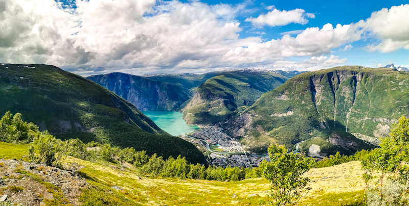


Day 67 (9): Approaching The Limit
Spiterstulen to Fleskedalen
Distance: 40km
I know I repeat myself but it's another rainy night. Heavy rain. Putting my backpack raincover on top of my leaky rainfly as additional layer helps me from getting even wetter.
I wake up around 4 but remain in my sleeping bag since it's still raining. Despite a long day ahead of me. At 5 it stops and in no time I am ready to hit the trail. After a short while, I meet Monika in front of her tent, cooking a porridge. She's is flip flopping Norge pa langs. At the moment, she's heading south, but taking a different route than me. Since she carries food for up to 3 weeks (!), no need to resupply. I must admit, I'm impressed.
It's time to move on, rain starts again. Several river crossing make the hike challenging. Fording these high flowing rivers requires care and since it's ice cold glacial melting water, it's pretty uncomfortable as well.
Luckily, the rain stops, make my life instantly more pleasant. It even gets better, when I head straight for a rainbow, popping up in front of me. Like yesterday, my hike takes me over a mountain pass. Again rocky, again slow going. For most of the time, I follow a hiker. With the approximately same pace, I follow him a couple of meters behind until I eventually close up. A bit of chit chatting and when Leirvassbu, a massive hut complex, is finally in front of us, we go in, have two well needed cups of coffee each.
It's raining again outside and our motivation to head out there is not really there. So we chat some more until I really have to leave. The late start, the slow trail and now the long break. I'm far behind my schedule for today. It would become a long day...
Thanks to an unexpected gravel road, the next 5 kilometers are surprisingly easy going. Also afterwards, descending to Skogdalsboen, progress keeps being good. Shortly after the hut, I spontaneously decide to jump into a river. Taking my smelly clothes with me into the water. It feels great thanks to sky, which cleared up. I put back on my wet clothes to dry wear them.
The trail gets rougher again. Progress on these last kilometers is painfully slow. I feel tired, ever step requires plenty of effort.
It's the view that keeps me going. As I get closer to the fjords, the valley narrows, huge waterfalls everywhere. A spectacular view.
Yet, the views only help so much. During a last steep descent to some flatter grounds, I feel every muscles in my legs. And when I struggle to find a campspot, my mood drops completely.
Anyway, now, after pasta and porridge, laying on my new sleeping pad, my world feels in order again. Yes, it was a long day. Too long maybe. I sure came close to my limits. Maybe not something I need every day, but every now and then I think it's a good thing to check where they are.

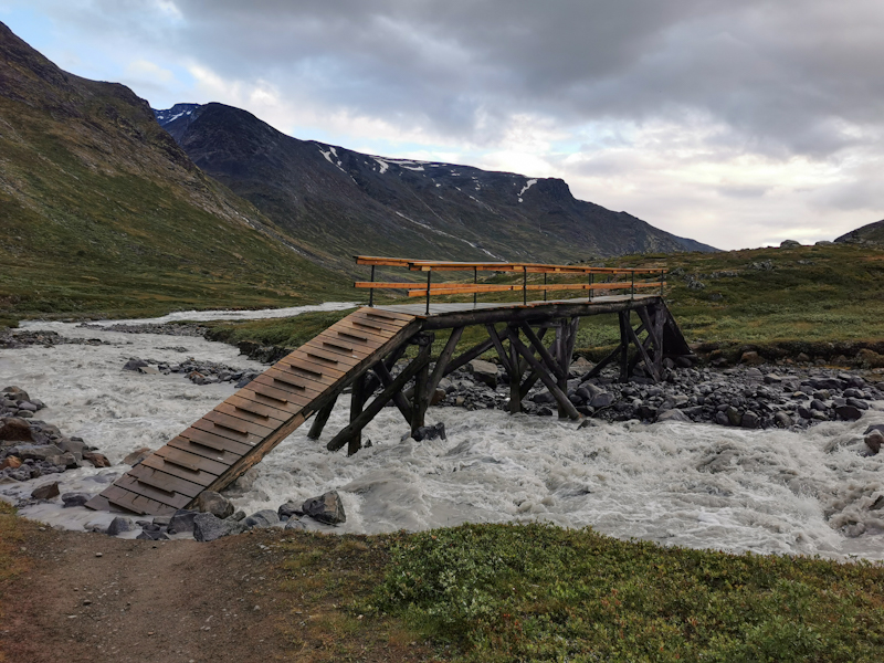


Day 66 (8): Rock Overload
Randsverk to Spiterstulen
Distance: 40km
I wake up to a spectacular morning sky. What a treat to start my day. My morning mood gets even better, when I notice my tent is completely dry. For the first time on this trip.
After a couple of kilometers, clouds are pushing in from the north, getting thicker with every minute. In Glitterheimen, at the end of an never-ending gravel road that I walked yesterday and this morning, I plan to grab a coffee. The hut is busy however, the line at the reception long. So I pass and shortly after leave the warm hut.
Back on the trail, going gets harder. As I climb Velsglupen, with 1650 meters one of the highest points on this trip, the trail gets rocky. Very rocky. Going is slow and with my not-so-fresh-anymore sandals, I feel every one of these rocks.
When the wind and the rain set in, I initially feel a bit down, but recover surprisingly quickly. I think to myself, I mastered much worse tracks and weather conditions on Nordkalottleden back in 2020. So this is actually a piece of cake.
And around 5 hours after leaving Glitterheimen without my coffee, I arrive in Spiterstulen. Another massive hut complex. Incredibly busy as well. Despite the adverse weather conditions. Should I stay or should I continue? Just booking a bed is tempting but somehow I feel like camping tonight. No idea why. Generally, I prefer a bed over a tent, especially when it rains.
So I continue. Back out into the rain, which is getting heavier. A bit more than a kilometer from the hut I have enough, pitch my tent in the pouring rain. Despite being incredibly quick, the inside is still getting wet. Still, I don't mind too much. Mainly, I am just happy to be out of the rain, after a surprisingly challenging day out in the mountains.


Day 65 (7): The Mountains Are Calling
Bekken to Randsverk
Distance: 45km
It has gotten late yesterday. Planning, organizing, packing. Some 'social' duties as well. When I finally called it a day, I immediately fell asleep. So a veeeeery good first impression of the new mattress. However, I must have been extremely tired and eventually woke up, feeling rather stiff. The pad is definitely firmer. But I think I will get used to it rather quickly.
Because of the late bedtime, it's not such an early start. Well, compared to other days. By 5 I am on my way. A humid morning, slightly foggy in the morning. As I climb out of the valley, it gets pleasantly warm. With 1000 vertical meters, it's a long climb, initially along gravel roads but eventually off track. Finding my own way. A bit trickier than I anticipated but once above the treeline, going is easier. I take the direct route up. My puls over 170 beats per minute. Unusually high for me while hiking. Anyway I feel good, the views are fantastic. Hundreds of flies follow me all the way across the mountain. As soon as descend below the treeline on the other side they are suddenly gone.
What follows is a long, tough roadwalk. Mostly across dairy country. Plenty of traffic, mostly Volvos, who are headed for a Volvo meeting. I pass the time looking at some of these cars and with plenty of ice cream. 3 to be precise. I wasn't expecting so many shops along the way. But I don't complain.
Despite all the ice cream, my legs start feeling tired, my back stiff. Once above the treeline again, I pitch my tent. No need to go any further. The views are spectacular. You can't imagine how happy I am that the weather is playing along. Enjoying it, as long as it lasts. Tomorrow, looks very differently.
It's when, I'll head into Jotunheimen National Park. Even deeper into the mountains. Exciting times ahead!
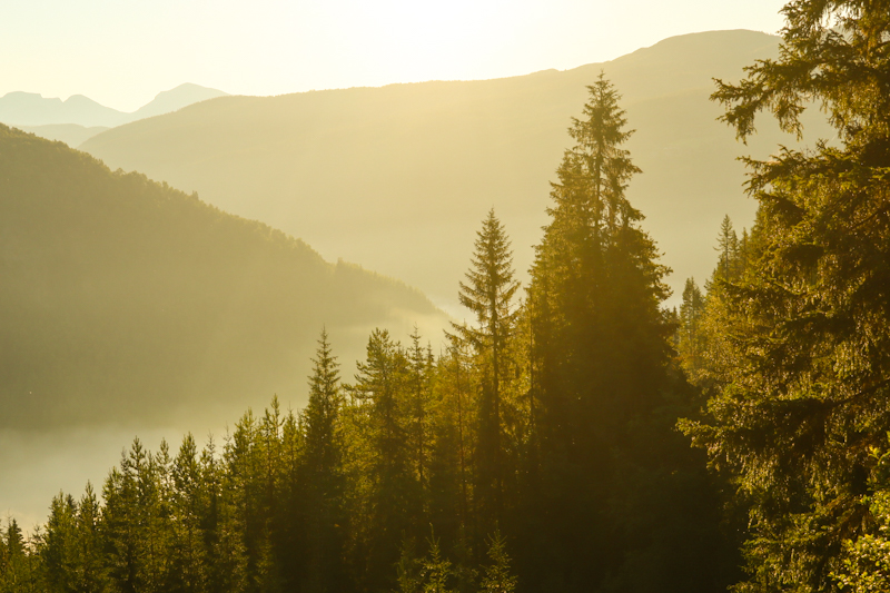


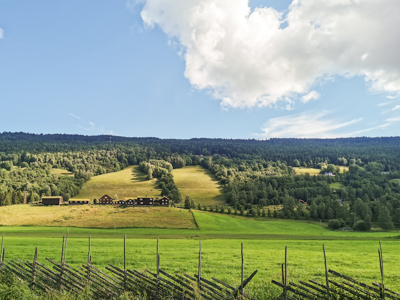


Day 64 (6): Roller-coaster Of Emotions
Straumbu to Bekken
Distance: 35km
No thunder, no steong winds. But another rainy night (at times it rained so heavily, the water penetrated the rain fly, making it an uncomfortable night), another early start, another fast packing due to mosquitoes.
The walk across Rondane National Park offers some wonderful views, however, due to a rocky track, my focus was mostly where I would put my feet down next.
On the other side of the park, at Rondvassbu, I more or less bump into Frank as he just gets out of the hut. Frank, a lovely hiker from Germany, who I met in Abisko, 4 years ago. Me on E1 southbound, he on his way to Nordkapp. Such a huge coincidence, we meet again. Again, I head south, he's heading north. There's so much catching up to do. We spend nearly 2 hours talking. It feels good and really motivates me to carry on my adventure.
After a long hug, it's time to continue. A long road walk to Otta to resupply. Or at least so I thought.
In Bekken, around a kilometer out of Otta, I get into a conversation with a local. And shortly after, get invited to pitch my tent in their garden. A wonderful, highly appreciated gesture as I don't have anywhere to stay in Otta.
I settle in, preparing for a relaxed afternoon. Well, at least so I thought again...
As I blow air into my mattress, three loud 'pops' make me flinch. It takes me a couple of seconds to realize that some of the seams of my mattress gave up the ghost. And from reports from other hikers I met over the years, that's it. Nothing to fix. Distaster. Yeah Maria, I know you warned me a while ago... But ignorant me wouldn't listen...
What to do? I take out my phone, google for sport stores in Otta. Bingo! But they close in less than hour. Marit, my trail angel, offers me her bicycle. What an nice gesture. A 10 minutes cycle takes me into town and to the sports store. Very limited selection. I go with one of their overpriced foam mattresses. Something completely different to my air mattresses. I'll report tomorrow how I slept.
Anyway, once back, I get treated with a delicious fish dinner with potatoes and carrots. We have very interesting conversations about the area. Great so get some background information about the area I walk through. Time flies. They are headed to some friends, I do my resupply, have a hot shower, write my blog. It's well past nine, whenn I finally retreat into my tent.
What a day it was. Full of surprises. Negative but (luckily) mostly postive ones. A day to remember for sure.


Day 63 (5): And Into The Mountains I Go
Dollbekksaetran to Straumbu
Distance: 40km
14 hours of rain. Not heavy but continuous. Everything in my tent is damp. Not a pleasant feeling.
So I start packing by 03:00. The super aggressive mosquitoes, going straight after my legs, are a good motivation to pack quickly. So soon after getting up I am on my way.
The rain has stopped, just some low hanging clouds remain. A friendly day weatherwise. Also the the rest of today's hike is wonderful from A to Z. Good but challenging, sometimes rocky trails, spectacular views and my body feeling fresh. A day like this is the perfect medicine too boost the hiking spirit.
Laying in my tent, overlooking a small alpine tarn, I feel satisfied after a rewarding day. Not even the strong winds and the towering cumulus clouds, which might even end up in thunder, can worry me at the moment.
I don't want to add anything else at this point. Rather, I'd like to let the photos speak.


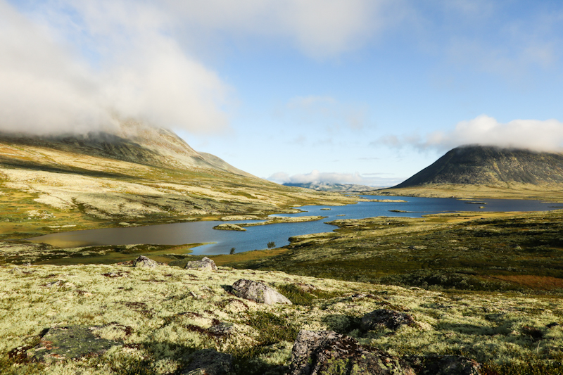


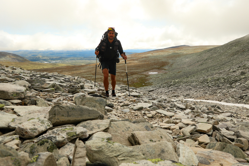
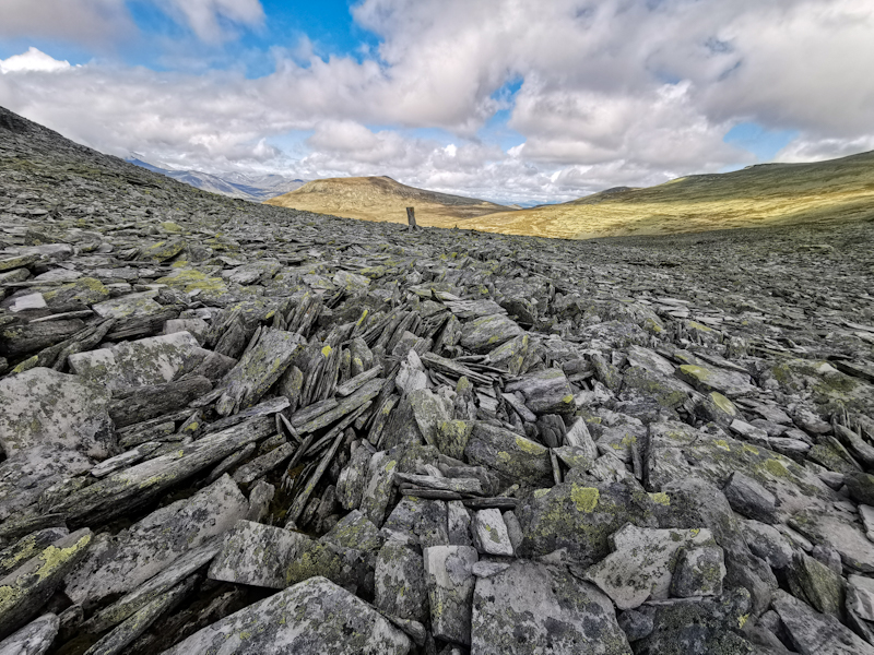


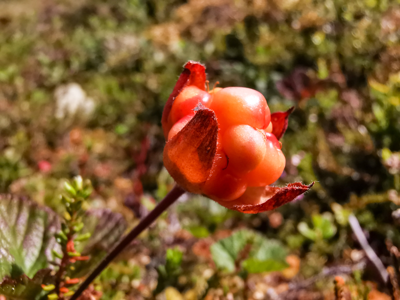

Day 62 (4): Like A Racing Horse In A Cage
Brønnåtjønna to Dollbekksaetran
Distance: 30km
03:00. Even for me, this is an early start. However, with daylight permitting and bad weather forecasted for the afternoon, it's not the most stupid thing to set off that early.
It's cold and due to the overnight rain, the humidity high. Yet, it's a smooth start into the day. Until I climb out of Tylldalen towards Avdal. Overgrown track, wet, hard to follow. Several times, I loose the faint trail. It seems like a typical "connection trail" that somehow remained on the map but neglected by whoever is responsible for the maintenance. Anyway, eventually I make it to Avdal. I have walked for 4 hours, still, it's only 08:00. And my body is already ready for lunch...
After stuffing the bought food into my pack and getting rid of all the packaging, I continue, only to realize that I forgot my hiking poles in the store. Luckily, I haven't left the parking lot yet, so the detour is not that painful.
With my poles, I now definitely continue. After a short while, I spot 2 through hikers coming the opposite way! (we all look the same, it's not such a challenge to identify a through hiker).
A quick chat reveals that they are headed northbound from Lindesnes to Nordkapp and have been on the trail for 2 months.
As we can already smell the rain, we each continue our own ways. It felt good meeting them, knowing that I am not the only one out there.
Rain starts a couple of minutes later. Not heavy but continuous. Before climbing above the tree line, I decide to call it a day. It only 14:00 and I would easily be ready for another two hours. Physically. But walk another 10 kilometers in the rain, with no sheltered spots to camp... Not the smartest idea.
A bit of shame that the weather is holding me back. Stopping, beside the urge to continue doesn't feel right. In the beginning at least it did.
Now, I actually feel quite comfortable. A lovely spot under a tree, listening to the rain and plenty of time to write the blog.


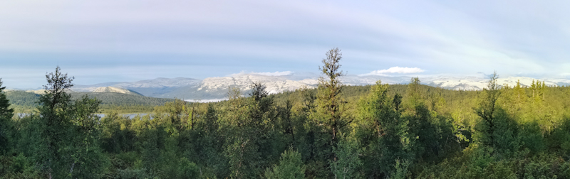


Day 61 (3): the long way back into the thru-hiking mindset
Hodalen to Brønnåtjønna
Distance: 45km
Thanks to the firewood, the tipi is warm and cozy when I slip into my sleeping bag. Nevertheless, the sleep still isn't as deep as I hope it would be.
Maybe, it's, beside the not so dark nights, the usual tension at the beginning of a new hike, that is keeping me awake.
Anyway, it's an early start. By 04:30, I am on my way, climbing out of Hodalen on a particularly wet track. Yet, progress is smooth and once above the bush line, the views are beautiful.
Every now and then, there's even some sunshine, which really helps to boost ny hiking spirit.
Eventually, I join a gravel road, taking me down to Bydalen, before gently climbing up the other side of the valley until I find a somewhat suitable place to pitch my tent. Nothing fancy, between a gravel road and a lake. Plenty of mosquitoes (reminds me of my time in Finnmark) but it's a flat, dry spot that will do just fine for the night.
It was a long day today as wanted to make the most of the weather. Doing these long ones are mentally challenging for me. Especially, when I haven't really arrived in my thru-hiking mindset. Somehow, I am still stuck, back in Switzerland, going after my daily routine. Running, swimming, working. Challenging as well, but in a very different way.
During the 45 kilometers today, I was thinking a lot about Switzerland, how nice it would be just to go for a run, a swim, having a shower and a coffee. Yet, towards the end of the hike, somehow I started feeling slightly more comfortable on the trail. Hike, eat, sleep, repeat... Doesn't sound that bad after all. I wouldn't say that I am fully there just yet but definitely on my way.


Day 60 (2): The Little Things...
Bredalsibua to Hodalen
Distance: 25km
While the sun is below the horizon at night, at this time of the year, it never gets completely dark. And despite being extremely tired, I still need to get used to it. As a result, my sleep is not as deep as I was hoping for. Anyway, I feel recovered enough to start into my hiking day. There's even a little bit of sun. Such a lovely surprise. The surprise, however, is just lasting for the first two hours. As I make my way up another hill, through a mystic, white mossy landscape, it starts pouring down. 3 hours of continuous, heavy rain, no shelter around. In the beginning, I cope with it but eventually it gets annoying. While the trail is great, it is still tough going. The more I am relieved, when I pass through the village of Hodalen and find some shelter under a porch of a closed restaurant. Still raining heavily, I have no urge to continue. I change into dry clothes, have something to eat. A local is approaching me, we have a chat. It feels good being a bit distracted from the weather. He points out a shelter just around the corner, even calls another local to ask if it was okay if I stayed there. With me still being cold and the weather not drastically improving, I head straight for the shelter. It's only 14:00 but I feel like walking no more today. So I settle in, hang my dry clothes. Eventually, the local comes bag with big bag of firewood. What a lovely surprise. Being out in the rain for several hours, this actually means a lot for me.
So I fire up the old, rusty stove. The shelter heats up quickly, making it super pleasant.
Another short rainy day. Not an easy start into my hiking adventure. My hiking spirit is still up, but for how much longer? The forecast isn't very promising. A pleasant morning tomorrow (the reason why I want to have an early start tomorrow). Then rain again on Wednesday. I will see how it goes, how I feel. But let me worry about it later. For the moment I fully enjoy my warm shelter.


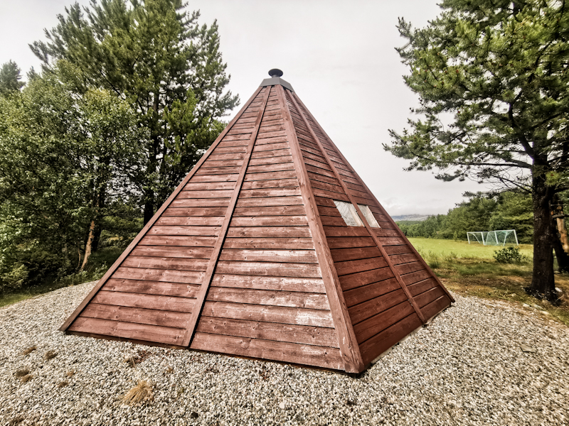

Day 59 (1): Embracing The Scandinavian Weather
Roros to Bredalsibua
Distance: 15km
Getting from Trondheim Airport to Roros is straightforward. Train to the City, another train to Roros. However, the connection is bad and the trains are slow. It takes me roughly 6 hours. I don't mind, I am not in a hurry to get off the train and into the rain, to hit the trail. While the train ride is actually quite picturesque, the bad weather and the tiredness, which hits me, makes for a difficult ride. Anyway, during my long layover in Tromdheim, I'm on a mission. Mission camping gas. Mission impossible as it turns out. Nevertheless, while looking for it in gas station, I meet to young cashiers. They apologize for their gas station poor selection and invite me for a well needed coffee, before I continue to Roros.
Once off the train, I head straight to the nearest gas station. One of my last chances... And success. With 175 kroners It's ridiculously expensive. It has to be a superb gas. Anyway, I am happy I have it.
In the waiting lounge of the train station, I change, get ready for my hike in the rain. With every minute, I feel better (maybe the chocolate I have bought together with the gas helped). And when I finally hit the trail, there's even a dry spell.
Navigating out of town is easy. After my third visit in Roros, I start to know my way around. Eventually, I leave the road. After 2 steps, both my shoes are soaked. A taste of what is yet to come. But it was expected. But beside being wet, the trail is fantastic to walk. No ticks, no mosquitos. And from time to time I am even able to ignore the weather, which is getting harsher by the minute. And it's during these moments, I really enjoy being back out there.
Still, despite being outside for only 3 hours, I start feeling uncomfortably cold. Luckily, there's a hut/shelter close to the trail. Without thinking too much, I head straight for it. It turns out to be a lovely wee hut and despite only a short distance walked, a suitable place to set camp.
While writing these lines, the weather is becoming more intense. I feels good being sheltered in here - enjoying the luxury
However, it will be the first and only hut like this along my way and I fully appreciate that from tomorrow onwards, I will be more exposed to the elements. So fingers crossed, the weather will improve.


Northbound
I am writing these lines from the arrival hall at Trondheim airport, after spending a short night here and after a long, tiresome journey from Zurich.
Exhausted, but still somehow relieved that my new adventure has finally started.
There really is not that much to write. Honestly, I just kill some time, waiting for my train to Trondheim Central Station, where I will connect to a train bound for Roros. Somewhere in between, I really want to find gas for my cooker. So far I haven't been lucky. The gas station at the airport, did not have any camping gas. At least they had (well needed) coffee.
The flights yesterday where uneventful. Heavy rain and thunder in Zurich, which delayed my first flight, rain again in Oslo. Because the same aircraft operated my second flight to Trondheim, I could make the connection. No free night in a hotel in Oslo after all...
The sun is shining here at Tromdheim airport. Blue skies in fact. But the sunny weather wont join me to Roros. Heavy rain is forcasted for the next two days.
So I am not fully certain that I will start my hike today. Maybe, I will wait a bit for the worst of the weather to pass. But there is still a bit of time to decide.


A New Year, A New Hike
It feels like yesterday, the moment I touched the statue at Capo Passero, marking the end of my four year E1 adventure.
In fact, however, more a year has passed, I am back in the daily grind. Lucky for me though, I take another couple of weeks off work this summer.
The big question: what am I going to do?
Launching a new big project? Trying something completely different?
Well, somehow I don't feel ready for a new big project like E1 just yet. Still, I'd like to do a bit of walking.
I have used the long winter nights to ponder my next move and eventually came up with Norge på langs (or NPL) – Norway Lengthwise. From the top to the bottom of Norway. Or vice versa. There is no given route. Hike your own hike. Whether you want to cut across Sweden or not, walk inland or closer to the coast – the choice is yours.
When I was hiking the E1 from Nordkapp to Sicily, without knowing back then (I only found out later about NPL), I was already doing roughly two thirds of the length of Norway (the green line on the map on the right), before making my down Sweden towards Denmark.
From Nordkapp to Roros, roundabout 2000 kilometers. The time spent on E1 in Norway was, looking back, the best of my whole 8000 kilometers E1 adventure. The scenery, the remoteness, being at the mercy of the elements, but also the people I met along the way – they all made my time in Norway unforgettable. There’d be so much to write about my time up there, but I don’t want to waffle on at this point. There is plenty of reading material here and here for those interested.
Since I have all these great memories, why not returning to this wonderful place and completing the length of Norway? Picking this low hanging fruit. From Roros to Lindesnes. Another 1000 kilometers to Norway’s southernmost point.
With my rough plan in place, I started looking for a date to hit the trail, suitable flights, planning a detailed hiking route, resupply points, etc etc.
A long story short: my flight leaves Zurich on July, 6th in the evening, arriving in Trondheim by midnight. From there, I will take the train to Roros, where I hope to arrive my Sunday noon. Somewhere between Trondheim and Roros, I will need to score a gas canister. Not an easy task on a Sunday in Norway. Anyway, if I get lucky, I hope to start diving into my adventure right after stepping off the train in Roros.
Weather isn't looking to promising at the moment, with rain and not very summery temperatures. But, as the Norwegian say, there is no bad weather, just bad clothes.
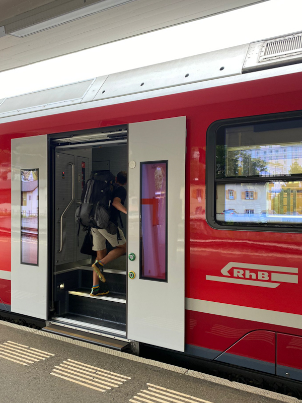


Ha det bra! Moi moi! Hej då! Hej hej! Tschüss! Ciao!
Norway, Finland, Sweden, Denmark, Germany, Switzerland and Italy. 7 Countries. More than 8000 kilometres, 219 days, 4 summers (and 1 winter).
E1 in a nutshell.
From the Far North to the Deep South. From the tundra in Finnmark to the steppe like landscape on Sicily. Through the vast Swedish forests, never ending corn fields in Germany, across the Alps and into the unknown, rugged Apennine and along coasts up north and down south. A trail scattered with milestones. Completing the Scandinavian peninsula, spotting the Alps, while still deep in the black forest, arriving home, seeing the Mediterranean near Genova and many more.
What a ride it has been. I have no idea, where I should start with the summary of my E1 adventure. I'm not even sure if I should call it E1 or simply my hike across Europe. While I was following E1 for most of the 7 months, I created my own hike here and there. Namely in the southern part of Sweden, Denmark and then again in Campania and Calabria. Up north because I was enjoying my hike so much and wanted to add some more regions, down south because E1 was either not defined or I didn't want to risk getting stuck in overgrown or non-existing tracks. A completely differing, everchanging hiking experience as I make my way south.
I still remember my first day on E1 like it was yesterday. Fog, briefly lifting, letting the sun through, creating a mystical atmosphere, as I leave Nordkapp at three in the morning. Embarking into a new adventure. Little would I know how unforgettable it is going to be,
Norway is wild. Sparse. With long stretches where neither paths nor markings are existing. Mosquitoes, snow, river crossings the unforgivable weather add to the challenge. So does the solitude. Long stretches in between civilization. Food for 300 kilometres leads to a heavy backpack. Yet, I love my time up there. Each and every day. Days, which are long. Never-ending. Walking in the midnight sun is an unforgettable experience.
As I enter the Sweden with its forest, the hiking changes. The trees give me the comforting feeling of being sheltered. Yet, they
have a confining effect. I miss the views. However, basically every day a vindskydd (a shelter) is awaiting me. Generally, idyllically nestled to a lake. Surprisingly, I have them for myself.
Many evenings, I spend swimming in these lakes, before warming myself up in front of the campfire. A wonderful ending of a hiking day. More often than not, these evenings where the highlight of
my day. Even when I hit the coast in Skane, leaving the forest behind. If there is something like thru-hiking romance that's probably as close as I ever get. I feel light-hearted. Happy. I am
hiking and living in the here and now, An unforgettable feeling. After exactly 100 days, I reach Sweden's southernmost point, completing the Scandinavian peninsula.
What follows next is Denmark. In November. A good idea? Well, until today I am not sure. Yes, it is cold, windy, wet. And dark. The days are short, many hours I walk in the darkness.
Nevertheless, walking the deserted beaches and huge dunes, hardly able to withstand the wind, passing through towns with their Christmas decoration, spending the evenings in the vindskydds,
reading my book by candlelight, trying to stay warm, gives my time in Denmark a special touch. An experience I have not had before.
The following summer, it's time to leave Scandinavia. Germany is calling. Honestly, I do not have high expectations. Lots of forest, flat terrain, cocky Germans. Things I thought would be
awaiting me hiking Germany.
As a result, I don't feel overly enthusiastic when I resume my hike in Flensburg on a wet and cold spring day. But my not too optimistic mindset is helping me to be positively surprised more easily. By the trail, the scenery and by the people. In fact, I very much enjoy my hike across Germany.
Yes, the terrain is flat for most of the first three weeks. A hill of more than 200 meters is the exception. A highlight even. Yet, the walk from Eckernförde to Kiel along the Ostsee is one to remember. Wonderful late spring weather, along a beautiful, deserted stretch of rugged coastline
The lakes disappear, the temperatures are getting higher as I make my way south. The heat. A new phenomenon on E1. Something to get used to. Walking E1 in Germany is fairly civilized. Plenty of resupply points, plenty of ice cream. I am surprised by the German's hospitability. More often than not I can camp in people’s backyard or even in their homes. They offer me food and plenty of beer. Not a single night I spend on a campground or in a hostel or hotel, And I must admit, once I cross the border into Switzerland, I feel a bit guilty. Germany has proven me wrong. In hindsight, Germany has been a refreshing hiking experience.
The next 250 kilometres across Switzerland are so different to Germany. First and foremost, they are on home Turf, then the terrain: mountainous with lakes every couple of kilometres. The way I like it. Furthermore, there's the great company of Fredy and the wonderful surprise of meeting Klaus and Gisela. This all adds to a lovely 10 days in Switzerland. Yet, I am happy to reach the Italian border. My feet feel tired and the hot weather too, has left its marks.
After a well-needed break, I tackle Italy a couple of weeks later. Resuming E1 in Porto Ceresio. From the very beginning, it is
somewhat of a struggle. The three-week break is too short to fully recover from the previous stint across Germany and Switzerland, yet long enough to throw me out of my thru-hiking
rhythm. Additionally, the first week, leading me across the Po flat, is mentally demanding: flat out boring through a desolate landscape with the odd dirty, smelly village thrown in
between. Dogs keep barking at me. For most of the time, hiking trails are often non-existent and thus plenty of the first 250 kilometres on asphalt. The cycle tracks along the Ticino
River are okay while the stretches on roads are, thanks to the terrible Italian drivers, not a lot of fun.
Things change dramatically once I enter the Ligurian Mountains, where proper, well-marked hiking trails are popping up. With the clearer air and the higher altitude, the views are
getting better with every day. When I spot the Mediterranean, I must shed a tear of joy as I start to realize how far I have come on my E1 adventure. Mentally, this helps me a lot. And I need
this extra motivation as the trail is getting physically demanding as I head into the Apennine. Lots of ups and downs, sometimes on technically demanding trails. Never dangerous or extremely
exposed though. E1 becomes surprisingly remote at times, meaning my backpack is generally rather heavy with food for up to six days and plenty of water. However, my effort is rewarded
with spectacular ridge walks, breathtaking views and lovely camping spots (while officially not allowed) wild camping in Italy is absolutely doable. Especially in the Ligurian Mountains and the
Apennine I never struggle to find a spot). It's exquisite hiking and one of the best so far on E1. After pausing near Firenze for the winter, I continue in 2023, where I have left the trail a
couple of months earlier.
I am mentally fighting with myself, making my hike harder than it should be. Around the earthquake destroyed area of Amatrice, I reach a personal low. Never in my thru-hiking career did I struggle with myself so much. I am close to giving up. I'm glad for all the support I receive from home and overseas. It helps me to change my attitude, accept certain things the way they are, even see the good things in them. Like the rain.
Italy is a long country. Walking down its spine seems never ending. Until I hit the coast.
Different walking. No more rain. Sunny and hot. Very hot. Mostly enjoyable walking. Having the deep blue sea to my right, always available for a swim, gives me good feeling. It feels like I am flying down the boot and across Sicily towards Italy's southernmost point and southern terminus of E1.
Of all countries hiked, Italy is by far the most challenging. Physically, with the heat and the mountainous terrain until reaching the coast but especially mentally.
To cut a long story short:
On E1 in Norway, the trail, the journey is my destination. The spectacular, mountainous scenery, the solitude, the remoteness, the untouched nature, the hospitality of its people is simply unbeatable. But also extremely challenging is adding to the positive experience.
In Sweden, after hiking through forest most of the time, the amazing shelters or vindskydd (as they call them), which were usually nestled close to pristine lakes and provided firewood and comfortable sleeping possibilities, were undoubtedly the highlight, my destination of the day. Germany was, what I would consider, comfort hiking. A country able to really surprise me. In a good way. Getting close to Switzerland, home, was the driving factor for most across Germany. Switzerland, well, that is home. Unique, different. Not much to add. Then Italy with its ups and downs in so many ways. Being so far into my adventure there is really no turning back or giving up. My motivation. So I continue. And knock the bastard off.
It's only on my way home, cruising just below the speed of sound at 30'000 feet, looking down at Italy and areas I have been walking, when I fully realize how far I have come. What I have achieved. It gives me the comforting feeling of fulfilment. At this very moment I feel complete. Happy to have decided to tackle and finish E1.
So what now? Honestly, I don't know. Scandinavia maybe. Probably. At least I don't have another big adventure lined up. For the time being I simply enjoy reminiscing.
Section 4 - Midlle and South Italy. Some thoughts.
I knocked the bastard off. And a bastard it was for sure - this last stretch of E1.
But I will come back to that a bit later.
Mid-June, I prepare myself for Italy, where heavy rainfall is causing death and destruction. The weather settles just as I continue my journey on Passo della Giogo. A good start. Dry, not too hot, not too cold a good track.
Things quickly get a bit more challenging with overgrown tracks, ticks and afternoon thunderstorms. Some fabulous stretches, like one a bit northeast of Perugia, the area around Castelluccio or the Abruzzo mountains are able to keep my hiking spirit from plunging. Stretches which by far exceed my expectations. Also the endless beech forestes are a pleasure. Overall I am mentally fighting with myself, making my hike harder than it should be. Around the earthquake destroyed area of Amatrice, I reach a personal low. Never in my thru-hiking career did I struggle with myself so much. I am close to giving up. I'm glad for all the support I receive from home and overseas. It helps me to change my attitude, accept certain things the way they are, even see the good things in them. Like the rain.
So I carry on. However, shortly afterwards I start to realize: the route I have planed to hike across Campana and Calabria (along Sentiero Italia) is out of my league at this time. Too long, too many vertical meters, the uncertainty if the tracks are walkable.
In my head, I am mulling different option. The most appealing and realistic one is simply follow the coast from Salerno the Villa San Giovanni. The ferry terminal for Sicily. Yes, it would involve a lot of road walk. But by then I am tired of missing markers and getting lost, so I opt for the coast. With the beach calling, I can gain new momentum and I have some great hiking days.
Nevertheless, I then extremely spontaneously decide to take a couple of days off anyway. Head home, leaving the trail in Sulmoma. Waiting for the weather to improve, plan my new route.
Is it the right decision to take a break? Or should I have used the momentum. On the train home, I question my own decision keep on doing so during my 6 days off trail. What I can certainly say is that they help me to sort my thoughts and hit the trail well motivated and mentally recharged. A different hiking experience. Like in the good old days. And after a few days inland (where I also meet Umberto, who, with his amazing hospitality boosts my hiking spirit and therefore adds a lot to my achievement!) I hit the coast. Different walking. No more rain. Sunny and hot. Mostly enjoyable walking. Having the deep blue sea to my right, always available for a swim, gives me good feeling.
And following a flat, fairly straight route, obviously is flushing my down the boot towards the end of the mainland, compared to the inland route. Together with the lovely company of my friend and future TA, Maria, I tackle Sicily. Leaving the coast, leaving the road. Yet another completely different hiking experience. Remote, wild, hilly. And a volcano. No more water to cool down makes walking in the heat challenging. People I talk to think that I have lost my mind walking in this heat. With my goal so close, I am able to ignore it. Push all the was to Italy's southernmost point. Yet enjoying every day. Completing Italy, completing E1.
Of all countries hiked, Italy has been by far the most challenging. Not just this year but also last year. Physically, with the heat and the mountainous terrain until reaching the coast but especially mentally.
Many hours have I thought about it. Trying to figure the 'why'. Why the mental strugge? Is it the 'walking away from home', the difficulty to connect with the locals, the barely existing hiking culture? Or not knowing if the tracks I walk on are really existing. The uncertainty. The missing identy of E1 in the middle and south of Italy. Maybe a combination. Maybe also the fact that E1 has been consuming me a lot for the past 4 years and I am somewhat tired. 8000 kilometers is a big number to walk.
Anyway. I made it. I knocked the bastard off. In the end much faster than I anticipated. Better this way than the other way round.
As I am typing this, I am sitting on a pebbly beach near Taormina, still on Sicily. Enjoying Pizza and Ice Cream. Feeling fulfilled. Proud. And despite all the challenges, I don't regret hiking it a single bit.
My flight back is on July 4th. Maybe by then, or when I look down from the aircraft, I will have fully realized what I have achieved.
I already mentioned my gratefulness for the support I received from family back home and friends overseas. Namely Fredy, George and Rob. Also a big thanks goes to Pierangelo from Bernate Ticino and Umberto from Bologna. Your hospitality meant so much to me. And last but not least Maria, who joined me for a couple of days, enduring me and my stubbornness. She is still recovering from her blisters. I hope you can keep your toenails and also hope you could gain some experience for Te Araroa.
So that was Italy. Most probably, I will also write a quick summary about my whole E1 experience in one last (I promise) blog entry. Stay tuned.


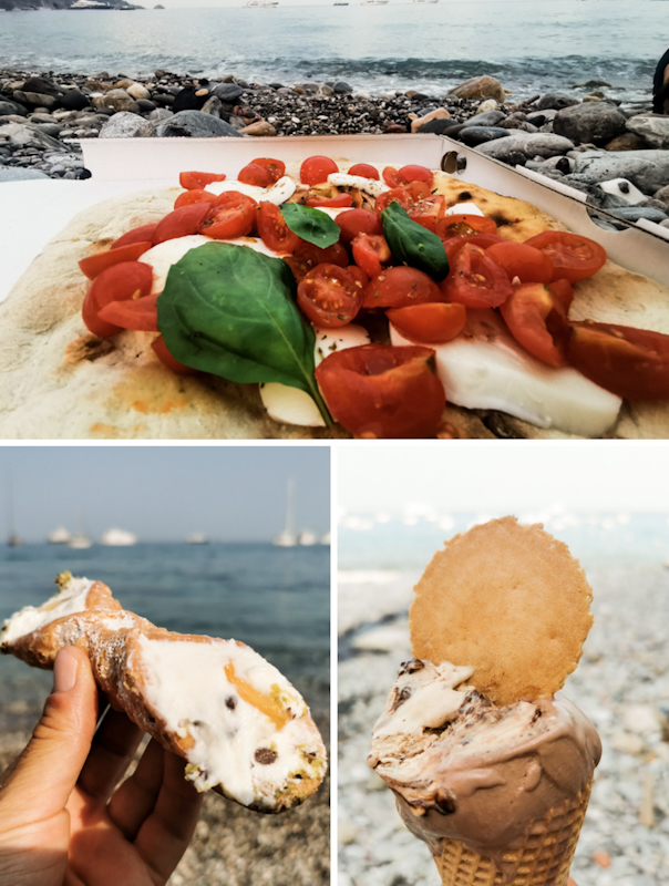
Day 219: The Last One!
San Lorenzo to Isola della Correnti
Distance: 20km
I take a slow start into, what I hope would be, my last day. I watch the sunrise, go for an early morning swim, before continuing following the coast along beaches and rocks. A pleasant start. In Marzamemi I stop for a Cappuccino and some chocolate bread. It's hazy. A strong contrast with the deep blue see. Eventually, I go for another swim before reaching Capo Passero, the last town before the end. It is also where I have to walk back tomorrow to catch a northbound bus. Destination unknown. I still have to figure that one out. Not now.
After a resupply I am tackling the last six or so kilometers. Initially along the road, then the beach. After a so far surprisingly unemotional day, the emotions hit me once the Statua del Cristo Redentore, the southern terminus of E1 comes in sight. Spontaneously, I have to think of my first day on E1. I remember it like it was yesterday.
The beach is packed. A causeway takes me to the statue and a plaque, indicating the terminus of Sentiero Italia (which strangely doesn't go here, but it gives a nice touch anyway).
People are surrounding the statue, taking photos of the "punta più a sud d'Italia" - -engravement. Italy's southernmost point. I walk right past the statue, taking a seat on a grassy spot. I can't hold back a tear or two - torn between "happy I made it" and a bit overwhelmed of the big void. E1 has been consuming me for the past couple of years and suddenly it's over. They are the same feelings I have had after Te Araroa. Feelings I guess many thru-hikers can relate to.
While sitting there, I notice Isola della Correnti, the island of the currents right in front of me. People are crossing the water. Since two of my trusted followers put some very gentle pressure on me to finish my hike on the island, I put my phone and tracker in a dry bag and head for the sea. Leaving my pack behind on the last few steps feels awfully wrong but observing the people crossing, it would be a terrible idea crossing it with my pack. Crossing the 100 meters of sea is straight forward. Yet, I am in the water up to my throat. Once across, I head straight for the southernmost point. That's definitely it. In fact, I'm on a more southerly latitude than Tunis, Africa. Crazy!
So until here and no further. I go for a swim. Right where the Ionian and the Mediterranean Sea meet. It's rocky, the waves are throwing me around but it feels amazing.
I don't hang around too long. It might sound weird but I feel a bit sorry for my pack, left behind on the other side. So I cross back. Back to the statue, where I just sit for another hour or so until it's getting a bit warm. I head to Camping Captain. Located just a few steps away. I check in, pitch my tent in the shade. All the emotions made me feel a bit exhausted. The right moment for a siesta. Now that I finished my hike, I can do that without any urge to carry on.
Somehow, it feels like someone pulled the plug and all the air is out. I guess it's the combination of the relieve to have arrived and the last couple of long days. Doesn't matter. Until I fly home on July, 4th, I take it easy. Plenty of swimming, maybe a bit of running. Time to process what I have just achieved.
I'll end the blog entry for today at this time. By the end of the week I'll try to write a summary of E1 in Italy and the whole thing. So stay tuned!
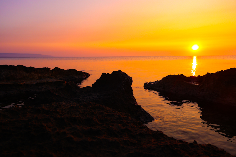
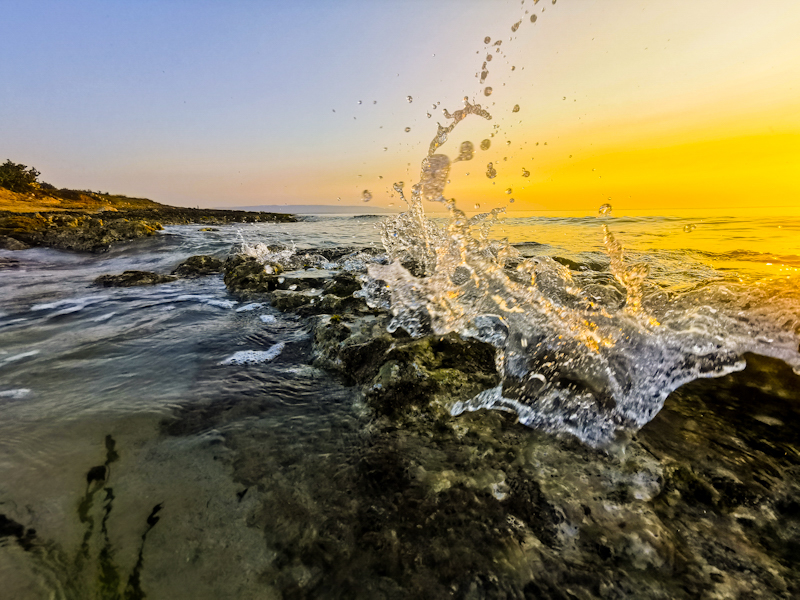
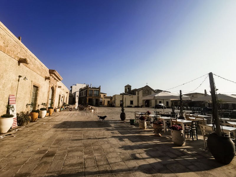
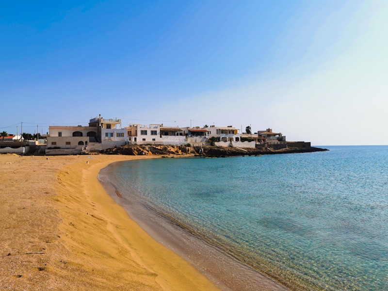
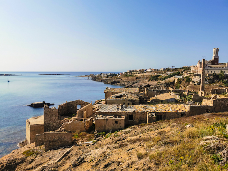
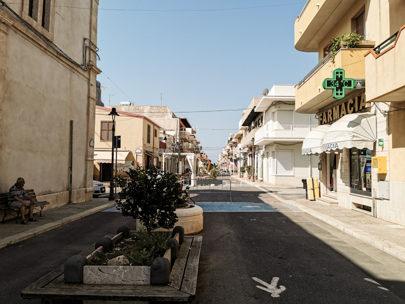
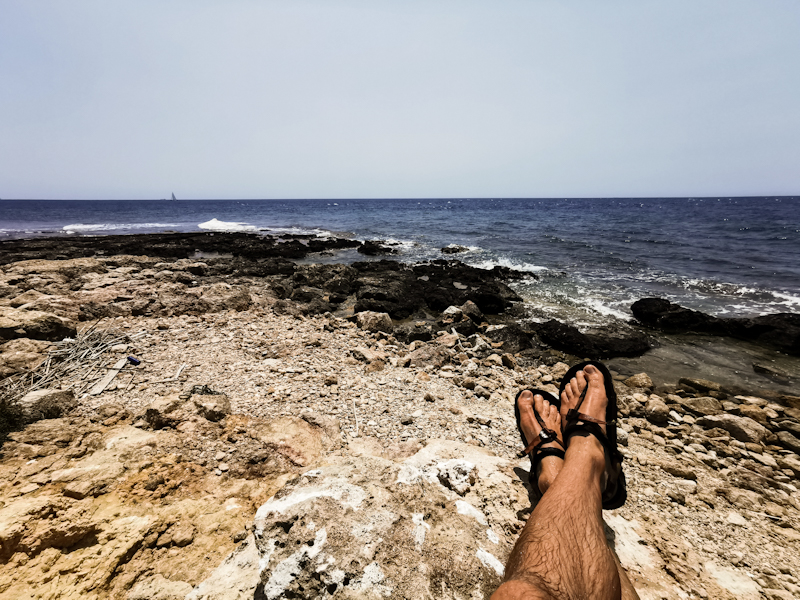
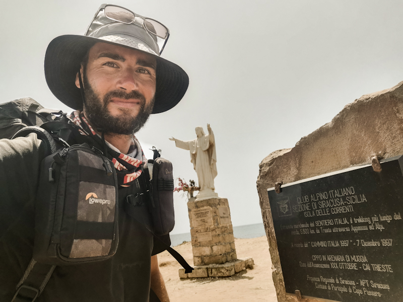
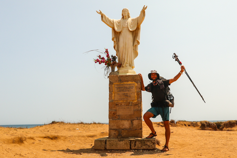
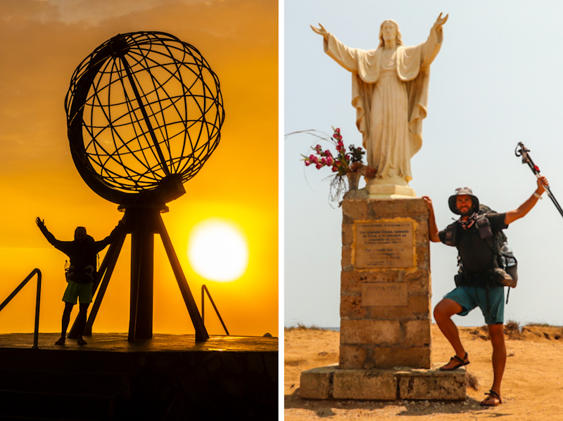
Day 218: Saved By A Naked Dutchy
Pantalica Solarino to San Lorenzo
Distance: 50km
Most probably my second to last day. Mentally it has never been an easy day. Lots of things going through my head. But then again, the beach is calling and that will boost my motivation for sure.
The day starts with 25 kilometers of road walk. Not much to say about that. It's still dark when I encounter a pack of wild dogs on the road. Before hiking in Italy, it would have freak me out but after so many experiences, I just 'shhhhh' them away.
Without taking off my backback, I cover the 25 kilometers in one go and only stop at the first beach for a swim. Gosh, it feels great. Azzurro water, extremely clear.
From then it's partly beach, partly road. The hike only gets interesting, once I enter
Riserva naturale orientata Oasi Faunistica di Vendicari. Following the official E1 (no markings though), I have to climb over walls and fences. On my left side, the cliff steeply drops into the sea. Eventually, I have to find my way down as well. To steep to descend with my backpack, I have to throw that poor thing down first, me climbing down behind.
I follow a beach and then another one. That's where the naked Dutchy comes into play. Because I stand in front of a estuary, with no plan where to cross. On satellite images it looked harmless enough. In reality not so much. The Dutchman sees me cluelessly standing there at the nudist beach. In German he explains that he has observed several other people crossing from that tree to that small pole than to the big pole, where it will get more than waist deep. So I'd have to hold my pack above my head. Wow, what a description and super accurate. I do a "dry" run without pack and it's exactly as described. So I put everything into drybags and tackle the crossing. Somehow funny that on my second to last day I have my deepest river crossing on E1 and possible of my whole thru-hiking career.
From then on, walking gets easier and I have time to enjoy the lovely coastal walk. Being a nature reserve and due to turtles laying eggs there, access to the beach is heavily restricted. I was planning on camping there but no chance. So I keep on going, leaving the reserve. Once the next town is only a few hundred meters away, I finally spot a promising looking place. I am waiting until shortly before sunset before pitching my tent. Just to be save. Not that I expect any troubles.
Some people are passing by, all friendly smiles.
Having walked further than planned leaves me with a rather short day tomorrow. No need to hurry. I'll enjoy sunrise, go for a coffee into town before tackling the last few kilometers to Sicily's southernmost point.
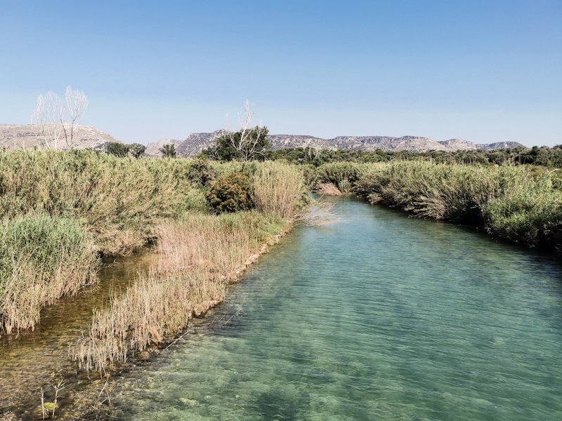
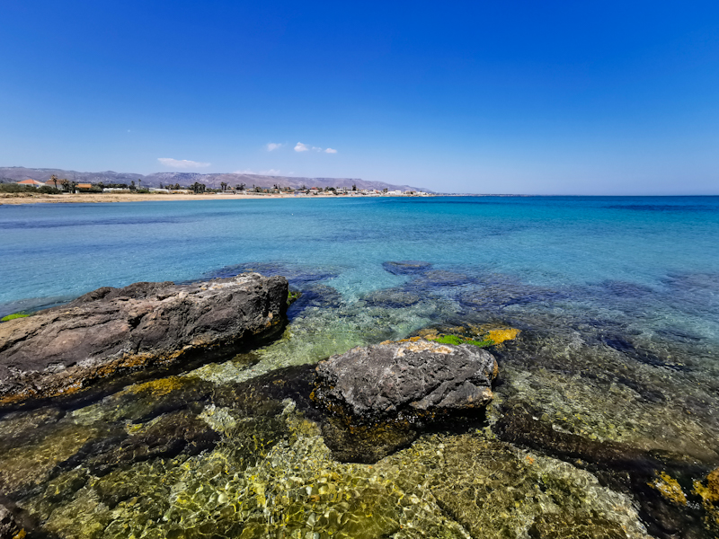
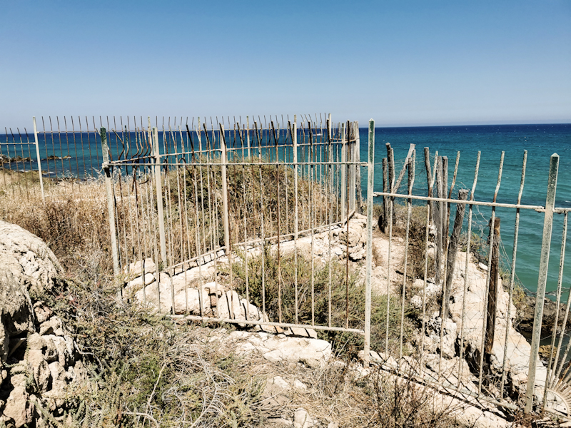
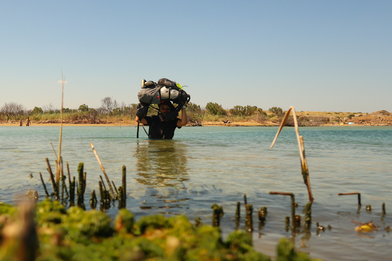
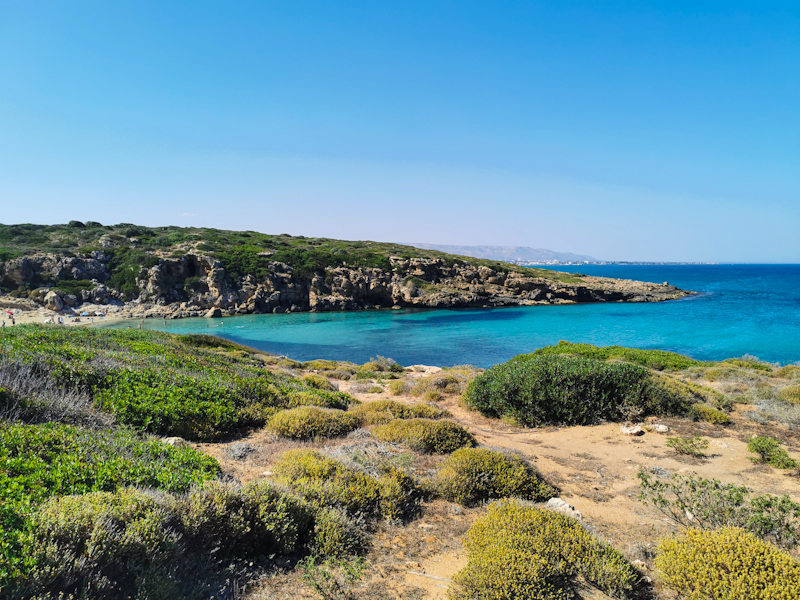
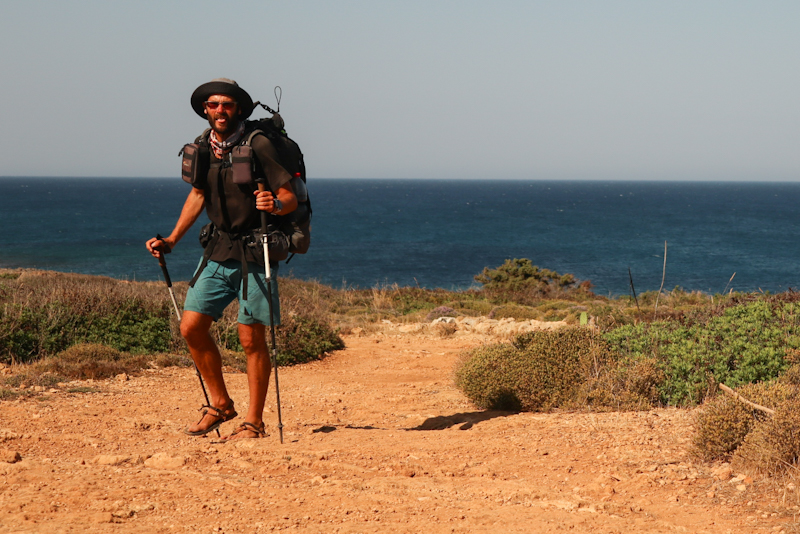
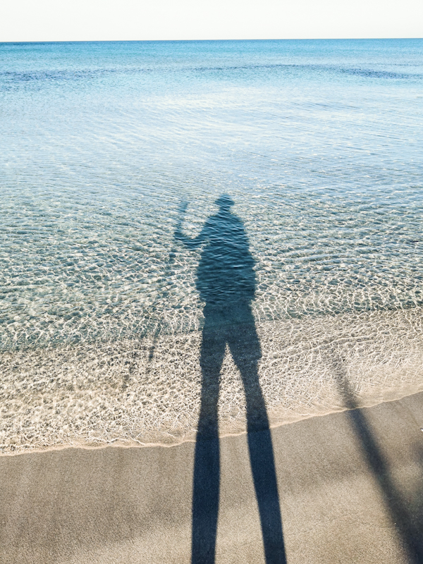
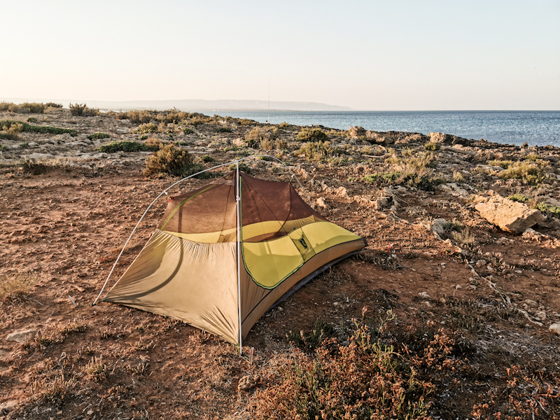
Day 217: Rubber Melting Hot
Catania to Pantalica Solarino
Distance: 60km
Walking through a big city at 03:30 in the morning gives me a somewhat uneasy feeling. Night owls are still roaming the streets but besides a hooker asking for a cigarette, it's an uneventful walk. An hour later I hit the beach. Dawn is approaching and looking back at Catania with Etna majestically rising behind is simply spectacular. I go for a quick swim before joining a long road walk along a state highway taking me inland. While the shoulders are surprisingly wide, rubbish and the stark smell of rubbish make it slightly unpleasant. The roads are getting quieter and cleaner, the views of the dry, sparse landscape much better. It's actually a very lovely walk in the heat. I can cope with it just fine. Better than the soles of my sandals for sure, which get really soft. As a result, gravel on the road easily penetrates the soft rubber. Every now and then I need to scratch the gravel out of the rubber. They are in a good shape anymore. Fingers crossed they will last another two days
Walking is a breeze and before I know I arrive in Sortino. Remote and authentic. I like the village. After a second Gelato, I am descending into a valley. Orange and lime trees left and right. It's like diving into another world. Much greener and cooler. By this time, I already have 55 kilometers in my leg and I start feeling tired. Time to look for a spot to camp. I knew it wouldn't be easy so I marked some spots on the map yesterday (thank you Google Street View). With that and a bit of improvising I find a suitable spot amids orange trees. Super tired but super happy after a unexpectedly nice day.


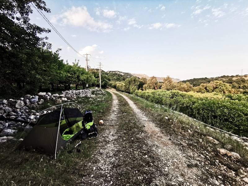
Day 216: 1 Day, 2 Worlds
Bivacco Poggio to Catania
Distance: 35km
Once the sun went down, so did the temperature. In fact, I was lighting a small fire.
The temperatures dropped even more overnight. I am surprised how far they dropped when I go out to do my morning business.
My hands and toes feel cold as I continue my halfway round the mountain track. Yet, the views of Etna and the now flatter landscape around are magnificent and make me forget the cold. It feels like it's just me, the volcano and some birds. A very tranquil atmosphere.
It takes a while until the sun appears from behind the mountain. For once, some warmth is highly appreciated. By then I am already nearing Nicolosi. From there, the hiking experience changes drastically. Busy roads, terrible drivers, drivers throwing garbage out of their window right in front of me and as I descend hot and humid conditions. Without taking a break a push on towards Catania, where I have booked a hotel. The last couple of days have been long and I need some time to plan my last days on the trail.
At exactly 15:00 I arrive at my hotel. Super small room but the view of Catania and the sea from the 16th floor easily compensate for that.
After spending the last 3 hours on busy roads all I need is a bit of rest to wind down. Then it's time for planning upcoming days. 3 maybe 4 more days hiking. I sure am getting close.
Then it's time for some sightseeing. I ask Google what to see. Nothing in particular is standing out. So I just head out, strolling around the busy streets. After a while I have enough of the hustle and bustle, buy some cheese and ice cream and head back to my room, where I have my dinner for one, enjoying the fabulous view.
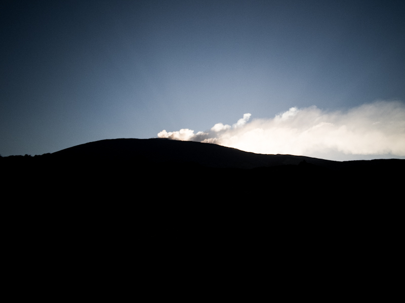
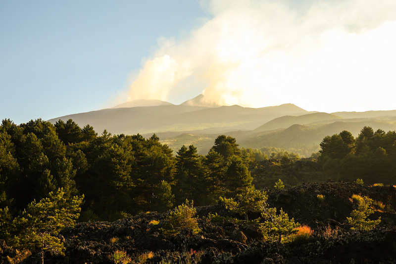
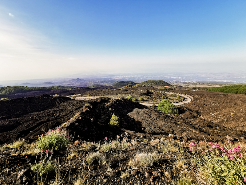
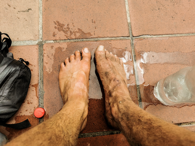
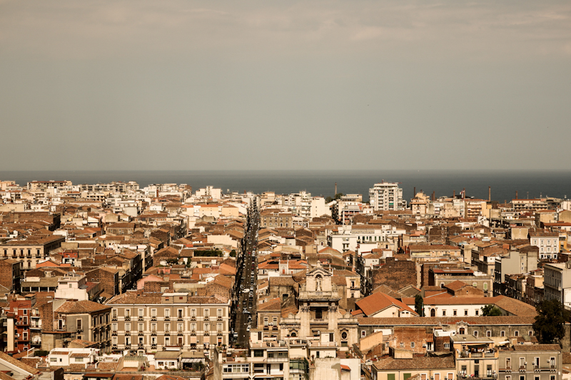
Day 215: Back Solo
Torrente Zavianni to Bivacco Poggio
Distance: 50km
A quiet night on the river and a good sleep. The highlight: Elon Musks satellites forming a long glittering chain on the sky. First time I see them!
Once more we start early, following the river bed to Villafranca, where it is time to say goodbye to Maria. She is heading home to Switzerland from here. Since I am not good at goodbyes, it's quite an emotional affair. As a hard core solo hiker, the last days have been challenging. However, I very much enjoyed the experience and the great company of Maria. Thank you joining me!
I leave her at the bus station. I want to have a closer look at Etna, so I start climbing its northern slope. Not all the way but up to 1900 meters. The beginning of the climb is tough and somehow I manage to get lost, adding some kilometers. Initially, there's a road and a hiking trail. The former seems to be popular with motor bikers. They use the road as their race track, making the road super dangerous to walk. So I opt for the hiking trail. As I get closer to a refugio where I turn east and the road turns west, I spot a biker lying on his back besides the road. He must have hugged the wall. It's not looking good. His buddies are there. Still, I offer my help, which they decline. So I continue, leaving the road and follow the Pista Alto Montana. A wide, sandy and gravelly road leading through forest and lava fields. Super nice to walk, super busy in the beginning. I share it with hikers, bikers and even a Lama trekking group. As I carry on, the track gets more quiet. Clouds were rolling in during the day, engulfing the top of Etna. Yet, the views down the valley are lovely.
At Bivacco Poggio, I decide to call it a day. The cute little two-bunk hut will be my home for tonight. Being at 1900 meters I expect it to be a pleasantly cool night with hopefully another good night sleep.
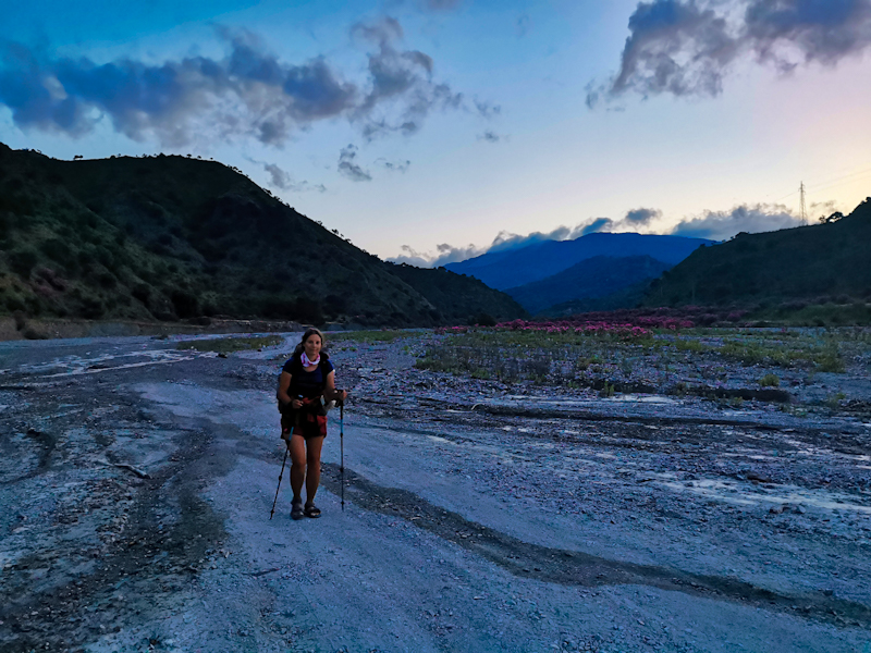
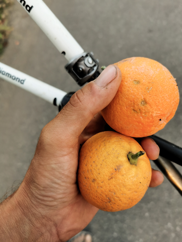
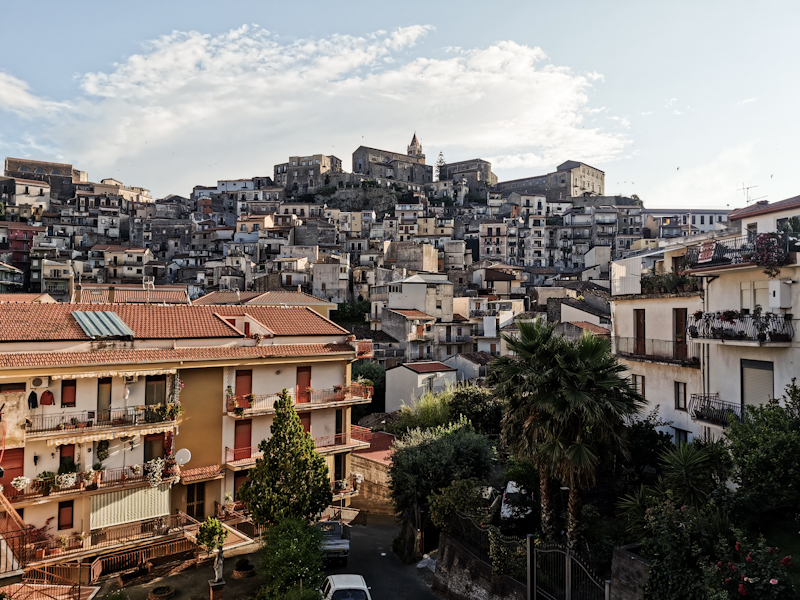
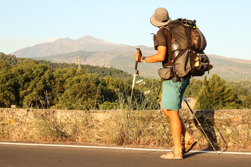
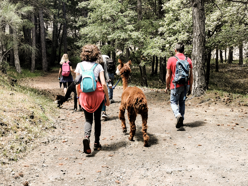
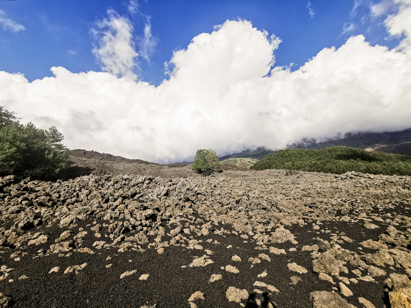
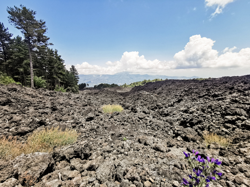
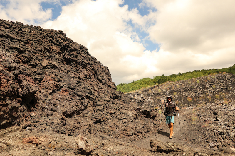
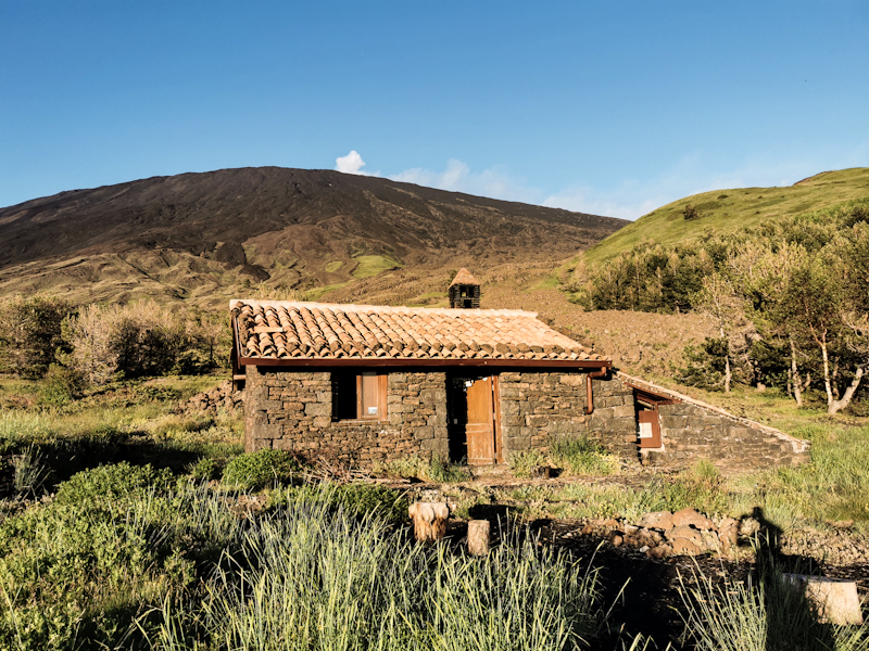
Day 214: One Step In Front Of The Other
Acqua Menta to Torrente Zavianni
Distance: 25km
Overnighting at 1000 meters above sea level meant considerably lower temperatures and therefore a rather good sleep.
Overall it's similar hiking to yesterday. 4WD tracks and initially great views which eventually disappear completely as low clouds are rolling in from the west. Luckily though I manage to catch a glimpse of the Etna volcano, with what seems to be a bit of snow and smoke at the top. But it's barely visible and I can't make out the detail. Hopefully, the weather will improve a bit until tomorrow.
At least the clouds mean pleasant hiking temperatures. While it's humid, it's not particularly hot. Since Maria is still fighting with her blisters, progress is slow. It's interesting that a slower hiking pace is actually pretty tough on my body. I certainly wasn't expecting that.
Anyway, in proper thru-hiking style, Maria keeps putting one foot in front of the other and so we get closer to Torrente Zavianni, our today's goal (deviating a bit from E1 which makes a detour inland). I try keep her hiking spirit up.
During the last descent, the weather improves drastically, opening great views of the volcano again, which has gotten much closer since the morning. But not only the volcano but also the wide, dry riverbed of Torrente Zavianni far below looks interesting and I am looking forward to following it.
It takes a while to kill the 600 vertical meters. I don't mind as there is more time to enjoy the view.
We make it to the river just before 18:30. Well, it's more of a stream. Easily crossed. On the other side, we quickly find a place to pitch the tent. Not perfect but for Maria it's been enough hiking.
I'm quite proud of her achievement. The temperatures, the tough pebble beach walk earlier this week and continuing despite hurting toes. Tomorrow, she will head back to Switzerland. I really hope the time on E1 helped for her Te Araroa preparation.
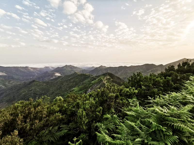
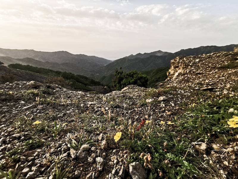
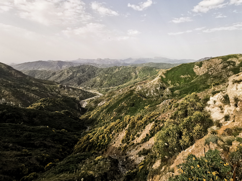
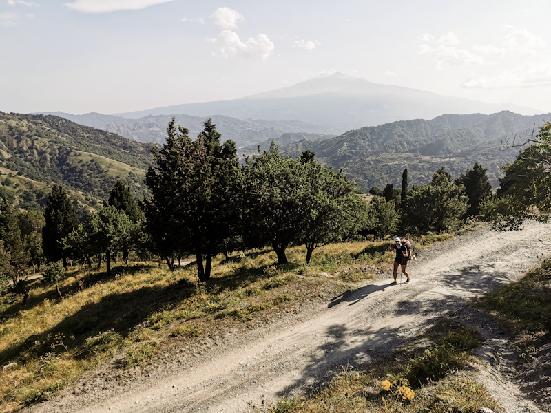
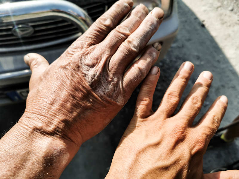
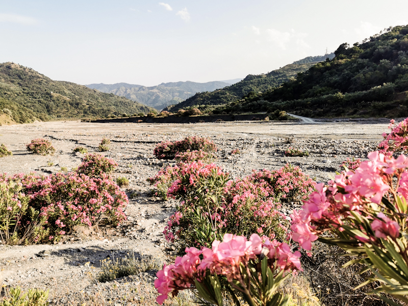
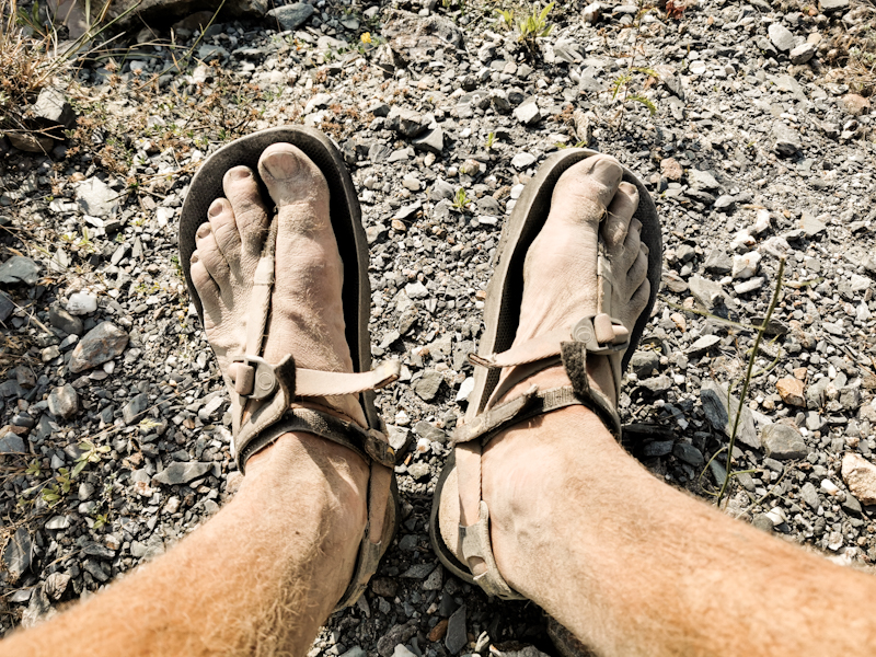
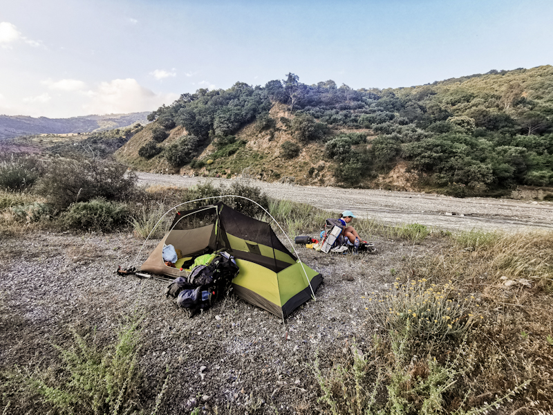
Day 213: Off The Beaten Track
Torre Faro to Acqua Menta
Distance: 45km
I have never been to Africa. But somehow it feels like Africa when I take my first steps on Sicilian soil. Beige sky, hazy. Sand must be in the air. The sun barely able to shine through. And it's hot. Very hot already as I walk back towards Messina, where I took the bus earlier this morning to Torre Faro. Yes I know, thru-hikers do weird stuff. But it's what E1 wants us hikers to walk.
After a long day yesterday and a short night, I feel a bit exhausted. Especially in combination with the heat. A quick swim fixes the problem and I feel like a new person. Eventually, I leave the coast near Messina and head up into the hills, where I meet Maria, who took the bus.
From there, the walk gets extremely pretty. Initially on a tar-sealed road then on more or less rough 4WD tracks with phenomenal views left and right and some proper hiking track in the end. It's hazy but clear enough to see the mainland.
The trail stays in between 800 and 1000 meters above sea level. Not too much up and down which is especially appreciated by Maria. While it is hot it's also windy, actually making it not too unpleasant to walk. At least for me. I don't think Maria would agree :D
So Ww take it easy, leaving enough time for breaks.
Water supply is challenging. Luckily just an hour before pitching our tent, we find Aqua Lima - a fountain. Without this one, I fear we would have run into problems tomorrow. It's already 18:00 but we (Maria ;) decide to carry on. While that last bit on a hiking trail offers more spectacular views it's also slow going. With no suitable camping spot, we walk and walk and walk. Then, just when the sun is about to set, we reach a gravel road and some great camping spot. A long, but fulfilling day. And obviously I am very happy to see Maria up and running again.
First day in Sicily complete. While I was initially a bit worried about the heat, it wasn't as bad as I thought. And then there were the views, an absolute highlight. I am now really looking forward to hiking across the island in the coming days.
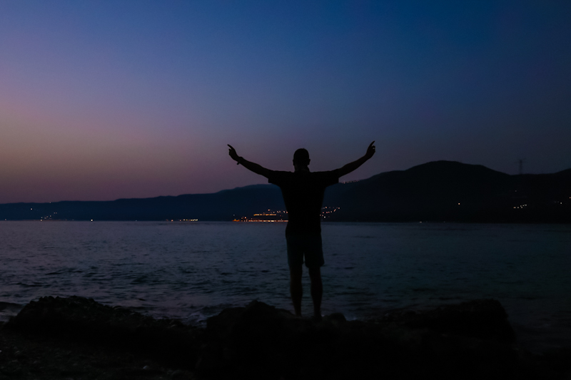
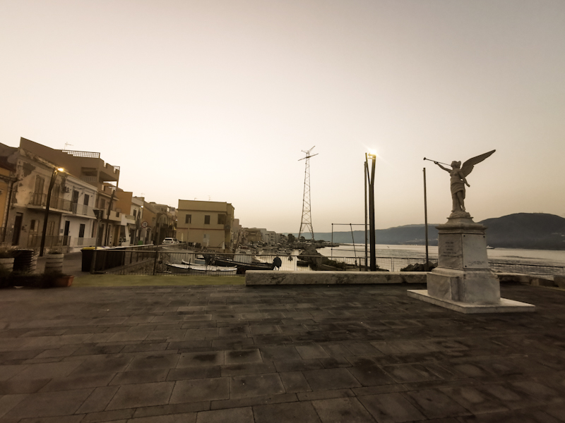
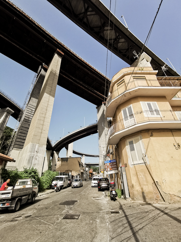
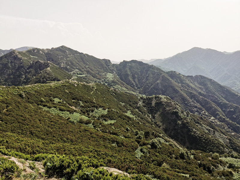
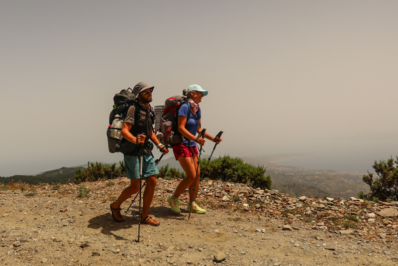
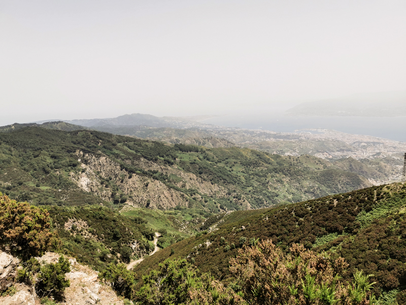
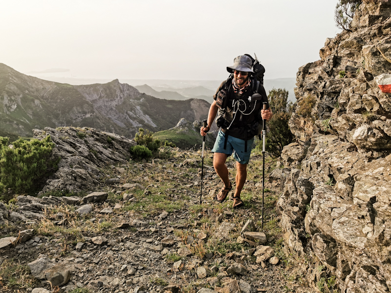
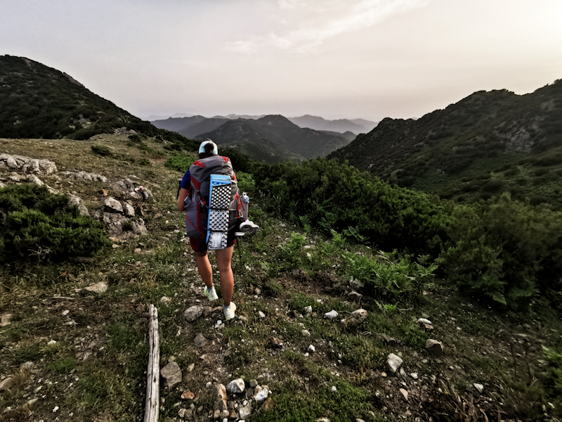
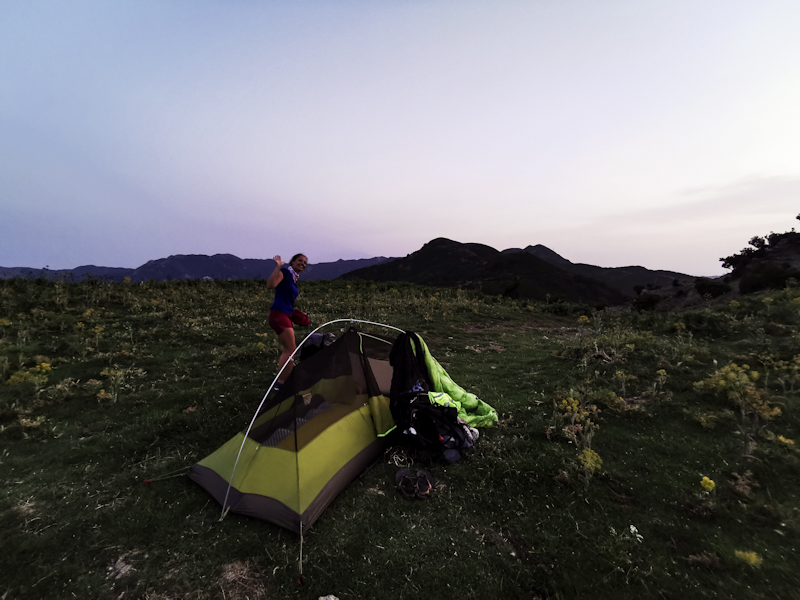
Day 212: Teamwork
Mimosa Campground to Villa San Giovanni (Sicily Ferry Terminal)
Distance: 60km
While eating tomato and cheese wraps at the beach, watching the sunset, we decided that a Zero Day for Maria would be the most sensible thing. No sense in making things worse by road walking the whole day.
I leavy early today. Very early. With the heat wave in full swing and temperatures up to 35 degrees Celsius, I am on the trail before 04:00 to have at least a few hours with pleasant temperatures. And I want to make it to the Ferry Terminal today - finishing mainland Europe.
The gate of the campground is locked, so I am forced to leave it via the backdoor and onto the beach, which I follow for a couple of hundred meters. Two dogs roaming around the beach in the dark scare me. After that encounter, I am definitely awake. Eventually, I rejoin the road, walk past a village and a port. As it is getting brighter I can see all the shipping containers. MSC, HamburgSüd, Maersk,... One of the few constant things on my hike. Since south Sweden, I spot them on ports and highways.
The air smells of sewage and burned rubber. A terrible combination and something I don't need in the early morning. Until late morning, the walk is fairly underwhelming. Depressing at times, as I make my way through dirty cities and villages. Things improve once I get closer to Bagnara. The views are excellent, in fact I can clearly make out Torre Faro, a decommissioned tall high voltage power line pylon, on Sicily, the trail head of E1 in Italy.
The Strada Stato 18, the road I have been following on and off since Salerno is not overly busy. Fruitstands left and right of the road give it a somehow non-European feeling.
Maria is waiting for me in Bagnara where we swim in Crystal clear water. Surrounded by high hills it feels amazing. While I am continuing my walk, Maria is planning. Arranging the ferry crossing, booking accommodation. It's wonderful having someone taking care of background. Thank you!
After another quick rendezvous in Scilly, I walk the final 10 kilometers to the ferry terminal, my end point of mainland Europe.
Literally 10 meters before reaching the terminal, I stand in front of a fence. I must have myself navigated into a dead end. I squeeze through somehow. It's a somewhat typical ending of my hike across mainland Italy.
The arrival is far less emotional than I thought it to be. Maybe it's the crowded, dirty location. Maybe the fact there's still some stuff to do. Mainly resupply. Which is not easy. Once more, shops on the map do not exist, a walk through the messy city of Villa San Giovanni unavoidable. Not exactly what I need after 60 kilometers of hiking. I meet Maria in the shopping center. I feel a bit sorry for her, as she has to deal with my temporary frustration. She tries her best to keep my hiking spirits up. It helps and once we board the vessel the earlier struggles are slowly forgotten.
The sail across the straight is amazing. Heading straight for the sun, which is setting behind the mountain range I would be walking tomorrow.
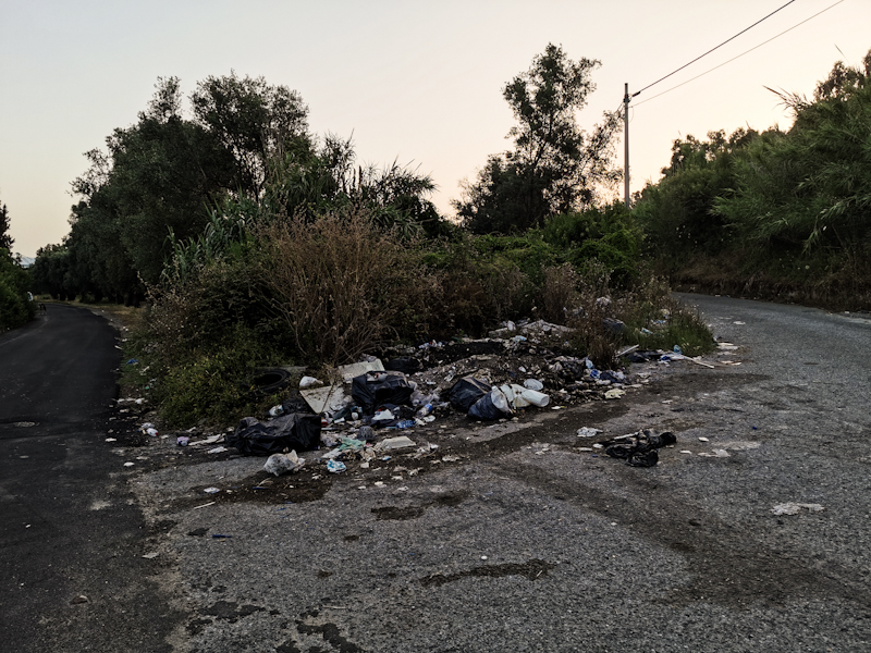
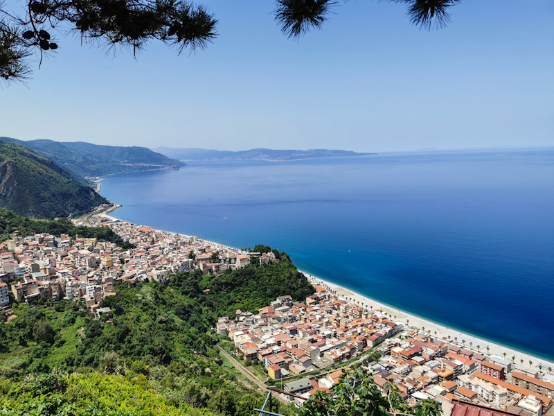
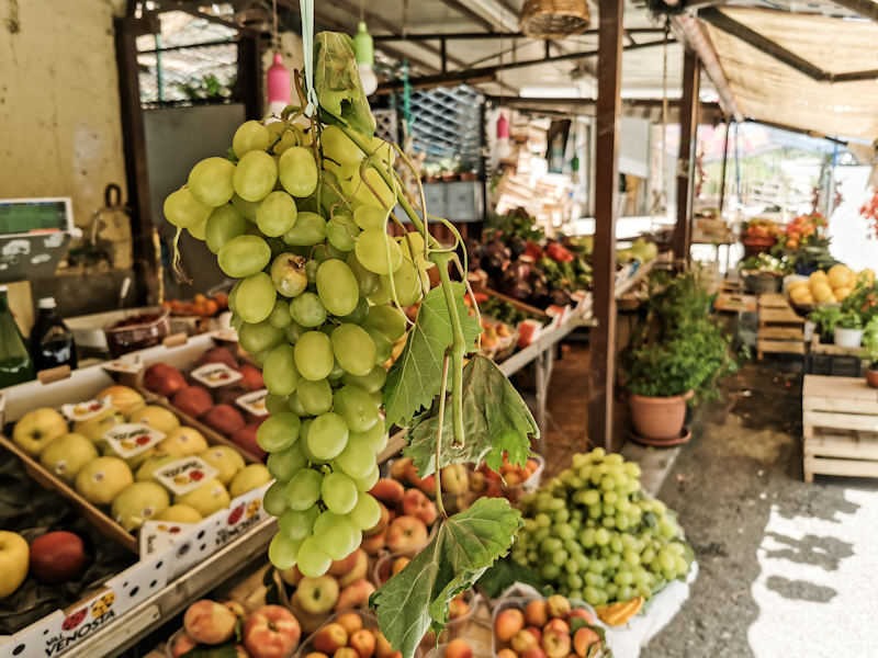
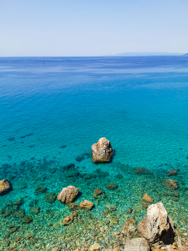
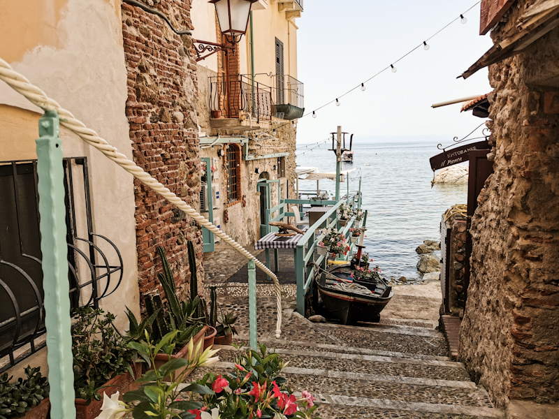
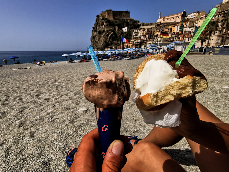
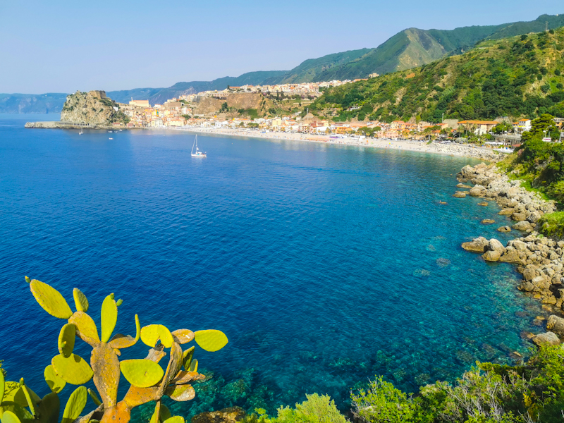
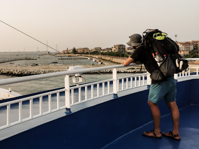
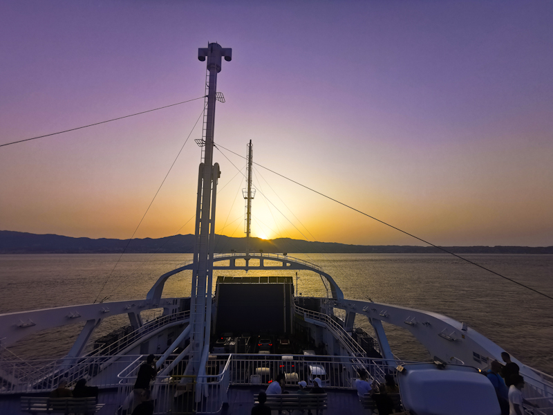
Day 211: Sicily Calling
Vibo Valentia to Mimosa Campground
Distance: 35km
The long day yesterday left some marks on Maria's feet. Not the beach walk but on the last 10 kilometers on the road she caught some blisters.
So we take it slow today as we leave Vibo Valentia. The surrounding of first few kilometers to a place called Aeroporto looks rather depressing with many buildings that were never completely finished. A landscape of concrete skeletons.
The scenery improves as we follow a quiet, windy road towards Nicotera. People are greeting us. I can imagine not many tourists, especially hikers, find themselves in this area, located a few kilometers inland. While walking the road and coming around a corner, we notice that the hills of Sicily are visible through the hazy air. An extremely emotional moment for me. A moment I have been waiting for a long time.
Every now and then we stop so Maria can treat her blisters. In Nicotera we treat ourselves with an ice cream. While eating it and admiring the scenery two South Tyrolean cycles that we briefly met on Falerna campground two days before, come around the corner. Super friendly people who are cycling the length of Italy. We have a nice chat and then they carry on. Their goal today: Sicily! But they don't get far. A couple of hundred meters later, they surprise us with a few beers. How cool is that!
Some more interesting talk follows. They sure are enjoying their retirement.
It's then definitely time to say goodbye. We carry on down to the beach, walk in the pine forest behind it all the way to the campground. A big one. Certainly the biggest I stayed so far in Italy. With a swimming pool, bar and restaurant, it brings back childhood memories from our camping holidays on Italy's east coast.
As I am writing this, I am sitting in a comfy beach chair, looking at Maria swimming in the sea. The sea breeze keeping me cool. A great feeling after a day in southern Italy's summer heat.
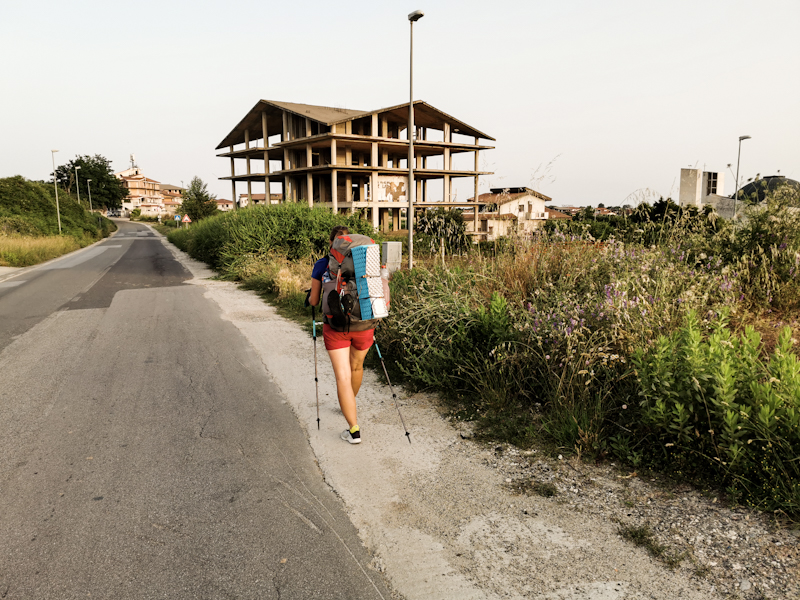
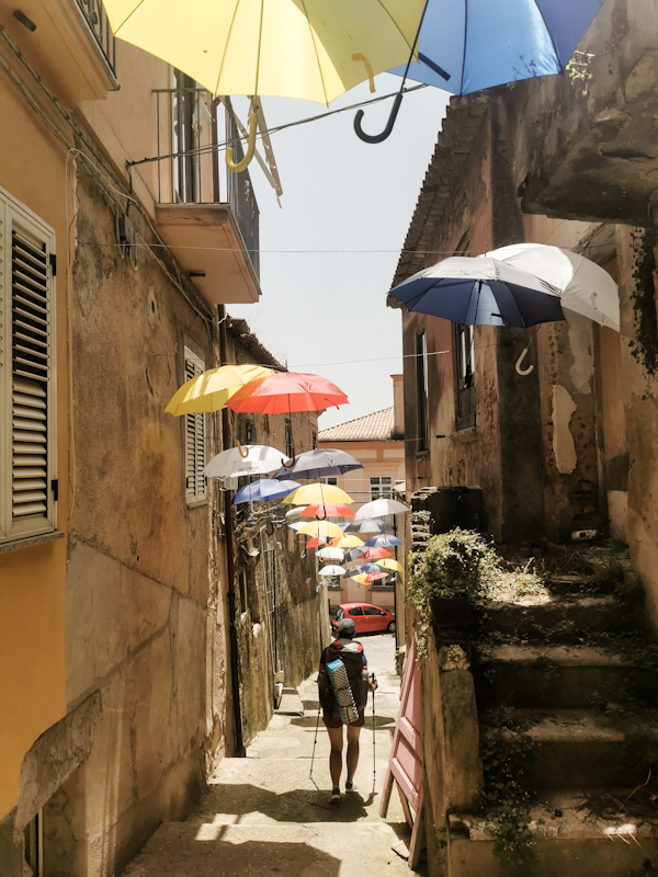
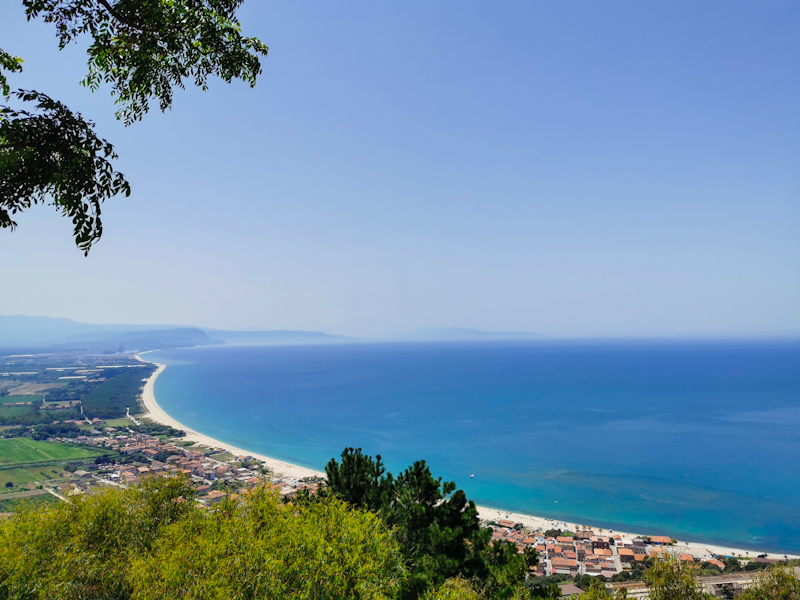
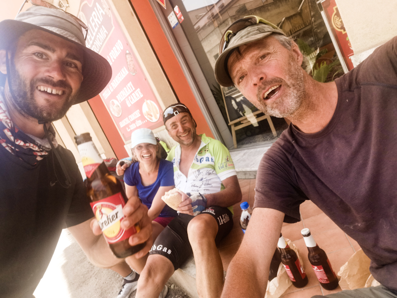
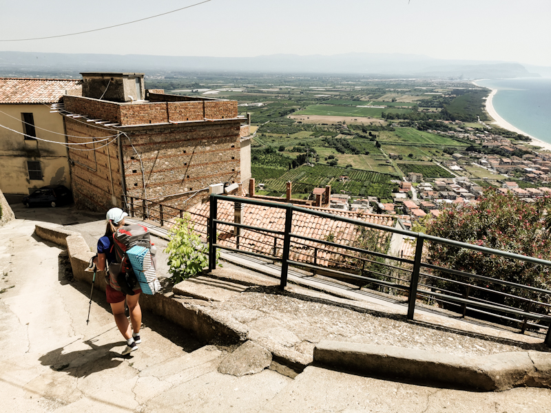
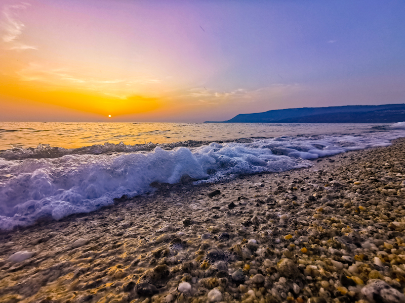
Day 210: Hardcore Beach Walking
Falerna to Vibo Valentia
Distance: 40km
A leisurely stroll along the beach. That's what I am hoping our day to be like when we leave Falerna.
Well, it starts quite okay but eventually the sandy beach turns into a gravelly then into a pebbly one. Initially, we are able to walk along promenades and the road. However, due to the lack of alternatives once past the Lamnezia Airport (which was surprisingly busy and which I like of course), it is 10 kilometers of tough going in the mid-day heat. Luckily the water keeps us cool and for the last 5 kilometers, going gets easier again. Otherwise, I don't think we would have made it.
The struggle of walking the beach are quickly forgotten once we enjoy a delicious Tortufo Ice Cream in the Tortufo capital of Pizzo. After a final climb to Vibo Valentia we decide to take a B&B for the night. With unpacking and showering complete, we had out at 20:30 and head straight to the closest pizzeria. Way too late for dining for me as a Swiss but hey, we are in Italy and do it Italian style.
It's a fantastic pizza that we enjoy and a great way to end a challenging day. Out there on the balcony on a warm summer evening.
I am super proud of Maria. The day with the beach walk was much harder than I expected. Yet, she did amazing. I told her, that 90 Miles Beach is a piece of cake compared to what we have done today.
Hopefully, she won't be to exhausted tomorrow.
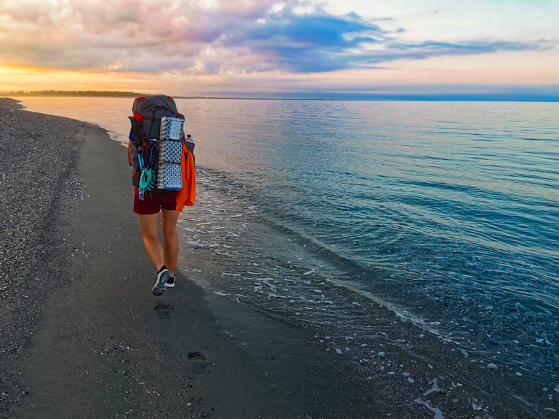
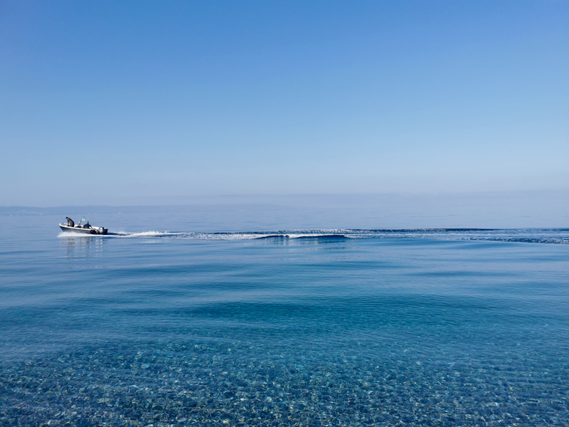
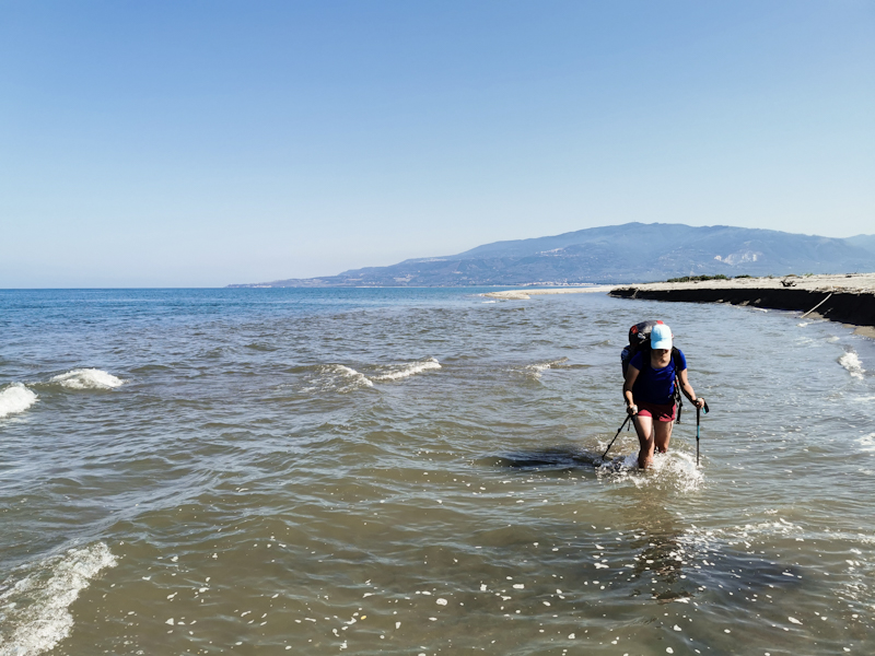
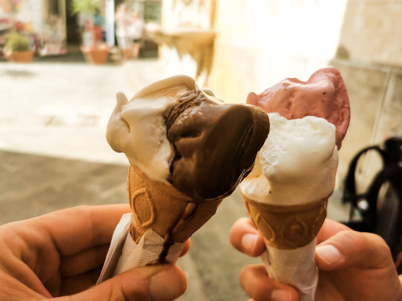
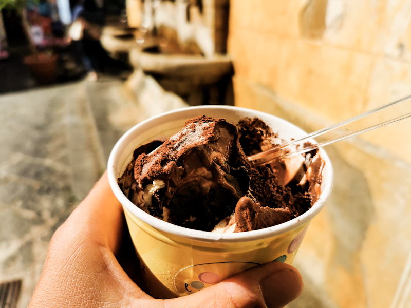
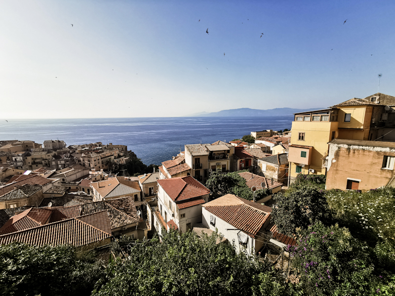
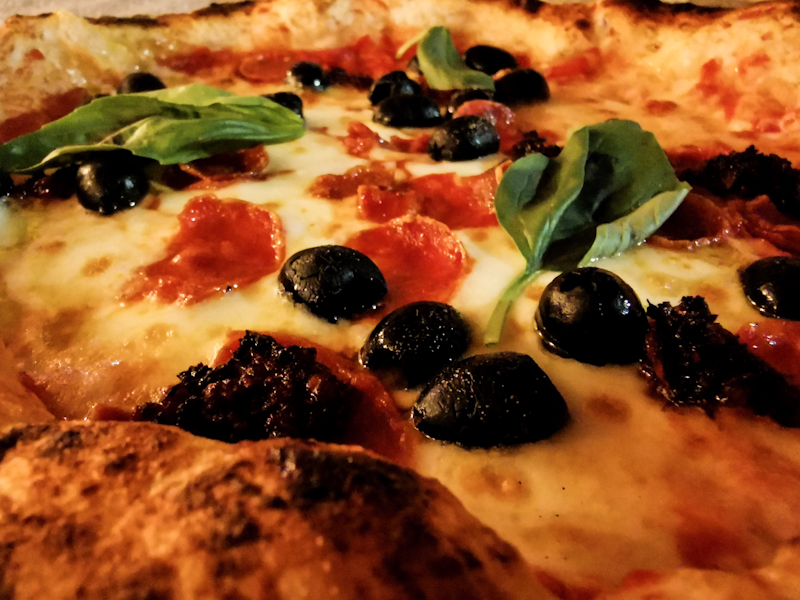
Day 209: The Beach It Is Again
Paola to Falerna
Distance: 45km
As I was lying in my tent last evening, my tent was vibrating with every train passing through. I was thinking "oh no, that is going to be an uncomfortable night"
However, 10 minutes later I was fast asleep and remained so until nearly 04:00. Wake-up time anyway.
With my headlamp on, I pass through the tiny tunnel and hit the promenade. I follow it and also walk on the beach for a couple of kilometers before going inland. The beach is too soft to cover longer distances and with no more promenade, I take a back road to Amantea. I planning on doing resupply. I pass several big stores but want to do the shopping at the last store. Mistake. Google Maps is inaccurate and there's nothing but a pharmacy. I curse. There's literally no more food in my pack.
So I eat a big ice cream at a Cafe. Keeps me going. And then, after walking past hundreds of fig trees, finally a tree with some ripe figs. I take a couple of them. Jeeps me going again.
Several times I do swim stops. The water is getting clearer the further south I get. Once I get lucky when I spot a secluded spot from the road. Swimming between the rocks in the clear water. Amazing.
I keep on going. Trying my luck once more with beach walking. And finally, the ground gets firmer. A pleasure to walk on.
I'm also happy for Maria, a good friend from the Engadin and future Te Araroa walker, who is joining me for a couple of days. She will have a bit of nice beach to start her hike with.
After finally doing my resupply, I meet Maria at the bus station. Great to see her again! We hit the beach immediately. It's 18:30 already with still a few kilometers to go. Feels great having some company!
The sand gets softer with every step so we are both happy, when we reach our campground, more or less right in time for sunset, which is once more spectacular.
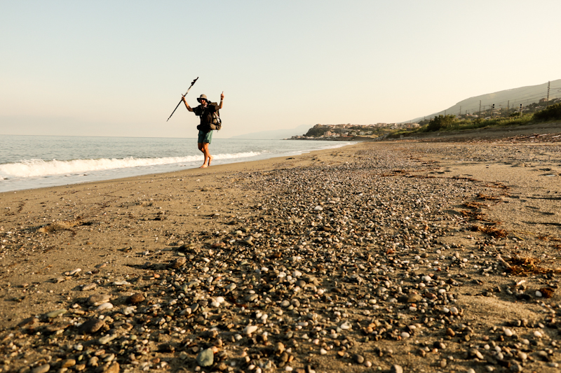
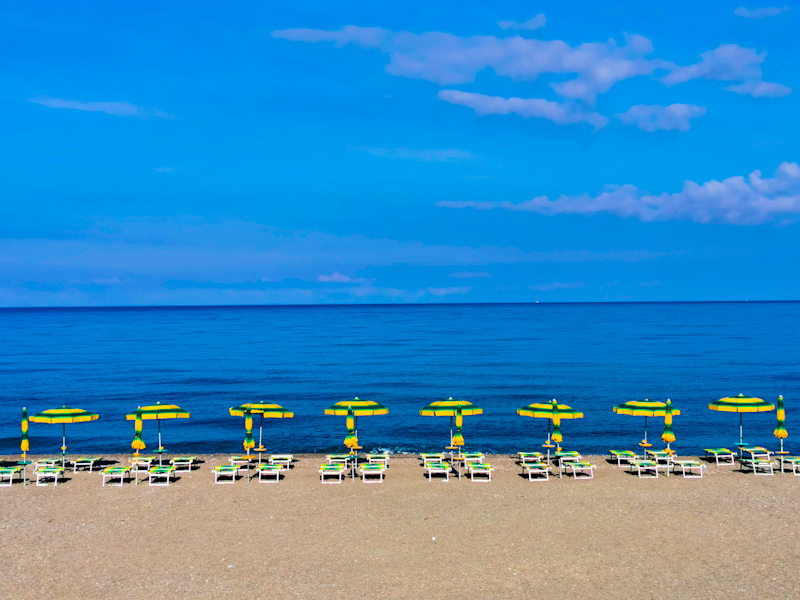
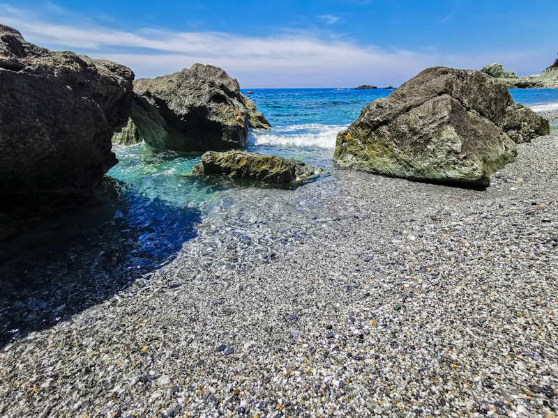
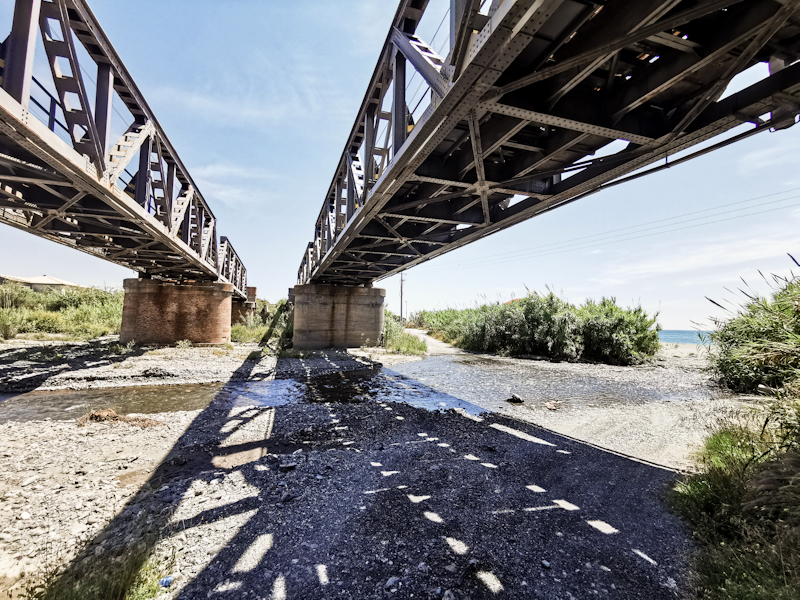
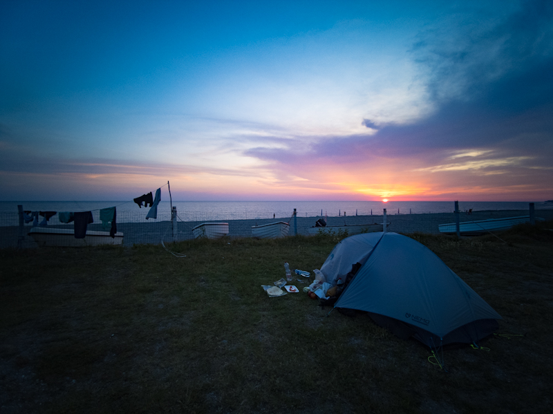
Day 208: Beach Hopping
Fiume Lao to Paola
Distance: 55km
A quiet night if it wasn't for a couple of idiots lighting a firework at the beach in the middle of the night. But I fell asleep rather quickly.
The friendly security guard is already waiting, when I approach the gate. I was told yesterday, he would open it for me.
After some small talk, I am on my way again. I am doing more road walk than I was planning because the gravelly sand is very slow going. So after a kilometer I give up and follow a mix of promenades sidewalks and roads.
In Diamante, I get invited for a coffee by the owner of a Cafe. In return I pose for photo for the Cafe's Facebook page. Seems like I get some local fame :D
In the next village, I stop for some pastries. One of them a chocolate croissant. Nearly bursting because it's stuffed with chocolate. Exactly the way I like it. Unlike these pathetic ones with just a trace of chocolate.
This one is keeping me full for a while.
Overall, it's a good day walking. I eventually stop counting my numbers of swimms today. The beaches are so plentiful and accessible, I can't resist. Especially, around lunch time and early afternoon, when the heat is my biggest enemy.
As I try to avoid wild camping in this rather busy area, I Google a campground in Paola. Missing language skills on both ends make check in a challenge. Eventually, it works though. Super basic,but enough
Everything I need (water, electricity and a hot shower). 20 meters from the railway line connecting Calabria with the north. The boulder beach is accessible via a narrow tunnel beneath the tracks. I'm sitting there as I am writing this. Enjoying yet another lovely sundowner.
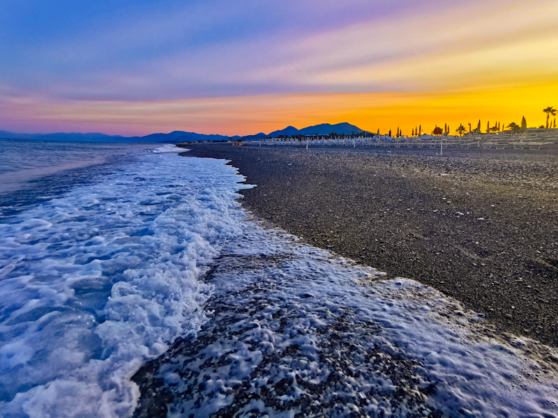
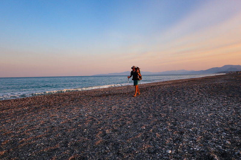
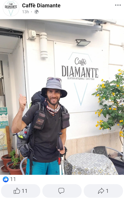
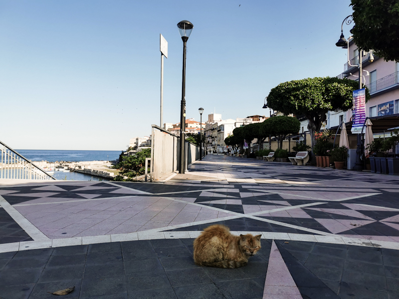
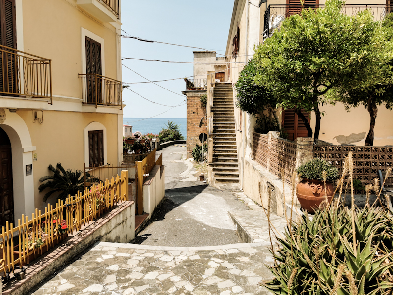
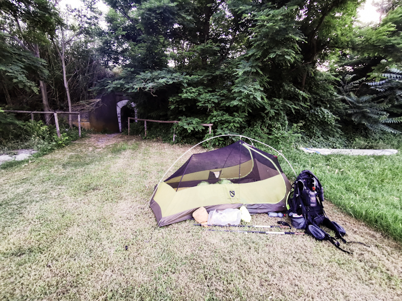
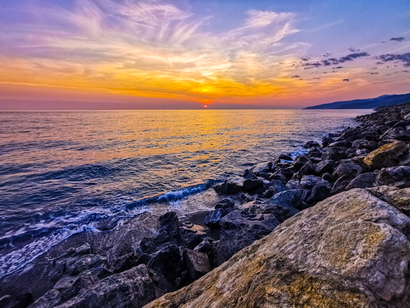
Day 207: Azzurro
Sapri to Fiume Lao
Distance: 45km
A warm night, but dry. Which is always appreciated since packing a wet tent is not much fun.
I take my time packing as I want to walk the road with enough daylight. It's a spectacular road, carved into a sheer rock face, winding its way to Matarea. Facing west, there's no sun, but there are no cars either. So I can pay all my attention to the views.
With the sun come the cars. But only for a short while since there are signs saying the road is blocked ahead. Waking the detour would mean nearly an additional day, so I push on, trying my luck. Walking into a possible cul-de-sac is not easy mentally. Once there, I see plenty of workers (on a Saturday! In Italy!) and a big "no access" sign. So I try Plan B: bush bashing. I get lucky, eventually stumble across a bulldozed track. After 3 or so kilometers I am back on the road. A bit of excitement.
At this point, I have been walking for 6 hours straight. Never took off my pack. So I treat myself with a swim, having a chat with Younes, a refuge from Marocco. He suggests to continue my hike across his country once I finish in Sicily. Well, never say never but it might be a tad hot.
Writing of the temperature: it's early afternoon, the heat is daunting. As I walk above the steep cliff again, I look down at the azzurro colored sea. So pretty. So inviting. I leave the road, head down. Find my self a spot beneath a rock. The beach is busy but I understand why. Feels secluded, yet easy to reach. After two swims and a bit of dolce far niente, I continue. Nothing too exciting to write about the last couple of kilometers. As I walk through Scalea, I do resupply. Resupply in Italy, always a pain. Somehow I find the stores so confusing. It takes me ages to find what I need.
Luckily, I have plenty of time and arrive at Lao Campground just after 17:00. It's just me. No other camper. And it's Saturday evening. Oh well, I don't mind. No need to be quiet tomorrow morning.
The waves are big, swimming not really possible. It's a wild but wonderful beach, reminding me of one of the many New Zealand west coast beaches. So I enjoy my quiet evening, just enjoying the atmosphere.
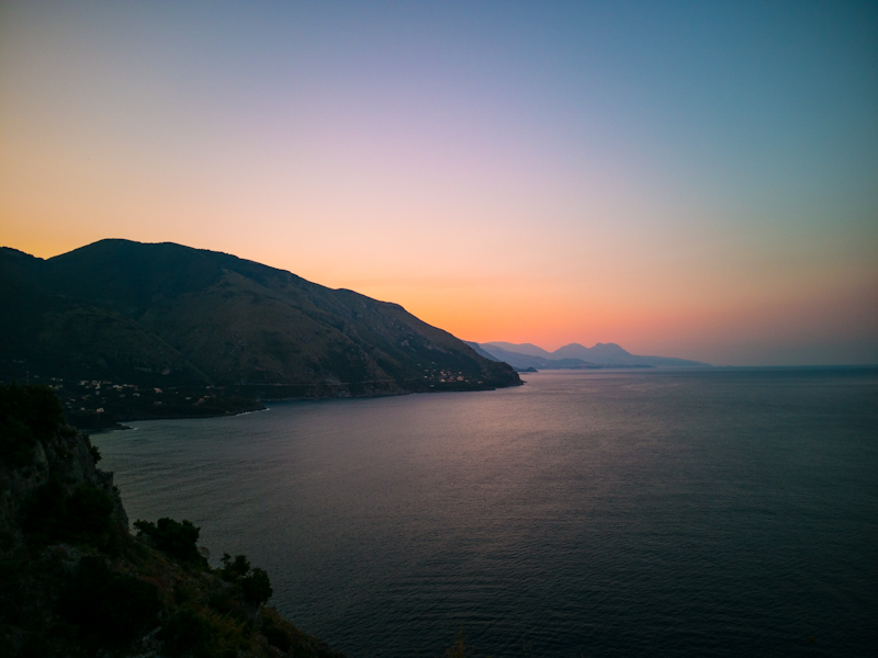
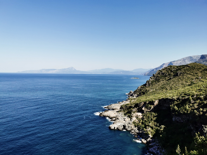
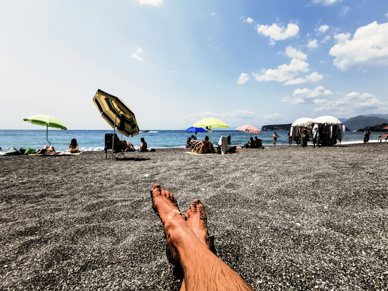
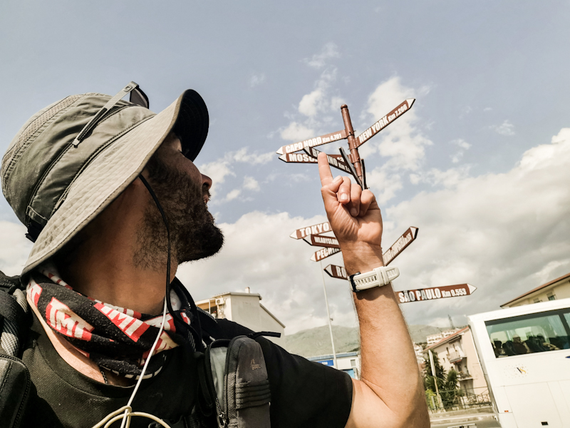
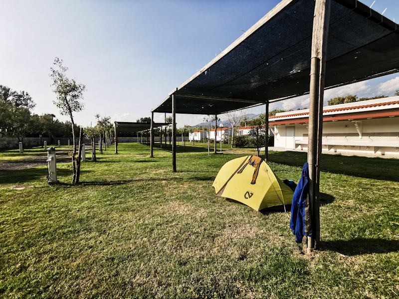
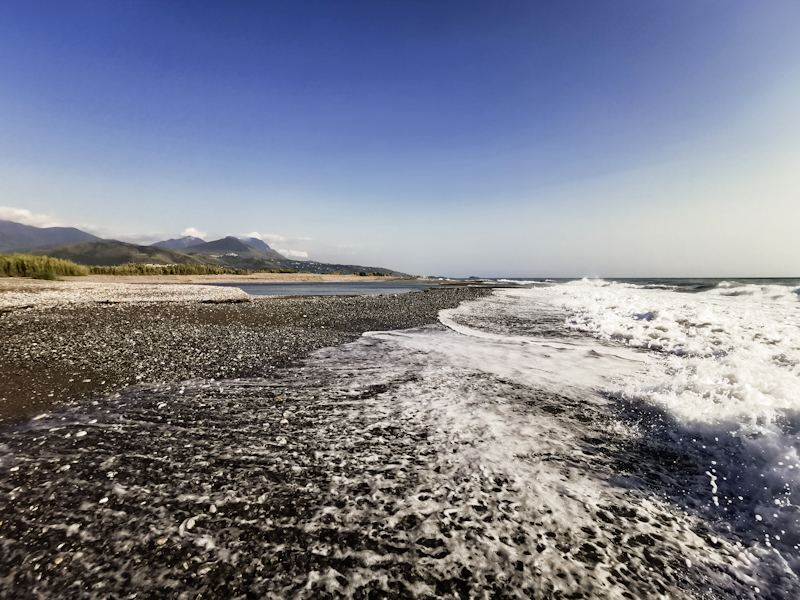
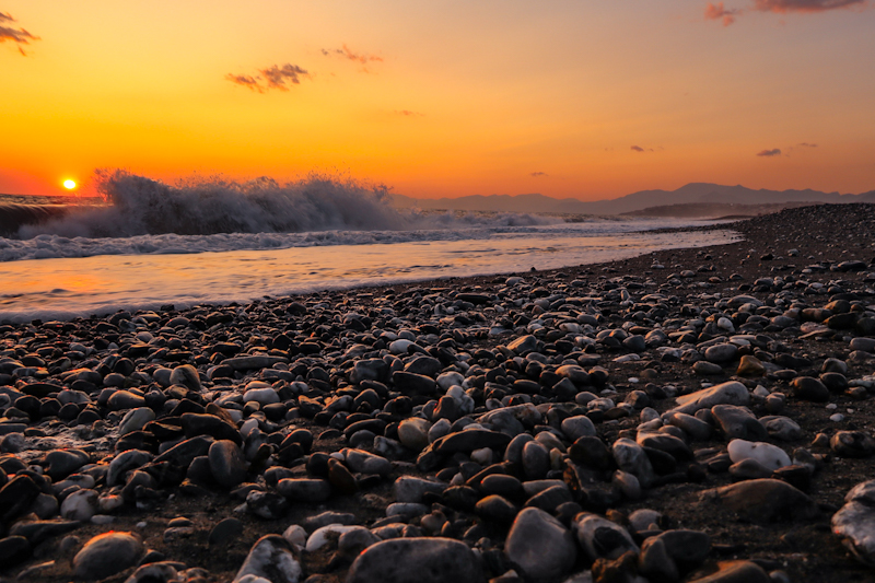
Day 206: A Long Way I Go Over The Hills And Along The Coast
Torrente Fiumicello to Sapri
Distance: 60km
Finally a night with some decent sleep. Therefore, getting up and starting my hike goes quite easily. It's a clear but extremely humid morning. It feels like you could cut the air with a knife.
Initially, I follow the coast but the big chunk of today's hike is further inland. I follow quiet roads, pass through, what I would consider as very authentic Italian villages. I stop for coffee and ice cream but generally keep moving. Only in Bosco, my favorite town of today, I take some detour. Such a picturesque place with amazing views. It's also where my feet need some attention. Blisters.
I am then descending back to the sea. Walking down here, along busy roads, is not much fun. However, swimming in the sea and the costal views (that remind me of Norway) are well worth it. My body feels excellent. I probably could go on much further. The sun is setting however, and I pitch it where I had intended to (I checked the place out beforehand with Google street view).
I pitch the tent and end a long, fulfilling day with some delicious smoked cheese.
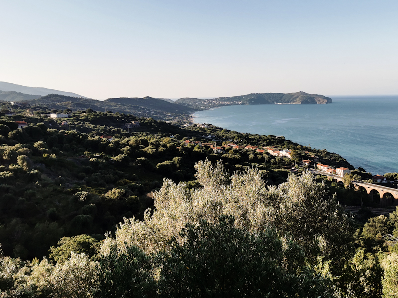
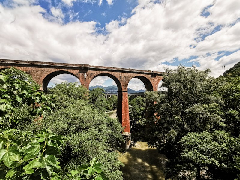
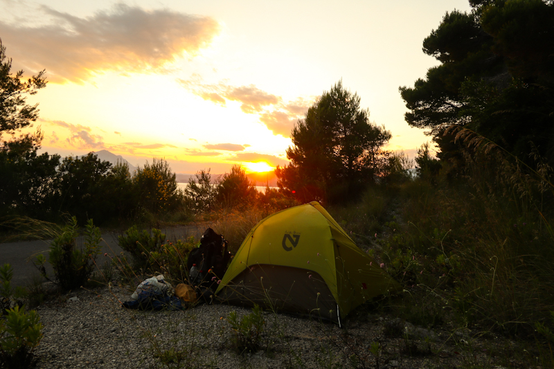
Day 205: Blue Sky Ahead
Vatolla to Torrente Fiumicello
Distance: 35km
Müesli with melons and apricots, scrambled eggs, bread with homemade marmelade, fruite juice and two capuchino. I take my sweet time today.
After saying goodbye to my wonderful hosts, I hit the trail just after 09:00. The rain has stopped and the sky looks rather friendly as I make my way through picturesque villages along quiet roads. A pleasant walk. Eventually, I am leaving the hills for the coast again. Busier, generally uglier looking. Still, the sea is nice and I go for a quick swim. As the coastline is steep, the road climbs again. According to Google maps it's closed. I am slightly worried because if couldn't walk the road, it would mean a looooong way round. An additional day at least. The road is closed indeed. Big concrete blocks blocking the way. But on foot, easy to navigate through.
Since it's already 18:00, I decide to use this quiet stretch of road to camp. Unfortunately, a heavy rain shower is passing through just before I want to start pitching my tent. I wait. I get soaked. I curse. Such an unlucky timing. However, I am glad I waited. To soil is hard as rock. I am not able to hammer my pegs into the ground and need to improvise. In the end, after hard work and getting bloody fingers, the tent is standing. Nothing more. If there's going to be wind... That won't be fun.
Anyway, for now, I am happy to have found a spot. Not an easy undertaking when following the coast here. And I am also happy and relieved that the weather should finally improve. No more rain, no more thunderstorms. And it should already be like this from tomorrow onwards! Fingers crossed it will really happen!
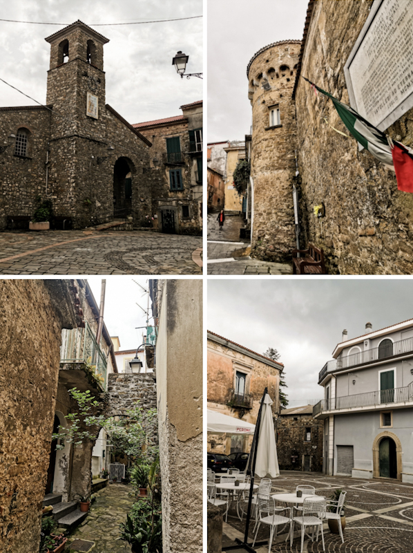
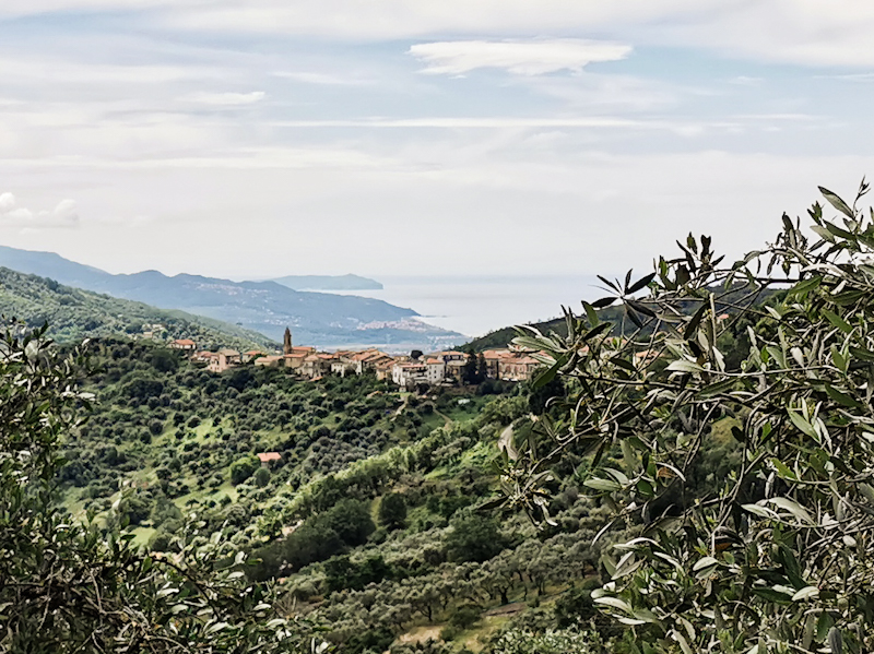
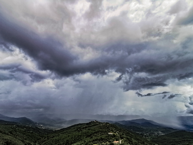
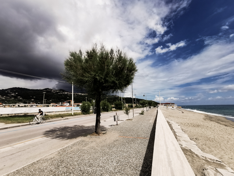
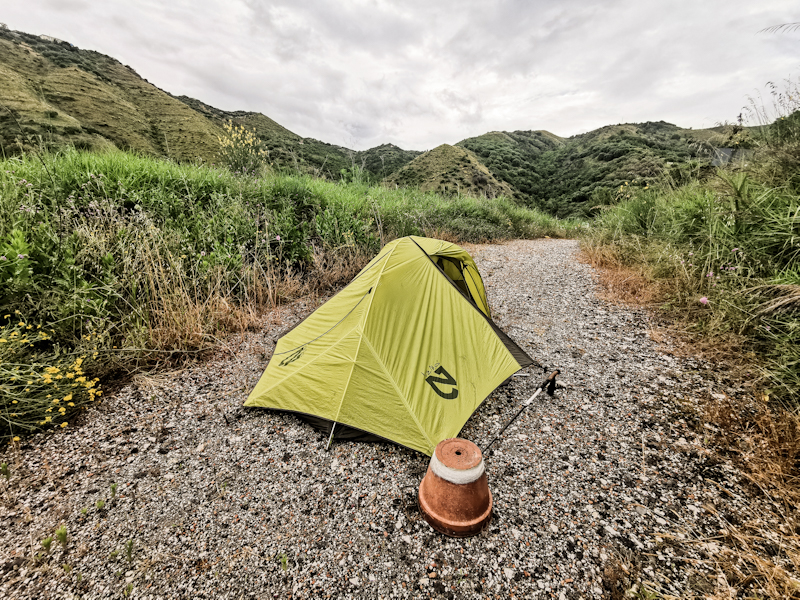
Day 204: Hike And Swim
Salerno Camping to Vatolla
Distance: 45km
As the previous night, my sleep is not good at all. I stay awake most of the time. And I can't really figure out why.
I hit the beach shortly before 05:00. Everything goes well until I want to cross a first river. On the satellite image it looks like a harmless enough crossing. In reality... Not so much. I do a trial run without backpack. I make it across but I am in the water waist deep. On the way back, I get swept away by the current. It needs quite an effort to swim back ashore. And this all happens before 06:00. What a start into my day.
Crossing with the backpack is a clear no go. Since the beaches are mostly private, there's no access to the road. I backtrack. A 30 minutes detour. Not what I need. I cross the river via the bridge and rejoin the beach. But only for a wee while. A small port is blocking my way and again no way out. I squeeze under a gate. Rejoin the busy road. Narrow, no side walk. A terrible walk. My hiking spirit reaches a daily low. Not what I expected my beach walk day to be like.
But I don't give up. Rejoin the beach once more. This time it's a wonderful beach walk all the way to Agropoli. Several times, I go for a swim. The beaches slowly but surely become busier. I wonder what people think of me walking the beach with a big backpack. I come to the conclusion they probably think I am just another guy trying to sell fake clothes or watches. Totally fine with me.
I leave the beach at Agropoli, head inland again. Spontaneously, I decide looking for a dry roof. The weather forecast for tonight and tomorrow morning is getting worse by the minute. I get lucky, find a very affordable bed and breakfast close to the trail. A short backtrack but I am used to that already.
I arrive 30 minutes after making the reservation. The hosts, a outgoing Austrian couple, welcome me their lovely place with great views. They offer to cook me dinner. I am glad I accepted because it's delicious. After some nice talk and self made liquor, I excuse myself and head to my room. I'll take it slow tomorrow. The last 6 days have been rather long ones and I don't feel like heading out into the rain that early.
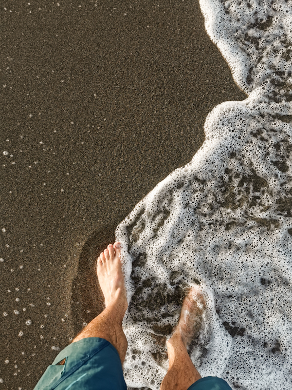
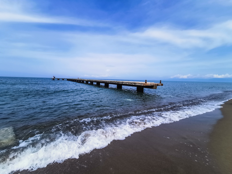
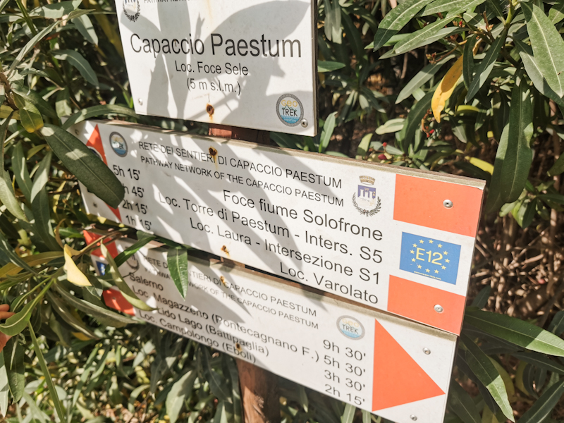
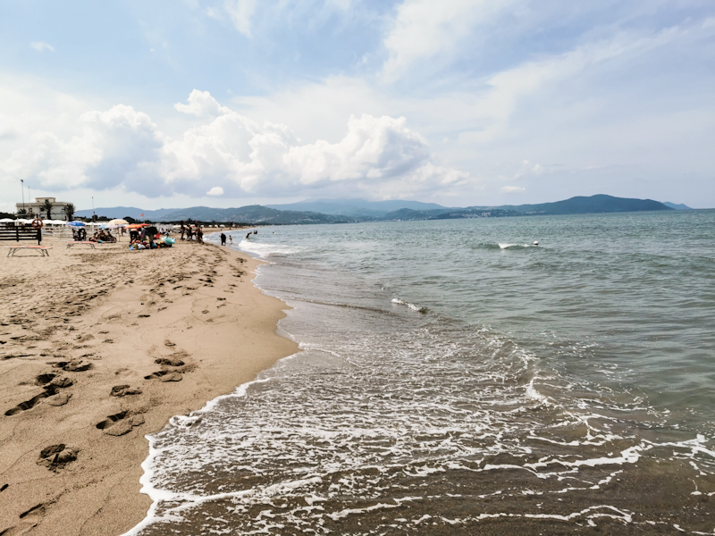
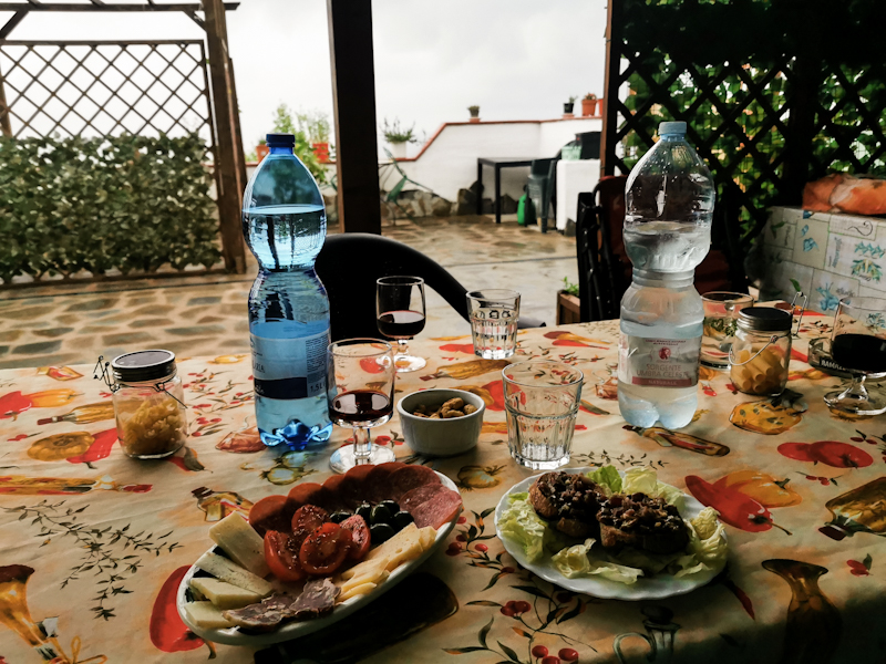
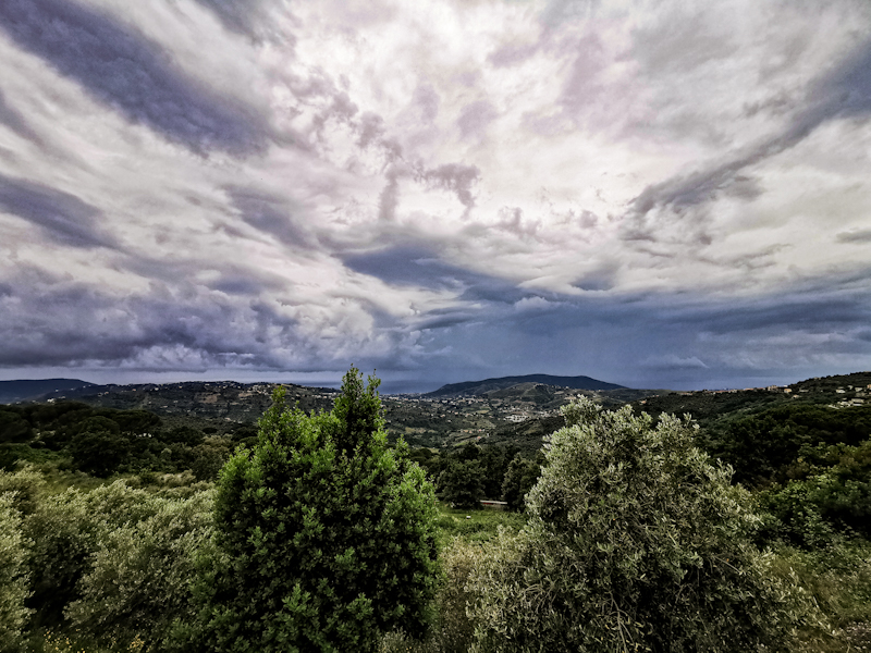
Day 203: Getting Wet By Choice
Ospedaletto d'alpinolo to Camping Salerno
Distance: 50km
I wasn't able to find the apparently best chocolate in Italy while strolling around the town yesterday. A shame but life goes on.
After a light sleep I pack and leave my room just before 05:00. As I stumble through the lobby, half asleep, the night portier (yes, I am as surprised as you that there's one) offers me an espresso. What a nice surprise and lovely start into the day.
A hiking day, which begins with walking some quiet back roads through hazelnut plantations. As I learnt yesterday, Nutella is made out of hazelnuts from this region. As I get closer to Salerno, the area gets more densely populated, the roads busier. Initially, it's interesting walking through all these busy villages, observing the locals. Eventually, as the I approach the suburbs, it's not too much fun anymore.
Therefore, I am relieved once I arrive in Salerno and full of joy once I see the sea. It's been a long time on E1 since I have walked the beach. In the region of Kiel in Germany if I remind correctly.
It's drizzling. What else would you expect. Nevertheless, I head straight for the beach, go for a swim. Feels so good. All the struggle of this morning forgotten. I continue walking. Not on the beach. Soft terrain and private beaches make it impossible. So I walk on the road towards Salerno Lido Campground. While doing so, the weather improves dramatically. I go for another swim.
I wouldn't consider the beach, nor the shore as particularly pretty. Dirty, run down, lots of deserted buildings. But I don't care. As long as there's beach access every now and then, I am happy.
I arrive at the campground at 18:30, get placed next to a girl cycling Italy. It's a decent campground with direct access to the beach, where I enjoy another swim and a spectacular sunset. My second night on a campground on E1. The first one was day 1 on E1. It's been a while!
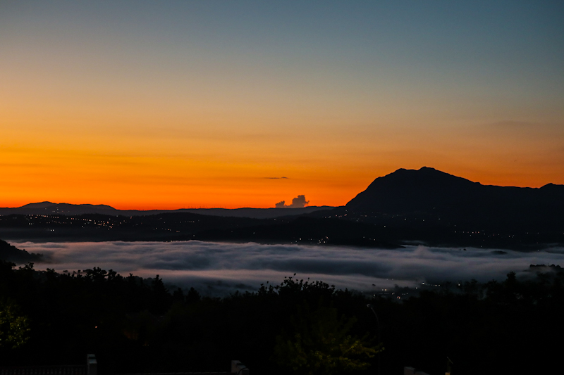
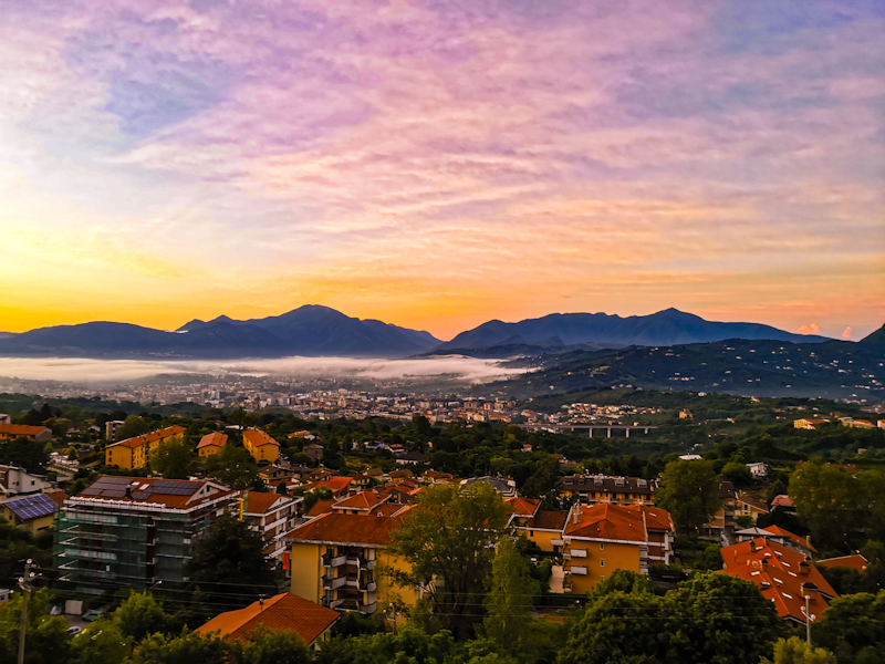
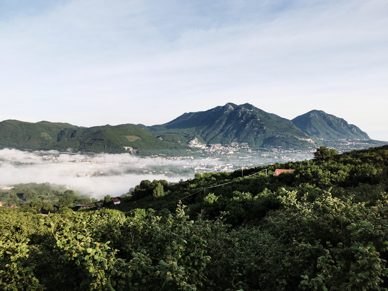
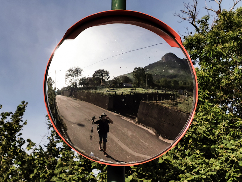
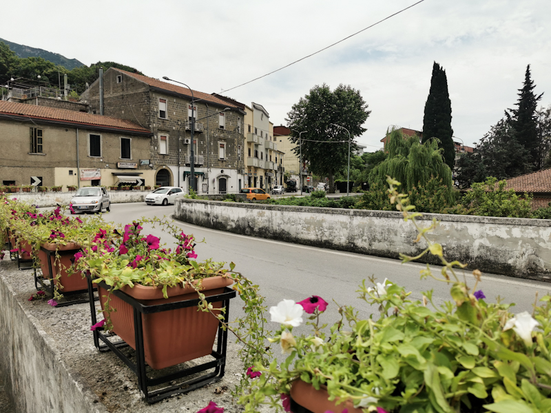
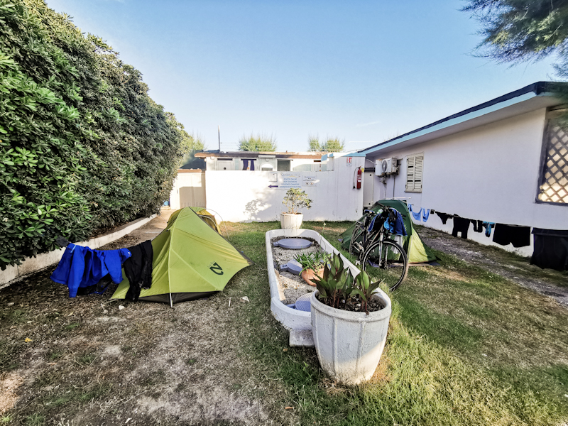
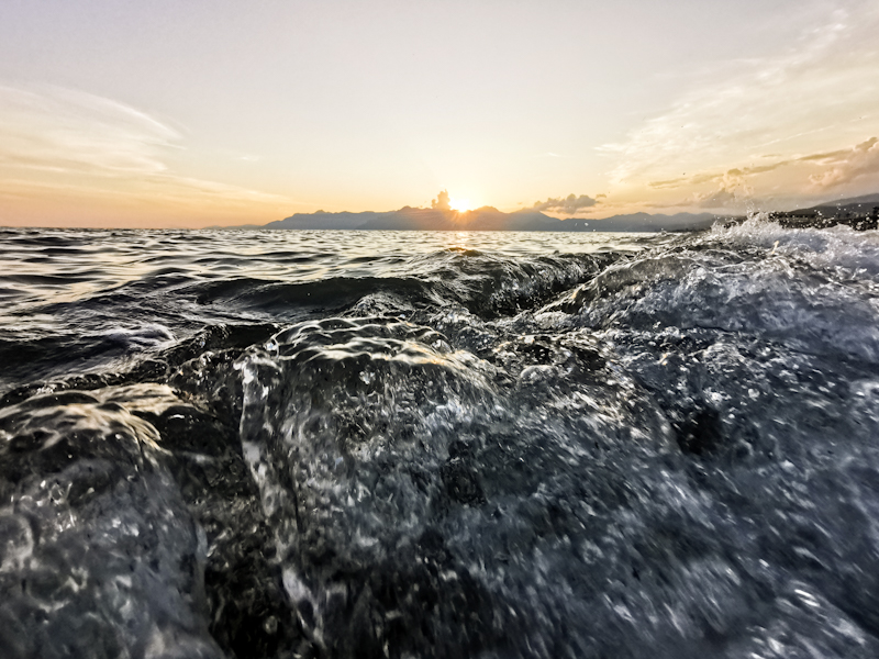
Day 202: Drenched
Taburno to Ospedaletto D'alpinolo
Distance: 45km
After a very peaceful night I continue my walk through the beech forest. The scenic views are rare but the once I have are wonderful. Fog swapping over the hills below. A special sight.
Once down in the valley, I enter the city of Montesarchio. Utterly depressing in its appearance I think. Things are not getting better as I follow a busy road.
Things change once I enter San Martino. A cute town, perfect for a break. I then enter Parco Partenio. The only road through the is closed and I am a bit worried I might have to turn around. But I don't. It's a lovely walk. At Lago Maggiore (not the big one in Switzerland) I meet Donato and his nice family. They offer me a pannini, which I gladly accept. During our conversation, dark clouds are rolling in, the smell of rain in the air. They offer me a ride. As much as I would like to accept, I can't. No cheating. So I continue and shortly after get into a nasty thunderstorm. Heavy rain leaves me soaked within seconds and coffee bean sized hailstones hitting my head hurt. Dripping wet I enter the Cafe at Santuario Di Montevergine. Quite a famous place. While I sip an espresso, the thunderstorm keeps raging right above the sanctuary. I'm a bit clueless what I should do. It doesn't seem like the weather is changing anytime soon.
I don't really feel like camping tonight so I check for hotels. There's one around 10 kilometers away and it sounds and looks luxurious! At 40 Euros quite a bargain. I pull the trigger.
With a hot shower waiting for me, I am flying down the steep but well maintained track. Still raining, still thunder and lightning. It's amazing how my mindset has changed over the last couple of days. I don't mind the rain. I accept it and see the positive side. Makes my trail life so much better.
Freshly showered and dry now. I'll finish the blog then head out to explore the town. I heard they are famous for their chocolate. As good as the Swiss one or even better. Let's see!
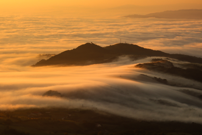
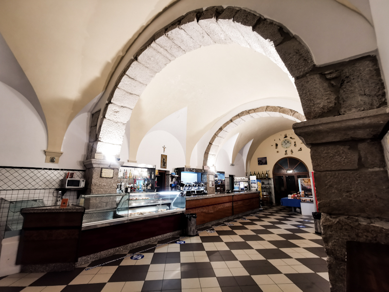
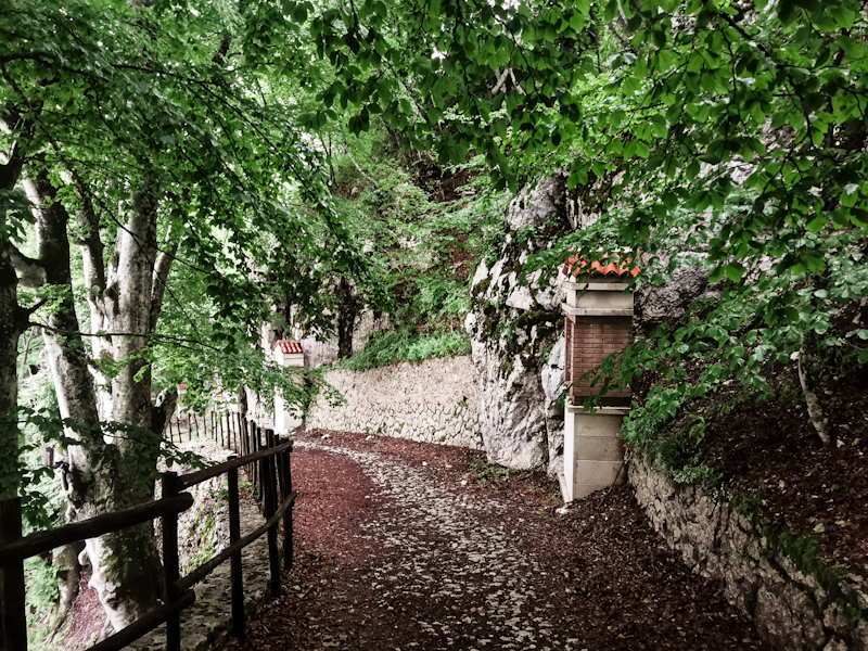
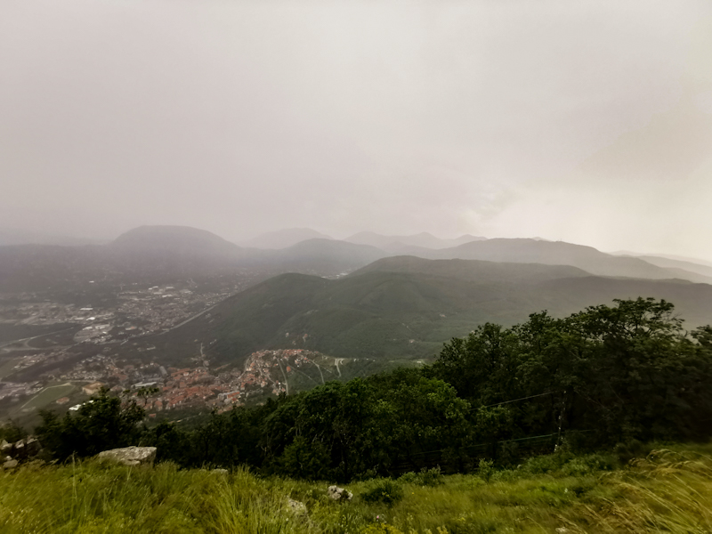
-
- 09/22/2022 - Day 184: Tutto Posto
- 09/21/2022 - Day 183: Ready To Call It A Thru-hiking Year
- 09/20/2022 - Day 182: Libro Aperto - The Open Book
- 09/19/2022 - Day 181: Keeping On Going
- 09/18/2022 - Day 180: Up High
- 09/17/2022 - Day 179: What A Ride
- 09/16/2022 - Day 178: Zero Day 2 Pontremoli / Riomaggiore
- 09/15/2022 - Day 177: Zero Day 1 Pontremoli
- 09/14/2022 - Day 176: Wind Of Change
- 09/13/2022 - Day 175: Norway? New Zealand? Italy!
- 09/12/2022 - Day 174: Ups And Downs
- 09/11/2022 - Day 173: Mediterranean Moment
- 09/10/2022 - Day 172: The Hills Are Calling
- 09/09/2022 - Day 171: Contrasts
- 09/08/2022 - Day 170: Long And Lucky
- 09/07/2022 - Day 169: Going With The Flow
- 09/06/2022 - Day 168: Rivers, Lakes And Little Motivation
- 09/05/2022 - Day 167: Tackling Country Number Seven
- 09/04/2022 - And The Show Goes On
- 09/04/2022 - Summer Memories
- 07/19/2022 - Day 166: Switzerland - Done And Dusted
- 07/18/2022 - Day 165: Having The Legs
- 07/17/2022 - Day 164: Buongiorno Ticino
- 07/16/2022 - Day 163: A Wonderful Surprise
- 07/15/2022 - Day 162: The Heart Of Switzerland
- 07/14/2022 - Day 161: The Mountains Are Calling
- 07/13/2022 - Day 160: Zero Day 2 With An Ode To My Backpack
- 07/12/2022 - Day 159: Zero Day 1
- 07/11/2022 - Day 158: Home!
- 07/10/2022 - Day 157: A Tough Job
- 07/09/2022 - Day 156: Grüezi Schwiiz (Hello Switzerland)
- 07/08/2022 - Day 155: Meandering
- 07/07/2022 - Day 154: The Gorge
- 07/06/2022 - Day 153: Two Early Birds
- 07/06/2022 - Day 152: The Highlands
- 07/05/2022 - Day 151: Challenging But Rewarding Black Forest
- 07/03/2022 - Day 150: Views, Views And More Views
- 07/02/2022 - Day 149: A Taste Of Home
- 07/01/2022 - Day 148: Black Forest Calling
- 07/01/2022 - Day 147: Zero Day Pforzheim
- 06/29/2022 - Day 146: Same Same But Different
- 06/28/2022 - Day 145: Farmland Fun
- 06/27/2022 - Day 144: Tough Walk In The Rain
- 06/26/2022 - Day 143: Encounters
- 06/25/2022 - Day 142: Contrasts
- 06/24/2022 - Day 141: An Electrifying Ending
- 06/23/2022 - Day 140: Some Proper Hiking
- 06/22/2022 - Day 139: Reset Needed
- 06/21/2022 - Day 138: Mid-summer Berry Heaven
- 06/20/2022 - Day 137: Zero Day Siegen
- 06/19/2022 - Day 136: It's all About Change
- 06/18/2022 - Day 135: Forest, what Happened To You?
- 06/17/2022 - Day 134: I Blame It On Jack
- 06/16/2022 - Day 133: Breaking Out of The Routine
- 06/15/2022 - Day 132: Vitamin D (and Beer) Overdose
- 06/14/2022 - Day 131: Blueberries And A View
- 06/13/2022 - Day 130: Up's And Down's
- 06/12/2022 - Day 129: Burning Legs
- 06/11/2022 - Day 128: The Hills Are Calling
- 06/10/2022 - Day 127: Back To School
- 06/09/2022 - Day 126: A Swim A Day...
- 06/08/2022 - Day 125: The Swing
- 06/07/2022 - Day 124: Recharged
- 06/06/2022 - Day 123: Heathland And Trail Angels
- 06/05/2022 - Day 122: Big And Busy Hamburg
- 06/04/2022 - Day 121: Preparations For The Big City
- 06/03/2022 - Day 120: Summer's Here
- 06/02/2022 - Day 119: Heading South
- 06/01/2022 - Day 118: Many Lakes More Rain
- 05/31/2022 - Day 117: Bye Bye Ostsee
- 05/30/2022 - Day 116: Hello Ostsee
- 05/30/2022 - Day 115: Warming Up
- 05/28/2022 - Day 114: Cold Start
- 05/28/2022 - Night Train Thoughts
- 05/25/2022 - Germany Calling
- 11/28/2021 - Day 113: I Knocked The Bastard Off
- 11/27/2021 - Day 112: A Feast On My Last Evening
- 11/26/2021 - Day 111: Feeling Sentimental
- 11/25/2021 - Day 110: Keep Pushing
- 11/24/2021 - Day 109: Frontal System
- 11/23/2021 - Day 108: Plans Fixed
- 11/22/2021 - Day 107: Energized
- 11/21/2021 - Day 106: Cold Starter
- 11/20/2021 - Day 105: Food For Motivation
- 11/19/2021 - Day 104: Dull Slow Down Day
- 11/18/2021 - Day 103: Bye Bye Beach
- 11/17/2021 - Day 102: Lots Of Sand
- 11/16/2021 - Day 101: Hello Denmark!
- 11/15/2021 - Northbound Into The Darkness
- 11/15/2021 - A Change Of Plans
- 09/19/2021 - The Days After
- 09/12/2021 - Day 100: A Good Number To Finish With
- 09/11/2021 - Day 99: Bye Bye Motivation
- 09/10/2021 - Day 98: I'm Ready
- 09/09/2021 - Day 97: Well Fed
- 09/08/2021 - Day 96: I Wish I Was A Fish
- 09/07/2021 - Day 95: Life's A Beach
- 09/06/2021 - Day 94: The Sea Is Calling
- 09/05/2021 - Day 93: So Long, Forest!
- 09/04/2021 - Day 92: A Hymn To The Vindskydd
- 09/03/2021 - Day 91: Dreaming Of The Beach
- 09/02/2021 - Day 90: New Possibilities
- 09/01/2021 - Day 89: A Taste Of Göteborg
- 08/31/2021 - Day 88: Easy Vindskydding
- 08/30/2021 - Day 87: Time To Slow Down
- 08/29/2021 - Day 86: Big City Life
- 08/28/2021 - Day 85: One Day, Two Breakfast
- 08/27/2021 - Day 84: Turning West-Southwest
- 08/26/2021 - Day 83: The Easy Way
- 08/25/2021 - Day 82: Precious Water
- 08/24/2021 - Day 81: In Need Of Motivation
- 08/23/2021 - Day 80: So Long, Bergslagsleden
- 08/22/2021 - Day 79: The Southbound Tick Express
- 08/21/2021 - Day 78: A Looooong One
- 08/20/2021 - Day 77: Lost In Time And Space
- 08/19/2021 - Day 76: Few Good Views, Plenty Of Blueberries
- 08/18/2021 - Day 75: Drying
- 08/17/2021 - Day 74: Short But Wet
- 08/16/2021 - Day 73: Tougher Than I Thought
- 08/15/2021 - Day 72: The Luxurious Hut
- 08/14/2021 - Day 71: Short And Sweet
- 08/13/2021 - Day 70: Squeezing In Some Extra Kilometers
- 08/12/2021 - Day 69: Another Day To Forget
- 08/11/2021 - Day 68: Electrifying
- 08/10/2021 - Day 67: Zero Day Sälen
- 08/09/2021 - Day 66: Mission Cashless Laundry
- 08/08/2021 - Day 65: One Last Day Above The Tree Line
- 08/07/2021 - Day 64: Up, Down, Up, Down And Up
- 08/06/2021 - Day 63: Closed Hut, Long Day
- 08/05/2021 - Day 62: Let's Talk About... Food!
- 08/04/2021 - Day 61: The 2nd Milestone
- 08/03/2021 - Day 60: A Sign!
- 08/02/2021 - Day 59: Shop'n'Hike
- 08/01/2021 - Day 58: Holy Mountain
- 07/31/2021 - Day 57: Lazy Saturday
- 07/30/2021 - Day 56: Temperature Shock
- 07/29/2021 - Day 55: Goals And Motivation
- 07/28/2021 - Day 54: Norwegians Rock
- 07/27/2021 - Day 53: Early Bird
- 07/26/2021 - Day 52: Swim And Hike
- 07/25/2021 - Day 51: Hot!
- 07/24/2021 - Day 50: (Cloud Berry) Heaven
- 07/23/2021 - Day 49: Own Navigation
- 07/22/2021 - Day 48: Blown Away
- 07/21/2021 - Day 47: Flashbacks
- 07/20/2021 - Night Train To Trondheim
- 07/20/2021 - It Ain't All Shit
- 07/16/2021 - New Year Same Shit
- 09/10/2020 - The Day After
- 09/07/2020 - Day 46: Section One Complete
- 09/06/2020 - Day 45: Wet, Wet, Wet
- 09/05/2020 - Day 44: Hang Over In Storelva
- 09/04/2020 - Day 43: Bye Bye Nice Weather
- 09/03/2020 - Day 42: Borgefjell It Is
- 09/02/2020 - Day 41: Happy Trail Day
- 09/01/2020 - Day 40: Trail Chatter
- 08/31/2020 - Day 39: Back To Normal
- 08/30/2020 - Day 38: An Involuntary Quickie
- 08/29/2020 - Day 37: Umbukta Express
- 08/28/2020 - Day 36: Easy Cruising
- 08/27/2020 - Day 35: Arctic Circle
- 08/26/2020 - Day 34: Can't Think Of Any Title
- 08/25/2020 - Day 33: Sun, Rain, Sun
- 08/24/2020 - Day 32: Back On Track
- 08/23/2020 - Day 31: Zero Day Naurstad
- 08/22/2020 - Day 30: Zero Day Naurstad
- 08/21/2020 - Day 29: Snow To Sea
- 08/20/2020 - Day 28: Back To Norway
- 08/19/2020 - Day 27: Padjelanta Calling
- 08/18/2020 - Day 26: A Pleasant Stroll
- 08/17/2020 - Day 25: Of Rivers And Hills
- 08/16/2020 - Day 24: Norwegian Bridge Experience
- 08/15/2020 - Day 23: Stormy Times
- 08/14/2020 - Day 22: Rock'n'Rocks
- 08/13/2020 - Day 21: Overweight Departure
- 08/12/2020 - Day 20: Zero Day Abisko
- 08/11/2020 - Day 19: My First Sauna
- 08/10/2020 - Day 18: Hello Sweden
- 08/09/2020 - Day 17: My First Rainy One
- 08/08/2020 - Day 16: Fishy Trails
- 08/07/2020 - Day 15: Routines
- 08/06/2020 - Day 14: 1 Hiker, 3 Countries
- 08/05/2020 - Day 13: Time To Reflect And Resupply
- 08/04/2020 - Day 12: Hello Suomi
- 08/03/2020 - Day 11: A Tough One
- 08/02/2020 - Day 10: Down The Gorge
- 08/01/2020 - Day 9: Back Into The Wild
- 07/31/2020 - Day 8: One To Remember
- 07/30/2020 - Day 7: Some Change At Least
- 07/29/2020 - Day 6: A Bridge And A River. And Mosquitoes.
- 07/28/2020 - Day 5: Mozzies
- 07/27/2020 - Day 4: Same Same
- 07/26/2020 - Day 3: Leaving Civilization
- 07/25/2020 - Day 2: Midnight Sun!
- 07/24/2020 - Day 1: And So The Adventure Begins
- 07/23/2020 - Day T-(E)1: Last Minute Preparations
- 07/22/2020 - Day T-2: Northbound