
Distance today: 26.2km
Distance total: 1736.2km
Time hiked: 9h 51min
Time total: 488h 25min
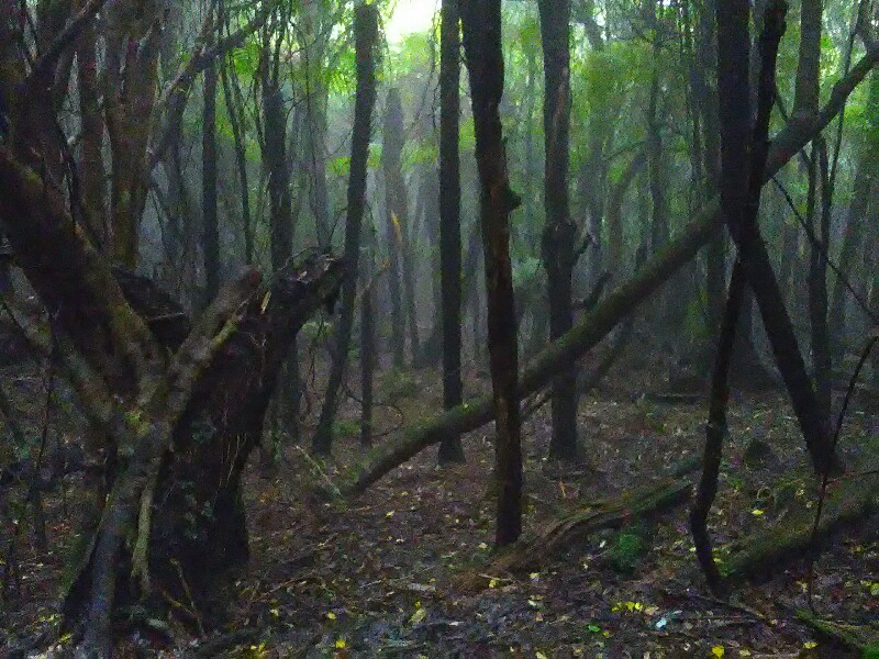
Even though no precipitation was predicted for today, it starts drizzling heavily 5 minutes after I start hiking. Within minutes I'm soaked.
Since I got so used to my hiking poles, hiking without them seems weird is difficult. So I keep an eye on suitable limbs, which I can use as hiking poles. Not easy at all. The wood is mostly rottsn and not suitable at all.
A short, quite miserable road walk (it's windy and pouring down) connects the Burrton Track with the 15 kilometers long Makahika Track.
On the first few meters of this track, I spot a long, more or less thin and strong looking limb. I break it in half and ét voilà, I have new hiking poles. With more than 500 grams each, a bit heavy though ;)
With my new poles, hiking goes much easier on the muddy but otherwise well benched trail. Initially it is climbing steadily up to a look-out. Instead of the "grand vistas", I'm right in the clouds. Zero views yet again. St least it stopped raining.
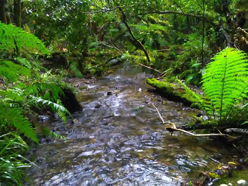
A long, continuous descent leads down to the Makahika Stream, flowing through a picturesque valley, totally reminding me of the gullies close to my home in Switzerland. A very pleasant walk with many small stream crossings. I cross Makahika Stream probably around 15-20 times. What's initially a lot of fun, gets a bit annoying towards the end though.
Another thing that bothers me is my left shin, which started to hurt slightly after the descent. By the time I reach the end of the track, it hurts fairly badly and the last 1.7 kilometers to the Outdoor Education Center, are no fun at all to walk.
I think the previous long road walking days were too much stress for my left leg and this last steep descend triggered the pain. I had the same during the last kilometers on Ninety Miles Beach - the left leg as well. At that time I thought it was probably because the left, the "landside" leg, was always a few millimeters higher up than the "seaside" leg.
Same with road walking. Roads are usually sloped - highest at the centerline and falling down towards the edge in order to let water drain off. As I walk on the right side, against the traffic, the left leg is again a few millimeters further up - same as at the beach and thus exposed to slightly but persistently more stress.
John, who owns the Outdoor Center, offers TA walkers a free place to stay, free food and hot showers - basically in the middle of nowhere.
While I'm resting my leg, he supplies me with valuable info for the Tararua (including a possible short-cut, which sounds so tempting but which I won't take ;) as well as a saw and file to fine-tune my "hiking poles": Cut them into the right length, remove sharp edges and wrap around some duct tape to make them grippier to hold. Hopefully they will last for the next 4 days to Waikanae - the same is true of my legs of course.
Write a comment